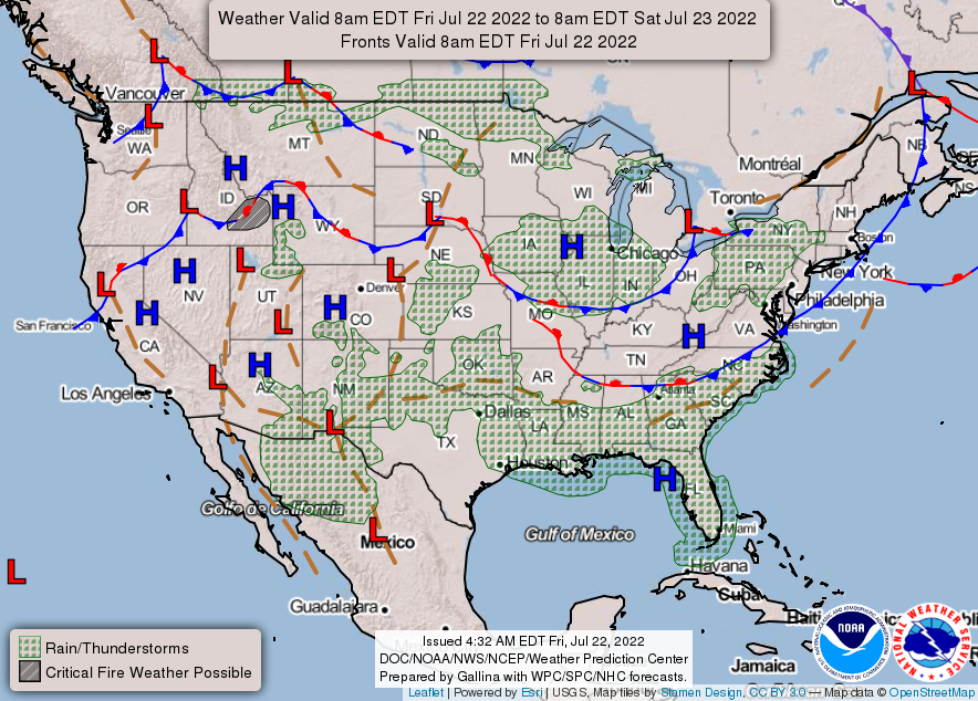
Hello everyone, it seems like the temperatures are starting to slightly cool down compare from the past few days. With the cold front coming down to southeast will bring another round of storms for today. The high-pressure system ridge still staying in the west, but slowly coming to the east in next few days to bring some hotter temperatures in some parts of the southeast.
National Forecast Chart // Courtesy: National Weather Service
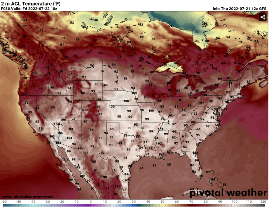
Across the southeast that the temperatures are soaring to the mid 90s to upper 90s degrees. For today, some parts of Mississippi, Louisiana, and Tennessee will be under a heat advisory. There heat index values will reach up to 105 degrees.
GFS AGL Temperature // Courtesy: Pivotal Weather
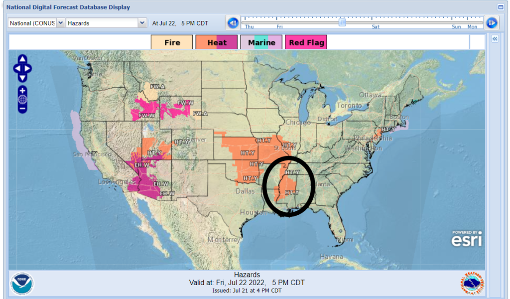
National digital forecast: Hazards // Courtesy: National Weather Service
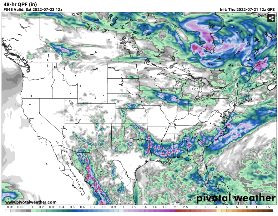
In the next few days, the deep southeast will receive some rainfall that will be from 1 inch to 2 inches of rain. The way the 48 hr. QPF will look like there will be isolated thunderstorms will bring in some heavy rain in some places.