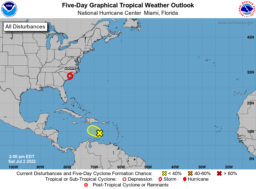
The water vapor imagery shows three notable systems in place. One is tropical storm Bonnie, which crossed Central America and is now headed out into the Pacific. It may regenerate strength and possibly even become a hurricane, but it is not expected to be a threat to land anymore, so it is not as much of a concern right now. Another system is tropical storm Colin, which recently formed off the coast of the Carolinas. This system is currently affecting the Carolina coast. The last system is north of Venezuela, which is currently disorganized but has some potential for development later.
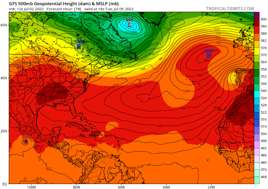
The first question to ask is what the track of the two systems we are focused on will be. A ridge of high pressure is expected to form over the eastern US early this week. This will steer tropical storm Colin away from the East Coast and out into the Atlantic. Meanwhile, the system in the Caribbean currently faces higher pressure in the upper levels toward the north, which will stall its motion.
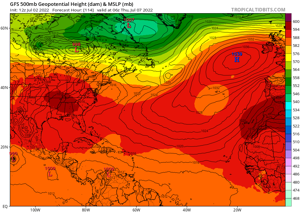
By the time Thursday rolls around, tropical storm Colin should be well into the Atlantic. Meanwhile, for the Caribbean system, a small “opening” of lower heights emerges over the northern Caribbean, which may help to steer the system northward a bit. As I will explain below, however, the system is not expected to be very strong by this time. Weaker systems have a higher tendency to move east to west than south to north, so it will likely retain some movement toward the west, resulting in a path toward the northwest.
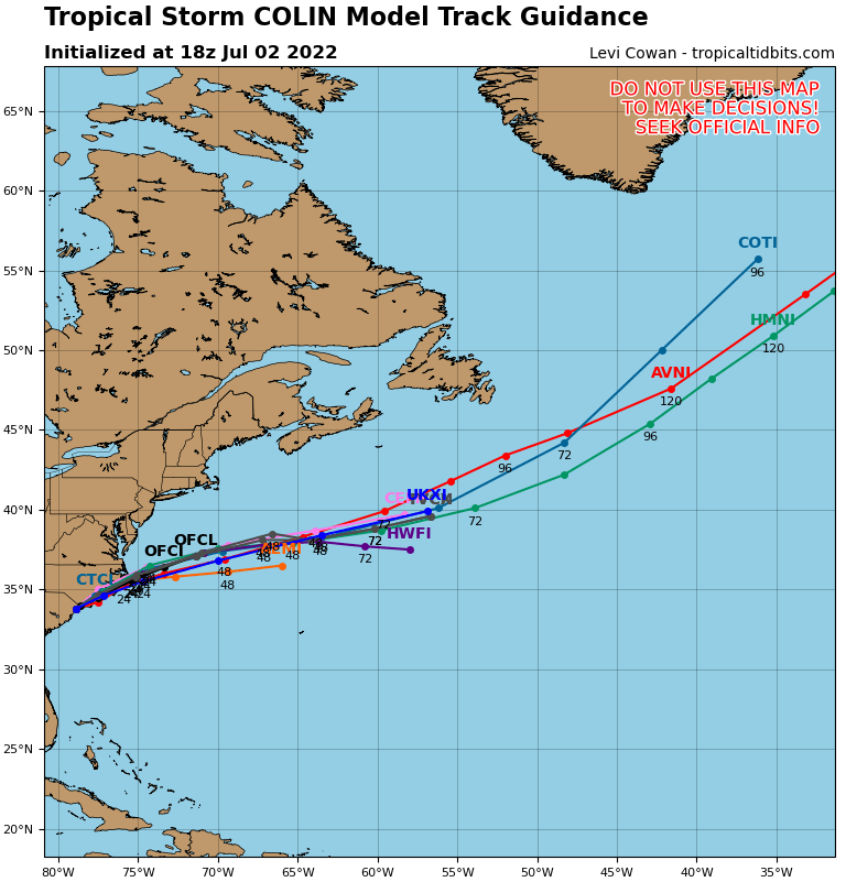
Tropical Tidbits overlays the paths each individual model shows for Tropical Storm Colin. Each model clearly shows the system moving out into the Atlantic after grazing the Carolina coasts. The Carolina coasts are currently experiencing tropical storm force winds and heavy rain, but that should end today.
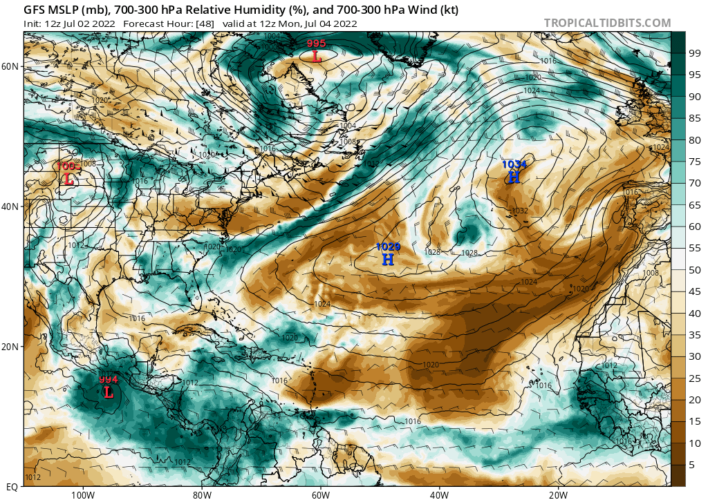
When looking at this map, we can see an immediate issue for Tropical Storm Colin: it’s heading for an area of dry air. Additionally, it is heading for colder waters of the North Atlantic. To add onto that, it is also heading into an area of higher wind shear. All of these things will essentially spell demise for the system as it moves out into the Atlantic, and it will soon just be a post tropical remnant with a bit of rain.
The Caribbean system isn’t in too favorable of an environment for development either. Notice that plume of dry air north of the Coast of Venezuela? That dry air is moving west and will infiltrate into the system, stalling development. Additionally, there is a higher level of wind shear that the system is expected to encounter. Neither of these things bode well for development over the next few days.
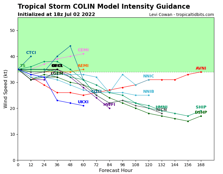
The model intensity guidance for Tropical Storm Colin confirms that the system is expected to weaken, and it should no longer pose a threat to land after today. Additionally, as you can see from the image below, the Caribbean system has a low chance of development, for reasons explained above. The National Hurricane Center gives it a 10 percent chance of becoming a tropical depression in the next 5 days.