The high plains is sitting under – arguably – the strongest ridge of high pressure of the summer season. In fact, dating back to April, this is the longest stretch of sunshine the high plains has experienced. I know what everyone is thinking: “When is this going to end?!”
Soon. Ish.
The stubborn ridge of high pressure responsible for the dry weather is showing some signs of weakening as we head toward next week. As an area of low pressure off the coast of Oregon slides to the east across the northern tier of the lower 48 it will open up the door for a cold front to push through the area.
Take a look at this:
Above is the upper-air pattern through next week. Notice the two circles, one near us. and the other Near the coast of Oregon? Now watch the circle off the Oregon coast. That is the area of low pressure. As it moves east, all of the lines, known as isobars, that are near our area change from a circle to a bell-curve or ridge and then to nearly flat. When that happens it is easier for cold front to move into our area. And that is when the next front is anticipated to arrive.
As it does, we will turn down the atmospheric thermostat.
As it looks right now, afternoon high temperatures will be tailing off from the mid-90s this weekend into the upper 80s by Monday and Tuesday of next week. And eventually into the 70s and 80s by Wednesday, Thursday and Friday.
Not bad, right?
Add to that the increased chance for showers and thunderstorms during the week, too.
The same front should offer enough low-level convergence and lift to fire off a round of showers and storms as it pushes through. Back behind the front there is a chance enough cool air could linger around to keep the area under mostly- to fully-cloudy conditions with hit and miss showers possible.
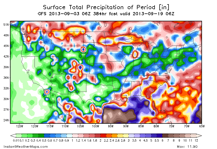
The GFS computer weather model is currently rather generous with rainfall totals. It is currently pointing to between .25″ and 1.75″ of rain across the area. While the GFS rainfall estimates will change during the next six to eight days, it has been consistent during the past three days, showing over an inch of rain possible in the area.


