When a Severe Thunderstorm Warning is issued for your area by the National Weather Service, it is time to take cover immediately.
But a lot of people don’t. They say, “It’s just a thunderstorm warning! Not a tornado…”
But not all Severe Thunderstorm Warnings are created equal.
In the case of a Severe Thunderstorm Warning with a “Tornado Possible” tag, it means that the storm that is warned could produce a tornado with very little warning. And the “Tornado Possible” portion of the warning is the NWS suggesting that the severe thunderstorm has some potential for producing a tornado. Officially, according to training.weather.gov:
The “tornado possible” tag is used in severe thunderstorm warnings for situations where a severe thunderstorm has some potential for producing a brief, small tornado, but forecaster confidence is not high enough to issue a Tornado Warning. This tag has also been in the forecaster toolbox for years according to NWS directives, and is typically used in QLCS severe thunderstorm events, or in severe thunderstorm warnings within tornado watches.
So, the next time a warning is issued, it is important to take it seriously!
A Severe thunderstorm Warning with a “tornado Possible” tag was issued one night while I was on the air doing the forecast on WDAM.
Here was the official warning from the NWS:
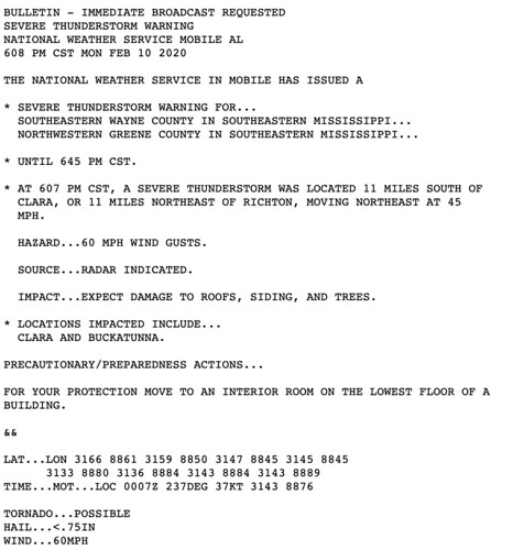
Look down at the bottom. It shows a “TORNADO…POSSIBLE” in the “tag” area. Notice that the Warning was issued at 6:08pm.
In this case, a few minutes later, there was debris detected on the radar, too.
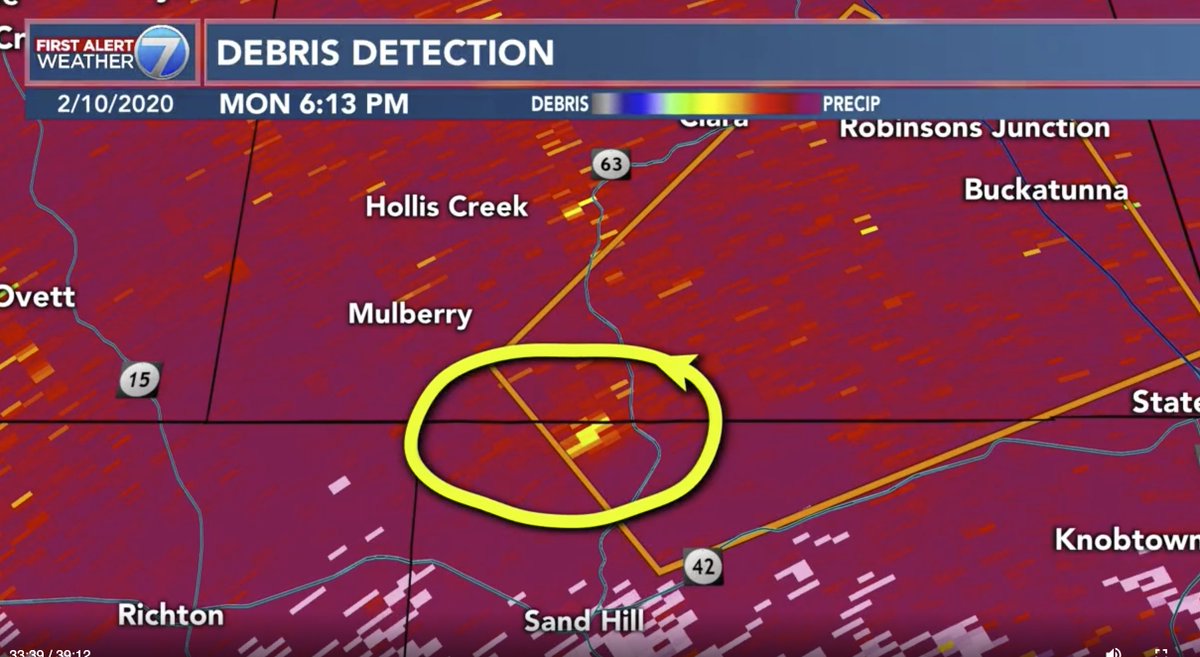
At this point, though, it was difficult to tell if what was being detected was actually debris from a tornado or bad data coming back to the radar because this debris only popped up for two or three scans (a few minutes). By 6:16pm, that debris signature was gone.
In this case, this was the right call by the NWS radar meteorologist, according to the training.weather.gov website. A brief tornado occurred but that is what the Tornado Possible tag is used for.
In this case, sadly, there was damage reported in that same area.
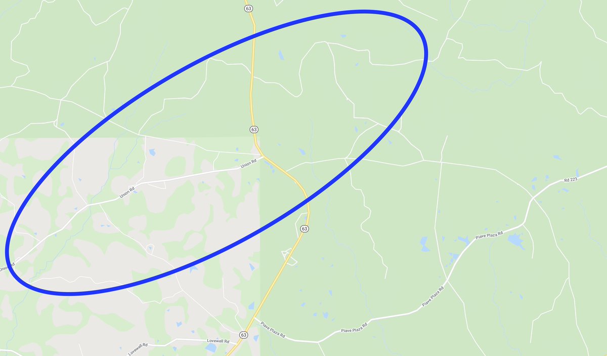
According to the NWS storm survey, “Tornado touched down just east of Old Ditch Rd causing numerous snapped softwood pines. As the tornado progressed northeast, width increased to approximately 200 yards with a clear convergent pattern of snapped softwoods. As the tornado approached Piave Church Rd, it appears to have weakened causing several uprooted hardwoods and a few snapped to uprooted softwoods. A few homes had minor roof damage likely by the outer circulation and RFD. The tornado shortly lifted after crossing Piave Church Rd but not before uprooting
a couple more hardwoods and removing a tin roof from a mobile home porch.”
The tornado was on the ground for about one-and-a-quarter miles and was rated as an EF-1.


