Severe weather isn’t as likely for the Southern MS/AL/LA area as it is for places in Arkansas, Tennessee and Kentucky. So while it is the same system, the impacts will be a bit different this far south. I’m sure many folks have seen some of the pictures and maybe even seen some snippets of the coverage, but the good news for our region is that things are looking much calmer down here.
All of that said, there is still a risk for some severe weather. It isn’t as high, nor will things be as fierce. But the threat isn’t zero.

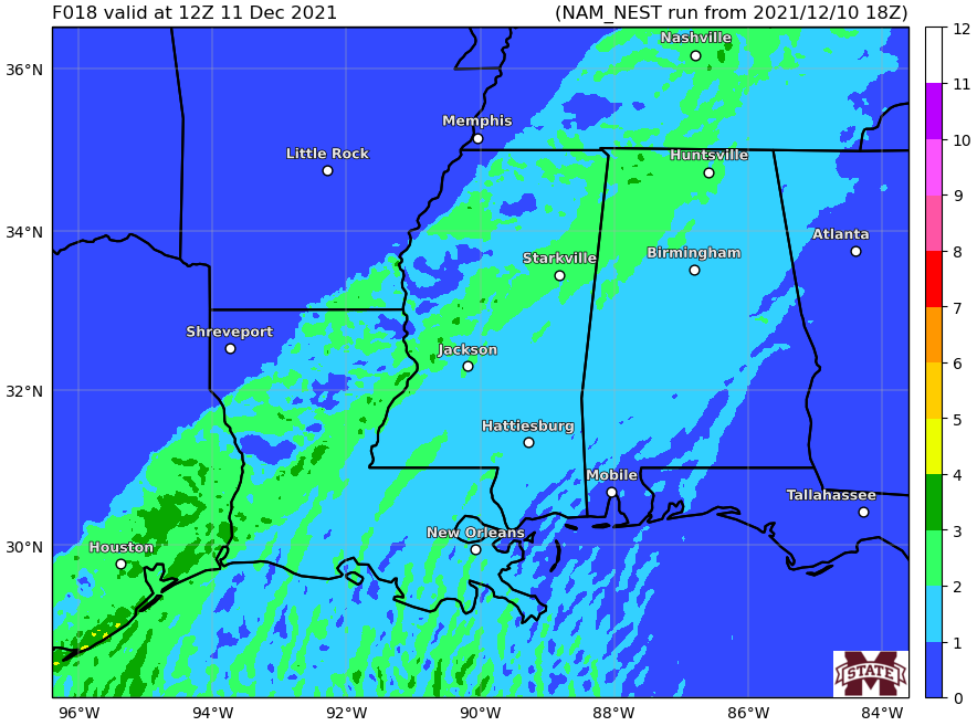
But the threat for places farther south will have to wait until Saturday morning. By that time, all of the discrete supercells will be merged into a lined and have moved much farther north. The fail end of the front will slide through this area leading to mainly showers, storms, the potential for some gusty wind, frequent lightning and small hail. And we can’t rule out the potential for a tornado – but it is looking very unlikely.
Tomorrow Morning
Here is a timeline of what the radar should look like during the day tomorrow:


Notice that the line of showers and storms basically falls apart as it passes through the area. This is due to how far away the front is getting from the area of low pressure driving the cold front south. The farther away it gets from the Low, the less ‘punch’ the front actually as, and most times, the lower the threat for severe weather.
The atmosphere ahead of the line is still going to feature some potent parameters. There will be some instability and shear, but it looks like all of the ingredients you’d need to create significant severe weather will be lacking.
The forecast sounding below shows CAPE, DCAPE Shear, and MLLCL levels all within the zone you’d need for severe weather.

But other parameters like SRH, the depth of the Effective Inflow Layer, and the lack of low-level forcing (goes back to there won’t be enough ‘umph’ with the front) to pose a potential risk for widespread severe weather, either.
A look at the Karrie Meter map at the same times as above…


The data does support the potential for some heavy rain, frequent lightning, gusty wind up to 50mph and hail up to the size of dimes, though, with any storm that develops.
Quick Breakdown
This is going to be a bit of a wide window for showers and storms to move through the area because the line will be moving pretty slowly. So know that while the timeline is rather long, the time you’ll spend dealing with storms will be pretty short within that longer window.
I may just take a while for these storms to make it to some of the folks closer to the coast versus folks living closer to I-20.
EVERYONE
Showers and storms will be possible between 4a and 2p, heavy rain and lightning with wind gusts up to 25mph
MOST PEOPLE
Showers and storms will be possible between 4a and 2p. Heavy rain, lightning, wind gusts up to 40mph will be possible
SOME FOLKS
Showers and storms with a few strong thunderstorms pass through at some point between 4a and 2p. Very heavy rain, frequent lightning, wind gusts up to 55mph, and hail up to the size of dimes possible.
A FEW PLACES
Showers and storms with a few severe storms move through the area between 4a and 2p. Very heavy rain, frequent lightning, wind gusts up to 60mph and hail up the size of nickels possible
ONE OR TWO SELECT SPOTS
Severe storms move through at some point between 4a and 2p. Very heavy rain, frequent lightning, wind gusts up to 60mph and hail up the size of nickels, and a brief and weak tornado possible
Help the Blog!
During this (and previous) event, people have asked if there is a way to “‘help’ or ‘say thanks’ for all of the forecasting work I do. For the longest time I said, ‘nah! I just like doing this! You know, to help!’ But I was recently convinced that other want to ‘help’ in their own way, too.
And their way of helping, or simply saying ‘thank you’ is with a donation to the blog to help keep it running – or to help keep me running. So I’ve added this link. If you are one of those people, let me say thank you to YOU.


