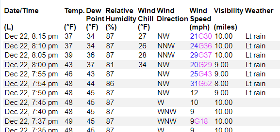
The cold front passed through Jackson a bit earlier tonight and dropped the temperature about 10 degrees in just 20 minutes. I’ve seen a few reports of flurries here and there on social media. Looking at the observations, the wind picked up quite a bit, too. Gusts were as high as 50mph.
That is supported by radar. There are still a few returns on the NOWRAD and NEXRAD radars. Most of the precip falling is still liquid, but for the remaining liquid precip, that will transition to snow flurries when you get behind the front.


The flurries won’t last long. Most of the snow will end within an hour of the front passing through your location. And if you’re wondering, “when will the front get to my house?” That depends on your location. It just passed through Jackson a bit ago, so it’ll continue to plow southeast during the next few hours. You’ll know when it gets to you because the wind will flip around to the north and really kick up.
From that point …until about an hour later… is going to be your window for snow flurries.
Then things turn much colder.


By midnight, freezing temperatures stretch from Baton Rouge to Hattiesburg to Meridian. And by sunrise, temperatures will drop into the 20s across the entire area. Some spots will be down into the teens. And some places may even get down into the single digits – especially north of I-20.
And this doesn’t take into account the wind. The wind will make things feel much cooler.
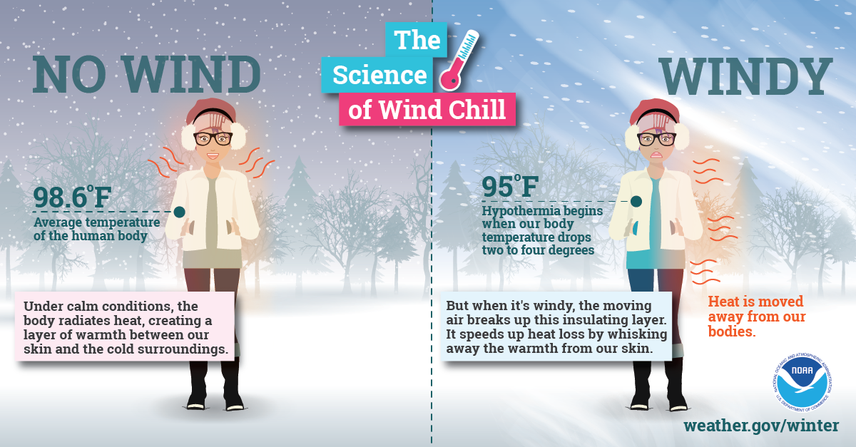
According to the latest model data, supports feels like temperatures – when you factor in the wind – down into the single digits north of I-10 and below zero north of I-20.

For folks that need to get out and drive tonight and tomorrow morning, most of the roads should be mostly dry.
But!
Given how fast we turn from mild and drizzling to spotty flurries to temperatures around 15F we will have patches of ice on the roads with some areas of black ice, too.
Thankfully this evening, two things have happened: (1) the atmosphere has dried out a bit since 5p ahead of the front and (2) the air behind the front is drying out faster than model guidance suggested.
So if you have to travel, please be careful on the roads and know that there will be patches of road that will be very slick.


