The other day, I mentioned that we would be in a reasonably good atmospheric setup to see some sort of wintry precip in January – and now it looks like as we move into the start of January we may see that chance pretty quickly.
Here’s the honest truth: No accumulation is expected given the latest data.
More honesty: we will have a lot of overcome to get actual full-blown snow to fall
QUICK DATA BREAKDOWN
But, looking at the data today (and the last few days) I don’t think we can rule out folks seeing a few fat raindrops, a rain/snow mix or even some ice crystal flurries on Wednesday morning.


Model guidance isn’t very enthusiastic about the chance for wintry precip at face value. But when you click into the details, then things get a bit more interesting.
Recall my “snowfall decision tree” I came up with a few years ago:

In this case, we check all the boxes “yes” for Step 1 and Step 2, then “No” for Step 3 and then “Yes” for Step 4. Leaves is with a chance for a wintry mix, and not freezing rain, because we will be above freezing at the surface.
But there is going to be a thin slice of the region where this looks most likely:
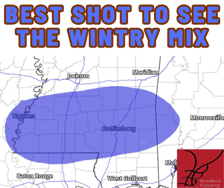
You can see that it is from about Natchez to Quitman then south to Lucedale and back to the northern parishes of Louisiana.
So! If you see some rain mixed with a few snowflakes or if your raindrops are a bit fatter than normal on Wednesday morning, you’ll know why!
COULD THIS FORECAST CHANGE?
Totally! But it isn’t likely to change and get any more snowy. In fact, I think the “impact” from this will be near zero.
The reason is multi-layered, but it has a lot to do with where the moisture is coming from (not the Gulf), how long it is here (for a short period), and how fast we warm up (quickly).
And there isn’t really a path — that I can see, at least — that will get the air cold enough and the moisture Gulf-enough to combined for a better chance for regular snow. And enough snow to be meaningful.
However, if – big if! – this little system ends up oriented a bit differently and the cold air behind the first system is colder, there is a chance to see a few extra flakes here and there.


