After a much cooler Christmas week, we’ll ring in the new year with some milder temperatures and some possible rain on New Years’ Day.
Today, we’ll see some nice winter conditions with sunny skies and temperatures in the mid-50s across the Pinebelt. Since we’ve no cloud cover and winds are fairly calm, the frost returns overnight with lows in the low 30s.

On New Years Eve, the winds will begin to shift southwest as the Gulf high moves further east. Temperatures will climb into the low to mid 60s during the day with clouds beginning to move in towards the evening. The good news for those going to see the ball drop at midnight is that temperatures won’t be nearly as cold as they have been. By midnight, we’ll be in the mid-40s, so bring a jacket and something to cover your head at least.
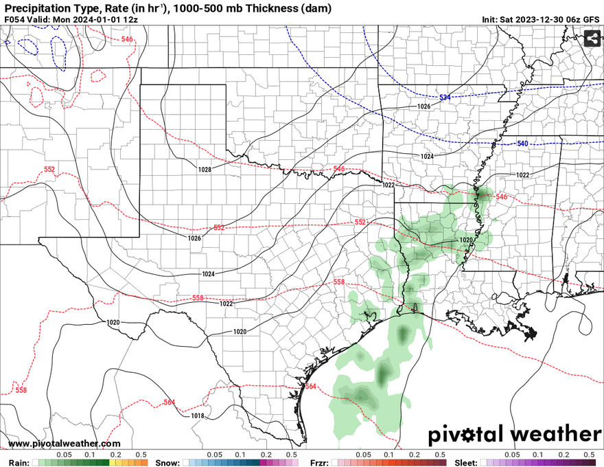
Starting early Monday morning, a cold front from the north will descend into our neck of the woods along with another small shortwave moving east from Texas. With the southerly winds prevailing, a decent amount of moisture will be present to provide us with some rain on New Years Day. This won’t be a washout by any means, but it will be enough to keep things damp throughout the first part of the day. Rainfall amounts will be around the tenth to a quarter of an inch mark and will likely end by the afternoon.
[wpcode id=”41179″]
Regional Day-to-Day Forecast
Today – Sunny, with a high in the mid 50s. West wind around 5 mph.
Tonight – Widespread frost before sunrise. Otherwise, clear, with a low in the low 30s. West southwest wind around 5 mph becoming calm.
Sunday – Sunny, with a high in the mid 60s. Light south southwest wind becoming southwest 5 to 10 mph in the morning.
Sunday Night – Partly cloudy, with a low in the low 40s. South southwest wind around 5 mph becoming west after midnight.
New Year’s Day – A chance of showers, mainly before noon. Partly sunny, with a high in the upper 50s. West wind 5 to 10 mph becoming north in the afternoon. New precipitation amounts of less than a tenth of an inch possible.
Monday Night – Widespread frost, mainly after midnight. Otherwise, mostly clear, with a low in the low 30s. North wind around 5 mph.
Tuesday – Sunny, with a high in the mid 50s. East wind around 5 mph.
Tuesday Night – A 50 percent chance of showers, mainly after midnight. Mostly cloudy, with a low in the mid 30s. East wind around 5 mph.
Wednesday – Showers until the afternoon. High in the low 50s. East northeast wind 5 to 10 mph. Chance of precipitation is 90%.
Wednesday Night – A 30 percent chance of showers, mainly before sunset. Mostly cloudy, with a low in the low 40s.
Thursday – Mostly sunny, with a high in the low 50s.
Thursday Night – mostly clear with a low in the upper 20s
Friday – A 20 percent chance of showers. Mostly sunny, with a high in the mid 50s.
[wpcode id=”41149″]


