Goodness. I have seen some things on social media that have me really concerned for the well-being of those with Severe Weather Anxiety.
I have also seen some things that have me concerned about everyone else getting an accurate forecast, too.
Good. Ness.
Here’s the skinny, folks: There is a chance for a few severe storms on Thursday across the Southern MS/AL/LA region. It is a possibility. Not a guarantee. And I would certainly not say severe weather is “likely” for everyone.
Has my assessment of the threat increased since 24 hours ago? Yes. Significantly? Not really.
The SPC
The SPC has parts of the area under an Enhanced Risk, other parts under a Slight Risk, and others under a Marginal Risk.

The SPC increased parts of Mississippi, Tennessee and Alabama into the Enhanced Risk (a 3 on the 1-to-5 scale where “5” is the highest risk for the most significant severe weather) earlier today given the model data coming back showing the potential for a bit more instability.


The SPC also added the 10-percent “hatched” tornado risk area highlighting the potential for stronger than EF-2 tornadoes.
Data Dive
There are a few – very important – limiting factors that may mean very little severe weather (if any!) in the region. But if Mother Nature exceeds certain thresholds, then we will be talking about the potential for very isolated significant severe weather.
One big limiting factor is instability, or CAPE (Convective Available Potential Energy). This is going to be limited on two sides. On the one side from how much of a low-level push we can get at the surface, and on the other side from how much upper-level cold will be around.
Looking at a handful of different models, we can see how they are all handling how much CAPE will be available. Notice how the maps are not very similar in placement nor coloring.
Because of that, models are struggling to agree on what will shake down. Model guidance that sees more instability also sees a much higher risk for severe weather. Those that don’t see the instability, don’t see much severe weather.

We can highlight this with the Karrie Meter. The Karrie Meter map shows a pretty limited threat. This is a bit surprising on one hand, but not as much when we think back to how the Karrie Meter derives its number. It is very CAPE dependent. The higher the CAPE, the higher the number. And CAPE is going to be our big limiting factor tomorrow.

Because CAPE is going to be such a limiting factor, I think it is important to see what the Karrie Meter looks like when we add 10-percent to all parameters and subtract 10-percent from all parameters. Notice that when we subtract 10-percent (left) the threat is rather limited and when we add 10-percent it does increase the numbers, but not by nearly as much.
That is a good indicator that the threshold for IF severe weather develops is dictated by CAPE but the potency of said severe storm IF it develops will be dictated by other factors.
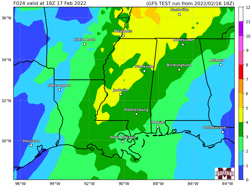
Another thing to keep in mind is that the maps above are from the GFS model. This is a coarse model best used to identify “general” weather patterns. It isn’t very good at specifics of a severe threat 24 hours out.
Instead we need to look at the HRRR model. And that is showing a more robust setup.

When I looked at this the first time, I eyeballed it as showing a Karrie Meter of around 4.5. I was close. But this model is showing a more robust low-level push of warm air as well as cooler air aloft. So this one is leaning toward the “GFS plus 10-percent” map above. Only it is leaning much harder.
And it has all of the other pieces in place. Plenty of Shear, Helicity, LCLs, and even Downdraft CAPE. This model is showing the potential for significant severe weather – like tornadoes up to EF-3 strength.
Updraft Helicity Streaks
Recall that the Updaft Helicity Streaks are where we ask the computers to try and figure out where and how many rotating updrafts there may be in the storms that move through a particular area.
The computer isn’t great at placement (its a bit too big of an ask, frankly) of these streaks, but I like to look at the clustering, length, and overall number of streaks. It gives me a good idea about the potential threat.

I don’t see any blues or yellows, which is good. Most of the darker shades of gray are short-lived. And I see a cluster near Jackson, MS and near Birmingham, AL and another near Tupelo, MS.
This tells me that any sustained supercells with rotating updrafts will struggle to be “very strong” and may have a more difficult time producing long-track tornadoes. The darker grays to suggest that a strong tornado is possible. And the clusters tell me there will be a few different areas (though not, necessarily the ones highlighted) where the atmosphere will be most conducive to produce these rotating updrafts.
Timeline & Threats
Here is another look at the timeline and threats. This will likely change a bit during the next 12 hours, but hopefully will give everyone a good idea about when to be most cautious with the weather.
6a-10a — Instability showers will be widespread with a few storms across parts of southeast Louisiana. Severe weather is less likely during this time period, but not impossible. Main concerns with storms during this time period will be…
– Heavy rain
– Lightning
– Gusty wind
10a-2p — Showers and storms, some severe, move across southeastern Louisiana, and southern Mississippi. Main threats with storms during this time will be…
– Very heavy rain
– Brief localized flash flooding
– Frequent lightning
– Wind gusts up to 70mph
– Hail up to the size of quarters
– Tornadoes (up to EF-3 in strength)
2p-6p — Storms ending for Louisiana and parts of southern Mississippi while eastern counties of southern Mississippi and southwest Alabama still deal with storms. Some severe. Main threats with storms during this time will be…
– Very heavy rain
– Localized flash flooding
– Frequent lightning
– Wind gusts up to 70mph
– Hail up to the size of quarters
– Tornadoes (up to EF-3 in strength)
6p-10p — Storms moving out of the area. Some lingering storms across parts of Alabama. Main concerns with storms during this time period will be…
– Heavy rain
– Frequent lightning
– Gusty wind
– Small hail
It still looks like 0.5″ to 2.0″ of rain is the best best across the region in terms of rainfall totals, but I’d bet that a few spots will have a chance to see up to 4″ of rain where some of stronger storms end up moving.
Karrie Meter

The Karrie Meter is up about 1.18 during the last 24 hours. But the overall forecast hasn’t changed much at all. We are still talking about a window during the afternoon and evening for a few severe storms and the potential for one or two tornadoes. And the potential for tornadoes to be up to EF-3 in strength.
So please, keep tabs on the weather during the day on Thursday and through the evening, too. Have your NOAA Weather Radio handy and have an app on your phone that will ping you when a warning is issued for your area.


