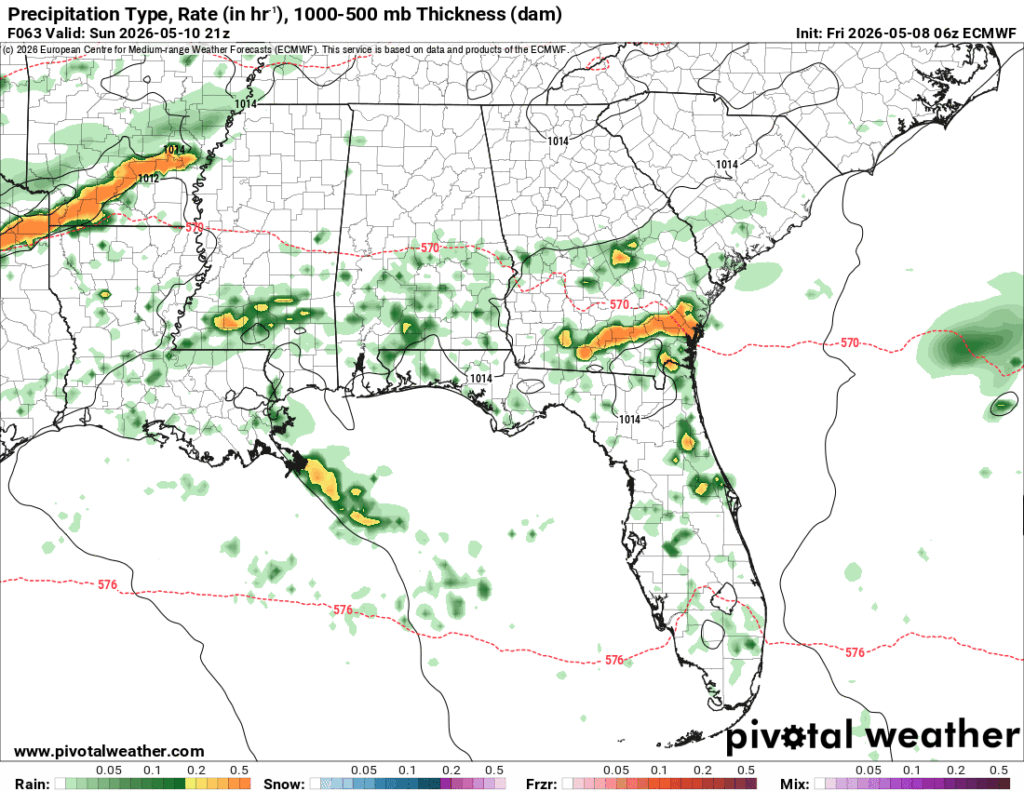
A rainy weekend is ahead as the stationary front lingers for a few more days. This means we’ll get not only a coastal front, but the leftovers of what Kansas and Arkansas are getting today. That system won’t move in until the early morning hours on Saturday, and we’ll have a brief break before our last round of rain on Sunday. Afterwards, calm weather…

Today
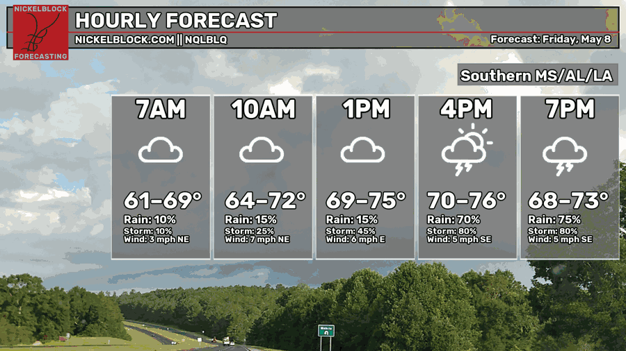
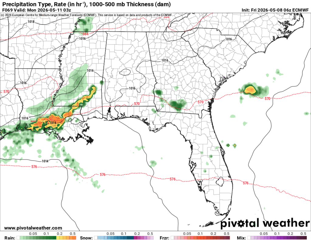
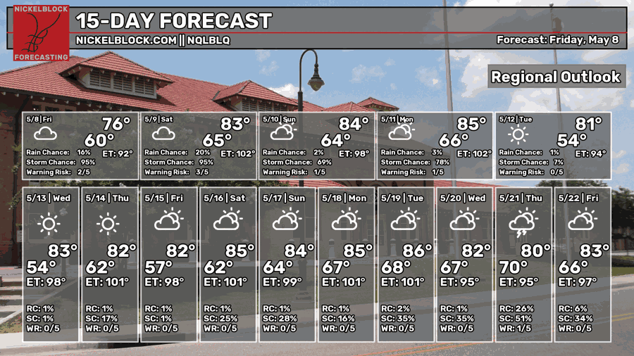
It’s already pretty humid outside with temperatures in the upper 60s. The rain will move in by the late morning hours and keep churning out more storms across south Mississippi and south Louisiana. A few strong storms are possible with lightning and winds above 40mph. This system will hang around until around 9pm, so if you’re out this Friday night, bring your umbrella! Highs will be in the mid 70s with a low around 70.
Overnight, another round of storms originating from Kansas/Oklahoma are moving in from the northwest. Another round of severe weather is possible as these storms arrive.

Tomorrow
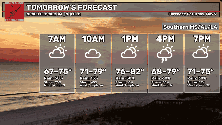
Here’s the second system I mentioned earlier. This one will move in by the early morning hours and move out by the early afternoon. Expect heavy rain, high winds, and possibly a tornado. This looks more like a wind event considering the outflow boundary that this system is riding on. Otherwise, this is going to be another warm and humid day with clouds hanging around after the storm has passed. Highs in the low 80s and a low in the upper 60s.
Sunday
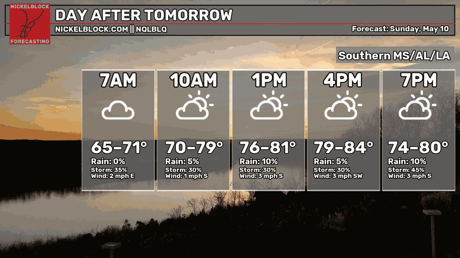
On and off rain is expected Sunday with a few waves of showers moving in during the day. It’ll be another humid day ahead as temperatures taper off in the overnight hours after the cold front’s passing. Our main band of rain is moving through during the mid-afternoon hours. Overnight, another band of showers is moving in before midnight. Highs in the low 80s with a low in the mid 60s.
Next Week
A few isolated showers are possible Monday morning, but afterwards the cold front will pass through drying us out with more northerly winds. Next week will be a more average-feeling week with highs in the low to mid 80s which is more like what we’re used to this time of year. The main caveat is there’s no rain! Just dry and warm conditions next week. We won’t really expect another system for another 12 days or so as the high pressure system takes root across the eastern US. A closed high pressure system will build right near the Gulf south along with a system in the Atlantic and the northern Plains. An incoming cold front will move through the Great Lakes and northern Appalachia, but the moisture will stay in that region. Overall, it’s going to be a dry and warm week ahead for us, so enjoy it! Albeit it’s a little quiet…


Finally … an end to the rain! With the exception of 1 or 2 days, after 2 weeks of it, we need a break.