While it might feel like an active start to the 2022 Atlantic Hurricane season, it may feel more active than it actually is. At least, in terms of direct impacts to the United States. There are two areas of interest this afternoon. The one that is getting all the attention is Invest 91L near the Yucatan. The other is a cluster of storms with a mid-level area of low pressure near the Bahamas.
Invest 91L may end up being an issue for Florida, but the main concern will be rainfall and gusty wind. As of now, data does not support the potential for any kind of well-organized hurricane developing.
From the NHC
The NHC started hinting about development from Invest 91L last week. The idea was that Hurricane Agatha would make landfall on the west coast of Mexico and drag across the country and be dumped into the Gulf.
That was an unlikely scenario, but one that was worth monitoring. Instead, something a bit different occurred with a similar outcome.
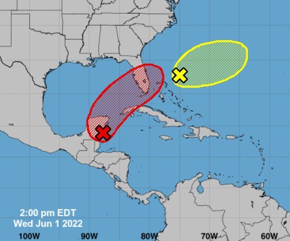
The latest from the NHC:
Tropical Weather Outlook
NWS National Hurricane Center Miami FL
200 PM EDT Wed Jun 1 2022
For the North Atlantic…Caribbean Sea and the Gulf of Mexico:
Near the Yucatan Peninsula and Southeastern Gulf of Mexico:
A broad area of low pressure located near the east coast of the Yucatan Peninsula is producing a large area of disorganized showers and thunderstorms over the northwestern Caribbean Sea and Yucatan Peninsula. Despite strong upper-level winds, gradual development is forecast and this system is likely to become a tropical depression while it moves slowly northeastward over the northwestern Caribbean Sea and southeastern Gulf of Mexico during the next day or two. Regardless of development, locally heavy rainfall is likely across portions of the Yucatan Peninsula during the next day or so, spreading across western Cuba, South Florida, and the Florida Keys on Friday and Saturday. Interests in the Yucatan Peninsula, western Cuba, the Florida Keys, and the Florida
Peninsula should monitor the progress of this system.
— Formation chance through 48 hours…high…70 percent.
— Formation chance through 5 days…high…80 percent.
Southwestern Atlantic northeast of the Bahamas:
A weak surface trough located about 150 miles northeast of the northwest Bahamas is producing disorganized shower activity. Surface pressures are currently high across the area, and significant development of this system appears unlikely as it moves generally east-northeastward over the next several days away from the southeastern United States.
— Formation chance through 48 hours…low…10 percent.
— Formation chance through 5 days…low…10 percent.
Forecaster Brown/Bucci
The Data
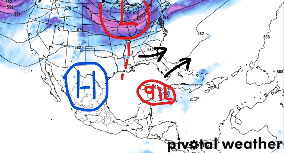
The general pattern shows an area of higher pressure across the western Gulf Coast that will be sagging to the west and across inland Mexico. As it does so, both Invest 91L, and the other area of interest, will lift to the northeast through the weakness between the ridging and troughing.

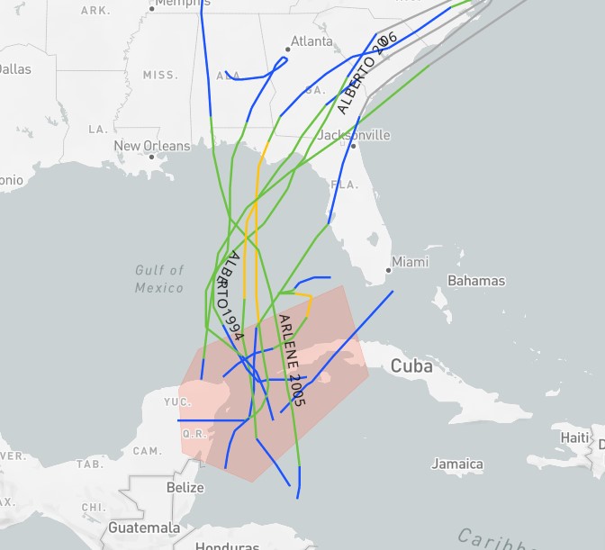
Historically speaking, Invest 91L is in a place where tropical systems have developed in June. Since 1970, nine named storms have developed from this region in June. Three f them were named Alberto.
But it looks like Invest 91L, eventual Alex, will be taking a different path than previous storms – if it develops. Instead of lifting north, it will move a bit more easterly than north.
The GFS computer weather model shows a weaker shortwave trough dragging along the Gulf Coast later this week and into the weekend. That will help to drag Invest 91L a bit more easterly than systems historically have moved.
Given the shear in the region, it is unlikely that Invest 91L ever gets too terribly organized. It will likely bring the potential for heavy rain, flooding, and gusty wind to parts of southern Florida.
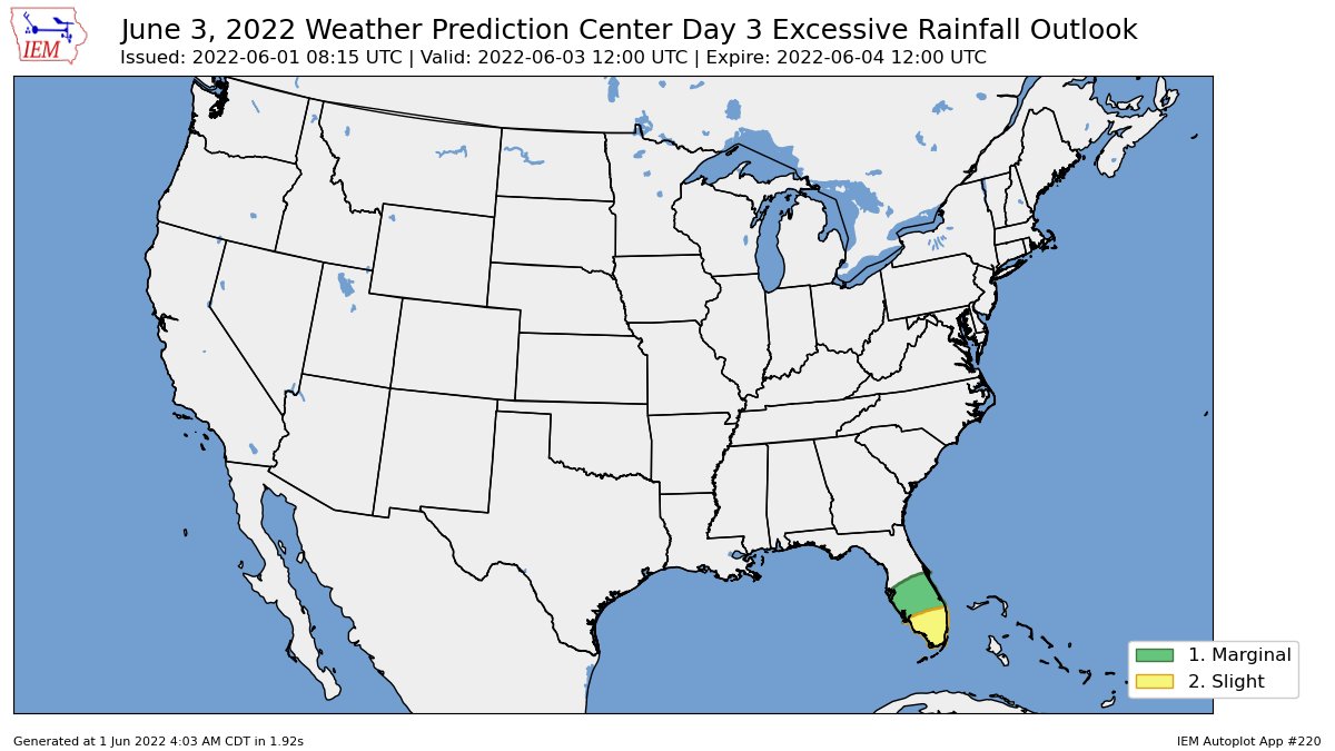
In fact, the WPC has already highlighted southern Florida in their risk for flash flooding.