
This weekend will be a rainy one for Eastern half of the country. We are starting to see that stationary front begin to move southeast bring rain and thunderstorm throughout the Eastern Central US. A strong upper-level low over Manitoba, Canada will propagate a cold front over the Upper Great Plains will lend to slight chances of thunderstorms throughout the region. Meanwhile, the West Coast is looking high and dry for time being under an intensifying ridge-trough pattern.
Lessening Severe Weather

After an intense day of severe weather yesterday across the Central Plains region, things are calming down today with only marginal risks of thunderstorms across the East Central US and near Northeast New Mexico. Most of the Central and Eastern US could also possibly see isolated thunderstorms primarily due to those frontal boundaries with some strong mesoscale convective systems (MCS) developing along this eastern cold front. Compared to yesterday, hail and strong winds will be much less of
While the Canadian cold front won’t cause significant showers due to a lack of moisture, the frontal boundary will still create enough lifting for possible thunderstorms throughout the Central Plains.
Intensifying Heat in the South
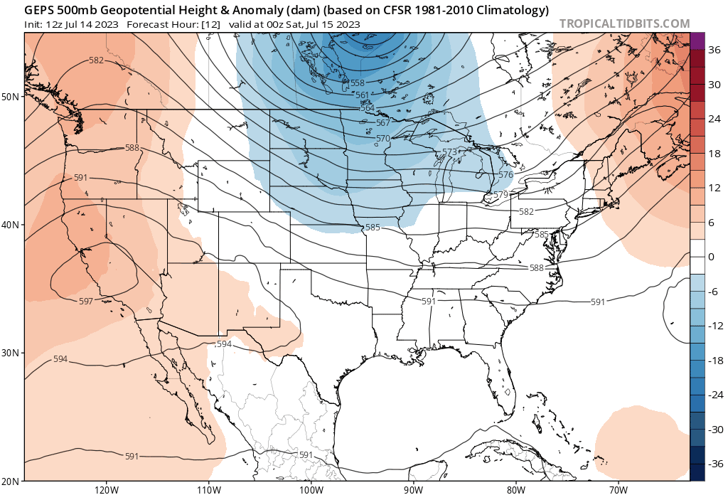
The upper-level ridge out west will intensify over the weekend bring sweltering heat over the Southcentral region. This heat into slow moving east, bringing that heat with it further all the way to Florida by the end of the weekend. Heat into the mid 90s will extend all throughout Texas into the Southern Gulf states with a strong heat index into the 100s. Extended time out in this weather will cause exhaustion quickly if you’re not drinking a lot of water. This heat risk will extend further east at the weekend progresses with the coastal area especially at risk with high humidity from the influx of moisture from the ocean. This will be some of the hottest temperatures the Southwest will experience so far this Summer.

Extended Outlook

Ridging out west will likely continue to persist throughout the next couple week which continue to spell strong high temperatures across the Southwest. The trough over the Eastern US continue in this pattern for higher than average precipitation over the Eastern US. With our usually high temperatures in place this Summer all across the US, strong convective storms, especially along the coast, will be of concern as we look forward.

Conclusion
The typical pattern of weather will continue for the time being over the weekend and should amplify for a similar strew of weather for the start of next weekend. While severe weather will lessen today, we could see of resurgence of severe weather along the Central Plains as the second cold front moves through.


