Dry and hot is what the west will be feeling this weekend. The midwest and plains will see some thunderstorms today and rain over the weekend. The east coast isn’t clear of some organized showers later this weekend. The already saturated northeast may see some more flooding this weekend. Let’s dive into it!
[wpcode id=”41149″]
Dry Heat Out West
The west will be seeing a lot of dry hot weather for a while as a ridging pattern settles itself along the west coast. Temperatures will be well above normal this weekend into next week. There will be no rainfall in the area which means this heat will be dry and no cooling rains will come in for a long time. This can cause a few different issues out west the biggest being the possibility for wildfires.
We are in wildfire season currently so the risk is always high but especially with dry heat the risk is very high. The west is prone to wildfires so conditions will be dangerous. Be cautious when outside. The next biggest risk is the risk of extreme heat indices that can cause people to suffer from heat related health problems. Be very careful when outside and be sure to stay hydrated and avoid extensive periods outdoors.
[wpcode id=”41149″]
Storms Across Midwest and Northeast
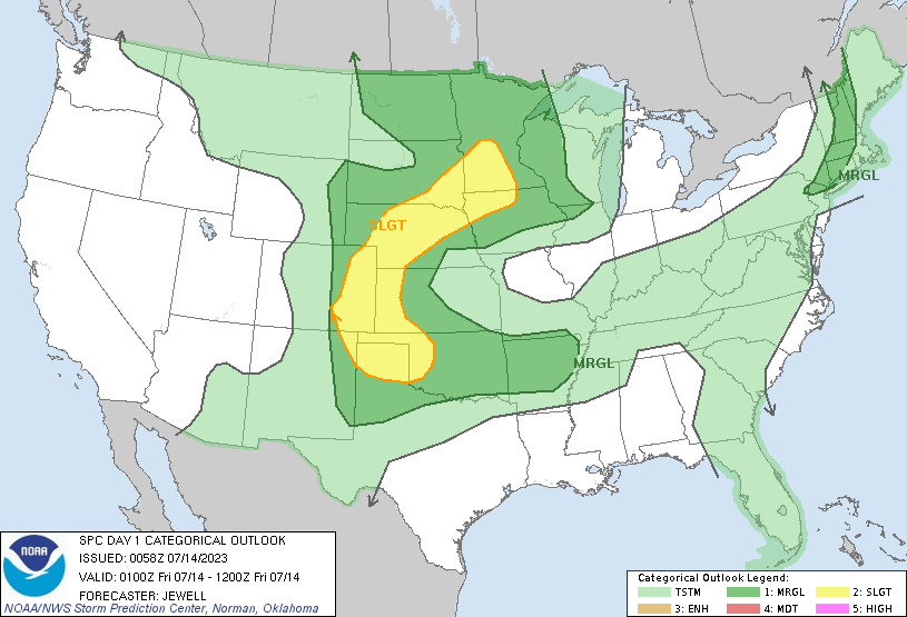
SPC Outlook up to Friday 12Z 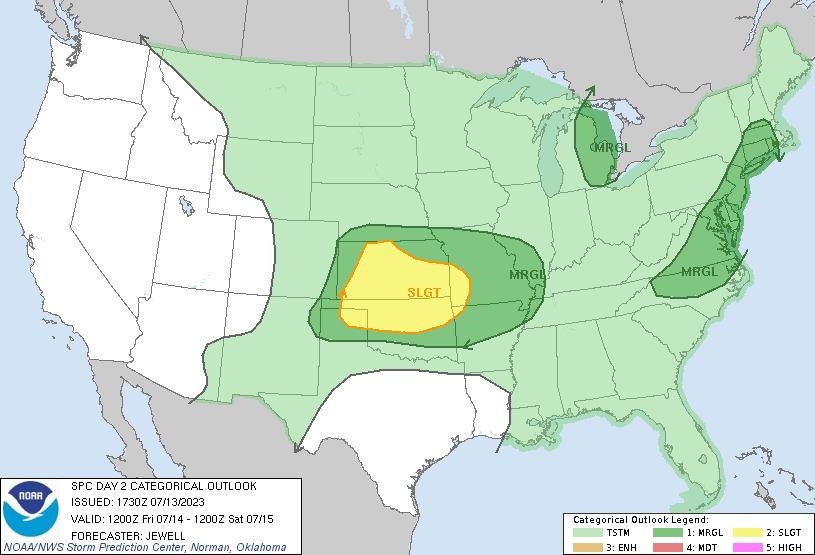
SPC Outlook for Friday 12Z to Saturday 12Z
Today we will see some showers across the Midwest and Plains region. Today we see a slight risk for the central plains region and much of the US is under marginal risk. We will see some rain showers and thunderstorms move across the area and head eastward. As the move east the more severe storms will die down into just rain showers.
Saturday, Kansas and parts of Oklahoma will be still under a slight risk with again much of the US under marginal risk. Rain showers will cover much of the Midwest and east coast. Sunday the east coast will see rain again and flash flooding may occur especially in the northeast which is still suffering from last Sunday’s flooding.
Over the next week we will see some showers in the Midwest and plains. Most of these storms will be organized systems with some thunderstorms in the mix. This stormy pattern is due to a low pressure system holding over much of the eastern US. This consistent rainfall can pose flooding and wind damage across the region.
[wpcode id=”41149″]
Travel Impacts
Across much of the plains today will be rainy so travel delays are possible. Over the weekend many major cities in the east will be covered in rain. Flooding is possible and roads may be washed away so its best to keep off the roads. Sunday the I-95 corridor will see rain from top to bottom and many other major highways. Flights may be rain delayed or canceled across the Midwest and east. Always be cautious on the roads in rain and extreme weather.
[wpcode id=”41149″]
Extended Outlook
We are going to see a trough push through the Midwest and northeast as we head into next week. The major ridge climbing across the west will remain in place and keep those hot temperatures coming. The south will also heat up a bit as the ridge extends itself downwards.
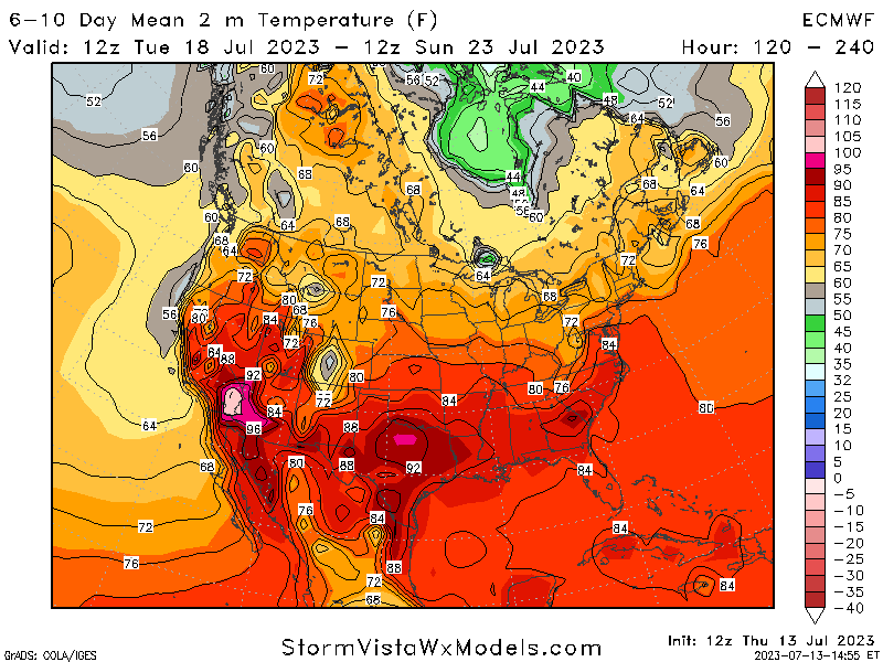
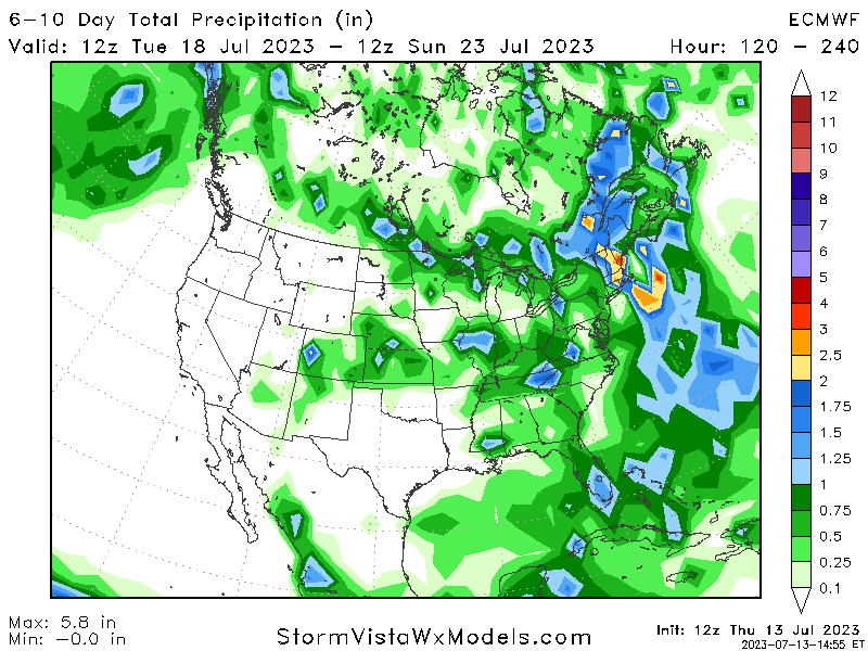
As for precipitation we will see a wetter Ohio valley and northeast. The northeast is already saturated so this moisture could cause moire flash flooding in the area. The west will stay virtually dry with patterns unlikely to change within the next week and a half.
[wpcode id=”41149″]
Conclusion
As we head close to the weekend, the west will stay hot and dry as much of the eastern half of the US will see rain at some point. The plains region will get more of the severe thunderstorms in areas with strong winds and hail possible. Keep watch in the northeast this weekend as more rain falls on the already saturated area. Be sure to continue being updated for your local area and stay safe!


