Summer is kicking into high gear for the west while the central and eastern half of the US experiences some wet weather. Let’s look at the potential severe storms for today and over the weekend!
[wpcode id=”41149″]
Severe Weather in Plains Region
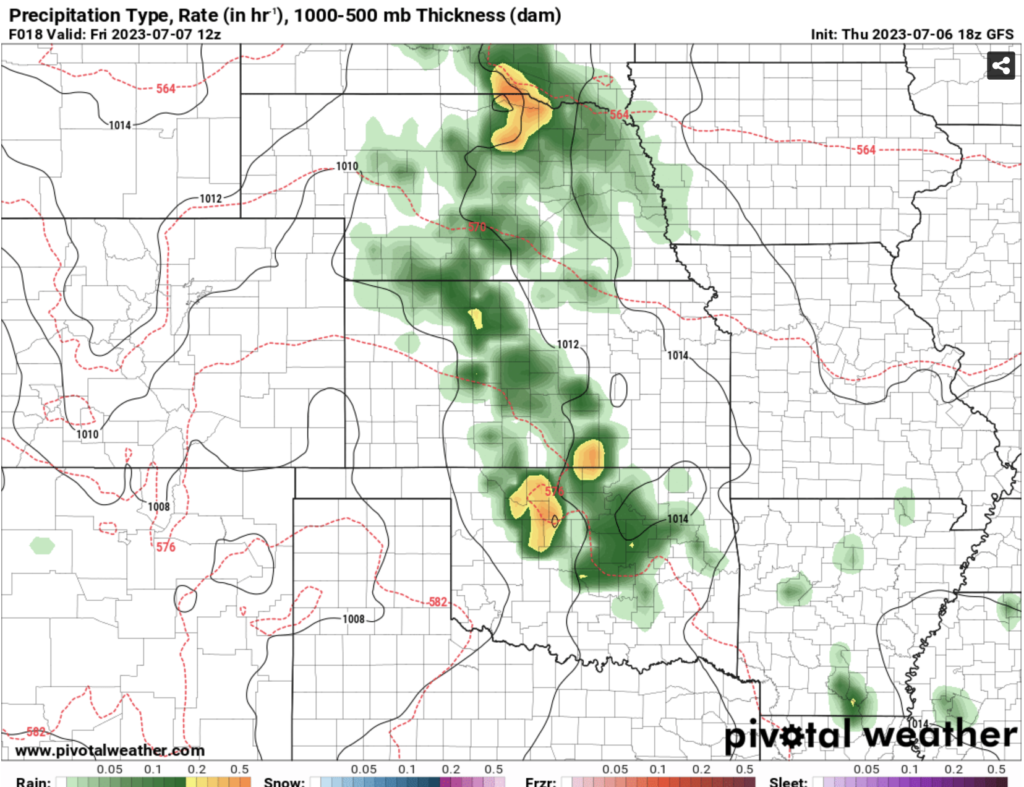
We have a few low pressure systems building across much of the eastern half of the US. Today we are seeing some storms brew across the central plains region. The most severe thunderstorms will be across Oklahoma and northern Texas. The Daktoas region will also see some severe storms. These storms have the potential to produce high gusty winds as well as hail. Flash flooding effects will be seen due to the heavy amounts of rain falling in the area.
This system is projected to move across the south eastward towards Louisiana, Mississippi, and Arkansas. The system will bring scattered showers and thunderstorms to this area laster today into the weekend.
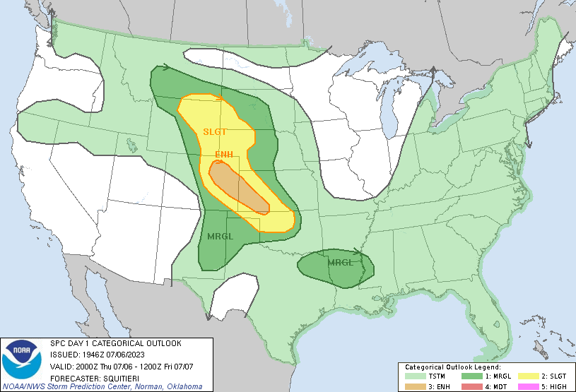
SPC Outlook up to Friday 12Z 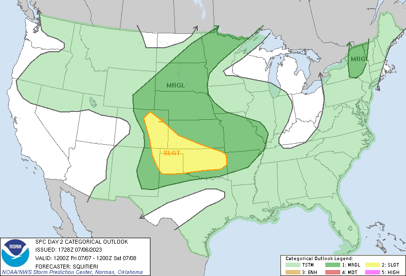
SPC Outlook for Friday 12Z to Saturday 12Z
[wpcode id=”41149″]
The West Jumping into the Heat
Last week we talked about the hot weather in the southeastern US but this week the story shifts from the southeast to the west. As the eastern US sees a cooling pattern due to a trough pushing across, the west is seeing warm ridging building across the entire coast. With this pattern brings in a high pressure system which will keep showers out of the area so it will be hot and sunny for the most part. This pattern will start early next week and will not be moving for a while.
Temperatures will range from the low 80s to over 100 in some areas next week. These are temperatures that haven’t been seen especially in the northwest. With the sun the heat index will be super high so be cautious when being outside for extended periods of time and make sure that AC is blasting!
[wpcode id=”41149″]
Wet Pattern in the East
We are seeing some major pattern shifts across much of the US. With these shifts we are moving away from the super hot weather down in the southeast to more moderate temperatures. However, we will be seeing a lot more moisture in the air with high humidity. Much of the eastern US will be seeing a lot of scattered rain showers and possible thunderstorms.
Today we will see scattered rainfall across the northeast as well some thunderstorms across Iowa and the Midwest. As we head into the weekend these pressure systems will bring showers and storms across the southeast, Midwest, and east coast. The northeast will get some severe thunderstorms Sunday into Monday as well as the southern gulf region.
[wpcode id=”41149″]
Extended Outlook
Looking ahead further into next week we see this pattern shift continue throughout the next 7 days. The southwest will remain hot and dry while the east will be stormy and slightly cooler than normal. The optional for changes will occur after this week and later into July so keep an eye out for that as we get closer!
Travel Impacts
If you are traveling across I-40 this morning be careful of the wet weather and flash flooding. Traveling across the east this weekend can be difficult with thunderstorms scattered sucrose the region. Many major highways and airport hubs reside in storm optional areas so be sure to check the local weather before traveling this weekend. On the flip side if your traveling along the west coast traffic won’t be because of the weather this week!
[wpcode id=”41149″]
Conclusion
The west coast will be feeling the heat and sun while the central plains and eastern half of the US experience scattered rainfall and thunderstorms today and over the weekend. Always be mindful of the possible chance for showers in your area and check out your local forecast day by today to see if storms will be effecting your area. We will be seeing this stormy pattern across the east for a while and the hot pattern across the west. Enjoy the sun in the west coast and be prepared for wet in the central and eastern US.


