
Hello everyone; I hope you had a good week. Looking at the general forecast for today, the primary conditions expected are hot temperatures and a chance for afternoon showers and thunderstorms. Our temperatures forecasted for tomorrow calls for afternoon highs to reach the low to mid-90s, with heat index values expected to be even higher. As for rainfall, most of the models show a 40-60% chance of rainfall, with the highest chances being along or near the coastline.
The Summer Heat Continues
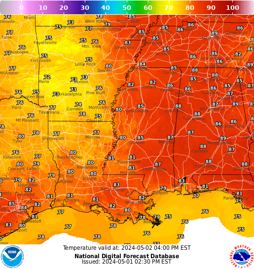
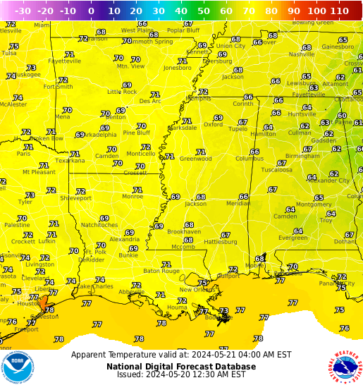
Looking at the graphics above, the sweltering heat that’s been present for weeks now will continue tomorrow. Afternoon high temperatures are expected to reach to low to mid-90s, with the highest temperatures expected slightly inland of the water. Not only will air temperates be hot, but the heat index of the fell-like temperatures will also be high. Heat index values are expected to top 100 degrees Fahrenheit (38 degrees Celsius). Although these temperatures may seem high, keep in mind that the average high in New Orleans for this time of year is 92 degrees Fahrenheit (33 degrees Celsius). Areas along the water should stay slightly cooler due to the sea breeze, which will also increase the rainfall chances as we will now move into the precipitation forecast.
Look Out for Showers and Thunderstorms
Looking at our precipitation forecast, you can expect a decent chance of seeing a shower or thunderstorm. Because of the sea breeze and the thermodynamics of connective warm air, shower activity is expected to increase as the day progresses. Also, a low-pressure system is expected to move in from the northwest, bringing in more shower activity to the region. Due to the combination of the low-pressure system and the afternoon sea breeze, areas near the coast should expect the highest chance of seeing rainfall. Looking at thunderstorm activity, any storms that develop should stay below severe status. Even so, any storm that forms could bring deadly lightning and flooding rains, so make sure to find a sturdy shelter if caught in a storm.
Extended Outlook
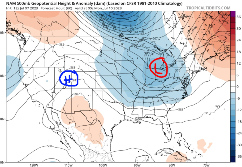
Looking at the extended outlook, quite a few things have changed. The first is a center of low pressure that has moved into the Midwest. This will bring cooler and wetter weather to the region, including the Gulf Coast. Not only will this increase the chance of showers and thunderstorms, but cooler temperatures can also be expected by next week. The other pattern I see is the ridge of high pressure forming over the four corners. This will bring hotter and dryer conditions to that region.
5 Day Forcast
Today: Sunny with afternoon showers and thunderstorms. High 94 with a heat index of 105. Winds south at 5-10 MPH. Chance of rain, 60%
Tonight: Showers and thunderstorms before 1 AM. Low 80. Winds southwest at 5-10 MPH. Chance of rain, 30%
Sunday: Showers and thunderstorms are likely. High 93. Winds west at 10 MPH. Chance of rain, 70%
Sunday Night: Mostly cloudy with a chance of showers and thunderstorms. Low 80. Winds southwest at 10 MPH. Chance of rain, 40%
Monday: Showers and thunderstorms are expected. High 89. Winds southwest at 10 MPH. Chance of rain, 90%
Monday Night: A chance of showers and thunderstorms. Low 77. Winds southwest at 5-10 MPH. Chance of rain, 50%
Tuesday: Partly cloudy with showers and thunderstorms. High 91. Winds west at 5-10 MPH
Tuesday Night: Mostly cloudy with showers and thunderstorms. Low 77. Winds southwest at 5-10 MPH
Wednesday: Showers and thunderstorms are expected. High 88. Winds southwest at 5-10 MPH
Wednesday Night: A chance of showers and thunderstorms. Low 78. Winds south at 10 MPH.


