Our El Nino is working over time this week as the Pacific remains active while Atlantic activity remains muted. In the Pacific, we are watching two new areas of interested after the two areas we had last week of Adrian and Beatriz formed and dissipated causing impacts to the western coastline of Mexico. Overall, we should see one or two storms form within the next seven days in this active basin as conditions remain beneficial for tropical development. The Atlantic, should remain quiet as Saharan dust and increased wind shear work to keep any tropical waves weak. Let’s dig a little deeper into the basins.
[wpcode id=”41149″]
Current Tropical Conditions
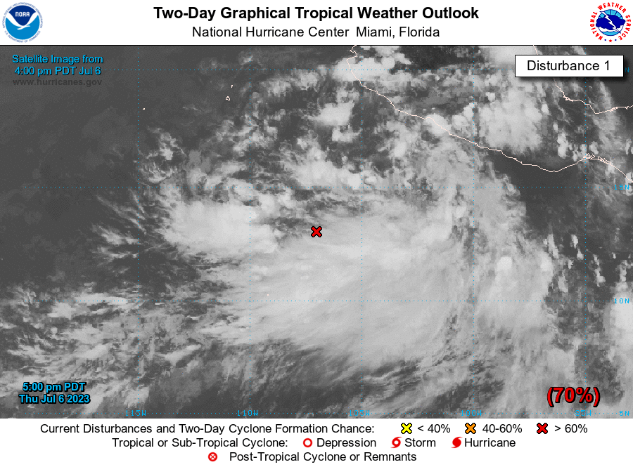
Currently, the Pacific Basin is putting on a show after getting a slow start this year with two new areas of interest, Invest 93E and a currently unmarked area of interest. Invest 93E is currently located about 12N 107W and is an area of disorganized convection with a broad area of rotation. We expect this area to gradually become better developed over the coming days as conditions allow the area of low pressure to consolidate and organize. The next area that is highlighted is due to models showing a second area of low pressure developing behind Invest 93E and under going the same developmental process. This region should remain active for at leas the next week as conditions are expected to remain the same.
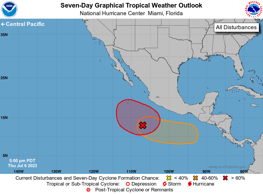
93E is currently within a plume of high SSTs (around 30 degrees C), weak wind shear, and an area of convergence. The only item that is limiting it’s development in the short term is the broad nature of the low pressure. As that low begins to consolidate around vigorous convection it shouldn’t take long for a tropical cyclone to form and begin to intensify. Over the next few days this system will track to the East Northeast before shifting to a West Northwest track and going out to see. Impacts for this system overall are expected to be little to none with the only notable impact possibly being an increased swell to the Western Mexican coastline.
Behind 93E, as another area of low pressure forms some gradual development could be expected as wind shear relaxes behind 93E’s outflow. This should allow a new tropical cyclone to form and progress in largely the same nature as 93E has. Climatologically, storms that form in the East Pacific this time of year tend to be fish storms as they largely go West and Northwest away from any coastlines. As we shift into August and September that may change, but for now like 93E impacts are expected to be marginal if any.
Out in the quiet Atlantic Basin the two main culprits for our quiet basin are Saharan Dust and High Wind Shear. The first, is typical for this time of year as climatologically June and July are months where waves of Saharan dust push off Africa into the Atlantic before settling in South America and the US. Fun fact, this dust is partially responsible for why the Amazon Rainforest is so fertile! The second, High Wind shear, has more to do with our El Nino pattern then climatology. As El Nino conditions result in higher shear values across the basin.
Extended Outlook
Looking ahead, the East Pacific looks to be the active basin for a while. Conditions out here are much more favorable for tropical storms than in the Atlantic, mostly due to the reduced amount of wind shear and deep moisture. Both the GEFS and EPS ensemble members reflect this by hinting at the possibility for more organized tropical systems to develop over the next two weeks, whereas both members are keeping the Atlantic Ocean largely quiet due to higher wind shear and large amounts of Saharan dust.
Conclusion
The East Pacific will remain active for a while as several areas of disturbed weather form, organize, and become tropical cyclones. The Atlantic during this time should remain quiet due to the shear and Saharan dust expanding across the basin. Overall, this looks to be the pattern over the next week or two as conditions are expected to largely remain consistent. Keep checking back for regular tropical updates!


