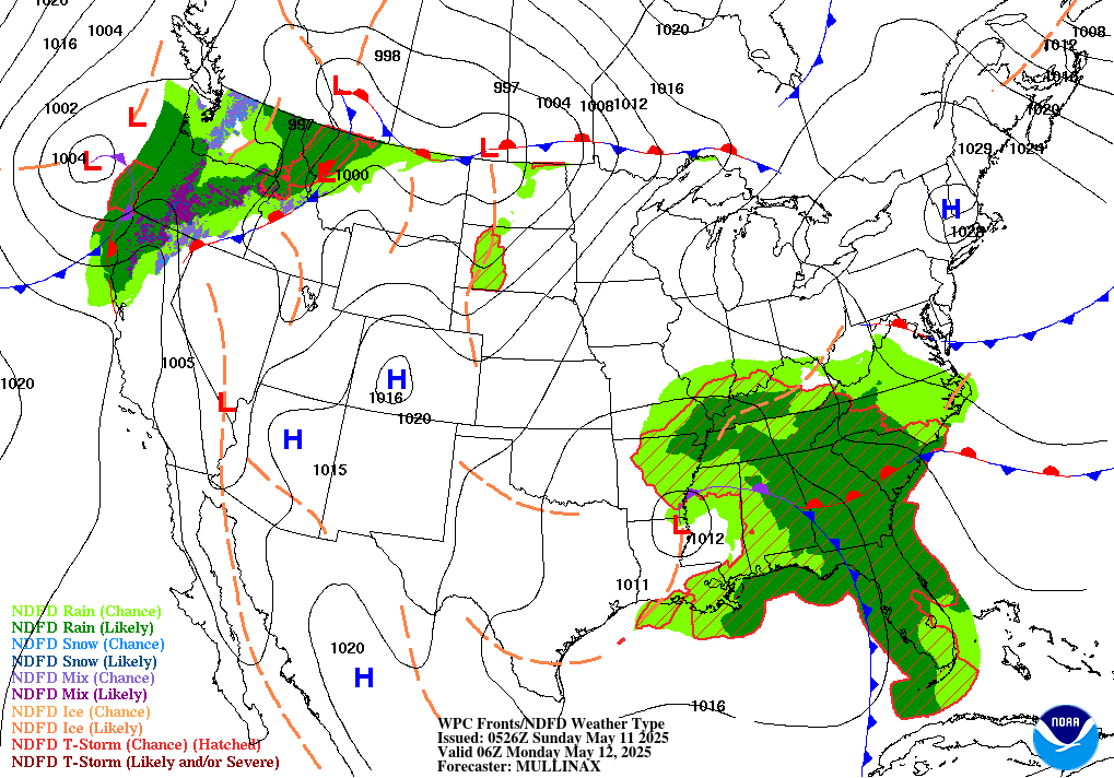
There is a widespread risk of thunderstorms and severe weather throughout most of the United States today with the main threat extending all the way from Wyoming down to Oklahoma and stretching east into Western Tennessee. Much of this is due to a sweeping cold front associated with the low pressure system moving along the Great Lakes. In combination with a strong southeast flow of moisture from Northwest into the Central Plains will lead much of this enhanced risk for severe storms.

Convective Storms Out West
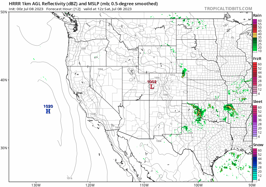
The High Plains region will be at risk today in part due to enhanced flow of moisture from the jet stream that at low levels is flowing more southwest into Oklahoma. This creates a strong instability for the convection afternoon to really blossom with the possibility of hail and strong winds. Isolated supercells will also have the chance to pop up this afternoon with strong enough shear. This threat area will span mostly from Eastern Wyoming and Colorado.

Jet building today with moisture flow

// Courtesy: Tropical Tidbits
Looking further south near Oklahoma and Arkansas, the primary driving force behind many of these storms will be the cold front moving through. Shortwave troughs off the mountains could also trigger some intense storms with hail all throughout the Slight Risk area.
Heat Building Up in the South

As this trough along the Eastern US continues to sit for possibly the next couple weeks, the ridging of our upper-level 300-500mb heights to the west will bring a intense heat to the Southwestern US while the Midwest will be seeing a bit of relief. However, this will be mostly be in the form of cloudiness and rain across the Eastern US.
Extended Outlook
Looking further out into next week, there is a general consensus among the models for an increasing ridge over the Southwest US that will likely heat up Arizona and New Mexico in a scenario similar to what we have seen throughout the South Central US the past couple weeks. The trough over the Eastern US will continue to bring a similar pattern to what we are seeing this weekend with widespread rain throughout region. The Central Plains extending down to the Gulf as well as the New England region will likely see an above average amount of rain the next coming week in this continuing trend of storms.


