Here is just a quick update on how things are stacking up out in the Tropics right now: Marco is producing heavy rains across parts of the Florida panhandle and Alabama as the center of the storm continues to mosey north. Laura is pounding Cuba with heavy rain, too, as it moves west-northwest.
Marco’s forward motion has slowed to just 8mph. While Laura is still chugging along at 20mph.
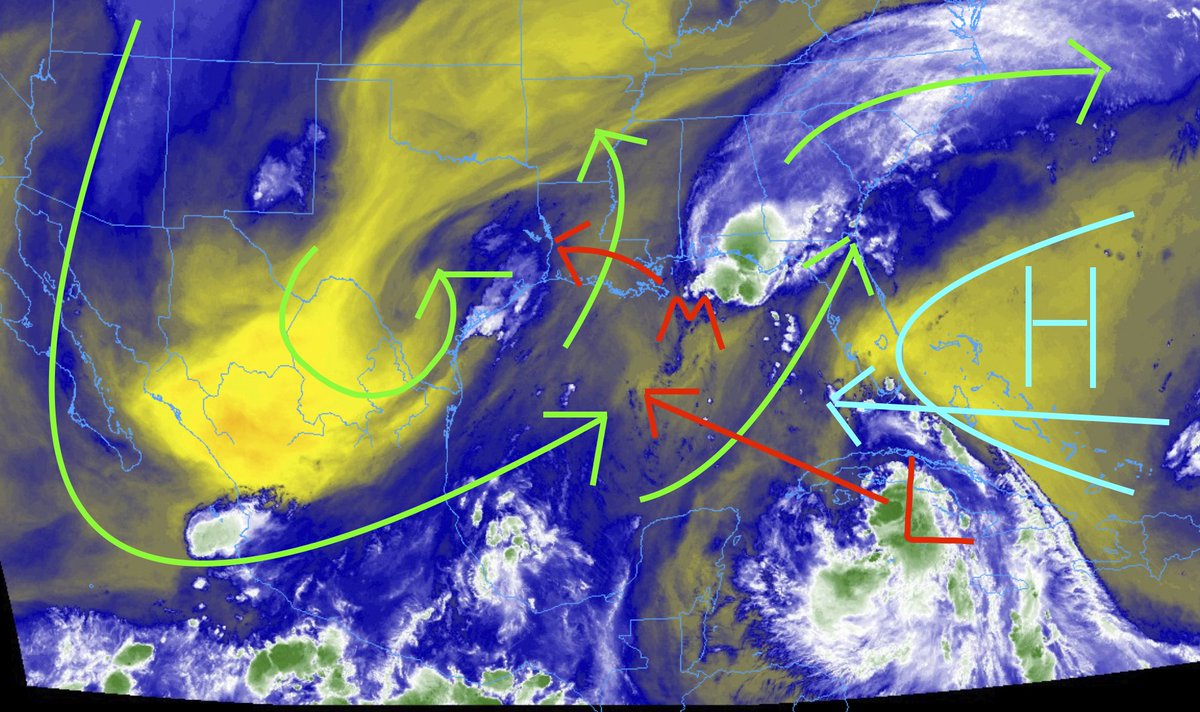
The entire setup is being influenced by a big ridge of high pressure in the Atlantic and a little upper-level Low that has developed in south Texas. The wind shear (yellow arrows) pushing across the Gulf and breaking apart Marco is the wind that is riding around the upper-level low and then up and around the ridge of high pressure.
In the lower levels, Marco is feeling the tug of the area of low pressure in Texas, as well as getting a bit of a shove from the ridge of high pressure in the Atlantic that is trying to move back to the west and assert it self across parts of the Southeast.
Laura is on the southern edge of that ridge, traveling west-northwest with the main flow of the atmosphere, trying to find the path of least resistance toward the North Pole (due to the Coriolis Effect).
In the above image, the orange arrows indicate the general movement of each piece of the puzzle during the next 36 hours. Marco will move west and die. The ridge will slide west, the upper-low will slide west and Laura will continue to move toward the Gulf trying to find a path north toward the Pole.
The tiniest of changes to these movements (or drastic ones) will change the eventual path for Laura.
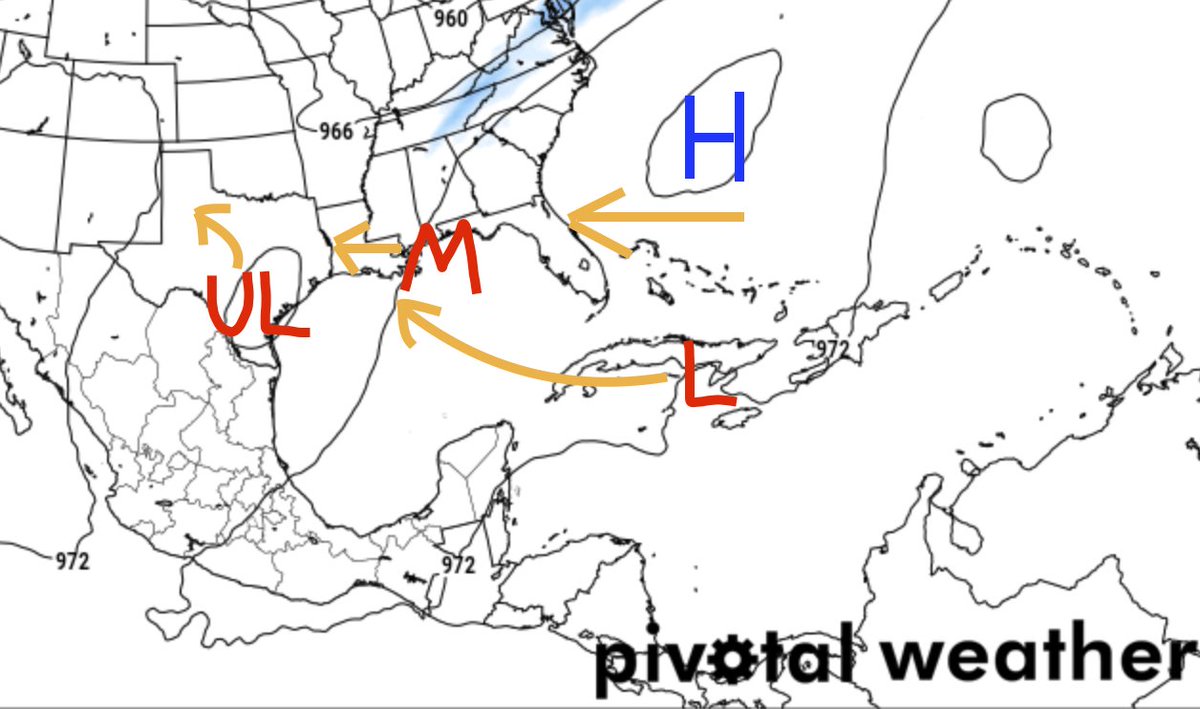
For now, in about 24hrs, the model data shows Laura out-pacing the ridge slightly and the upper-low pulling back toward Texas.
This will allow Laura to feel less of a shove from the ridge, but not yet any shove from the shear/steering and the upper-low. At this point, how strong it is will start to play a bigger role in where it moves specifically. Though, generally, it should continue to meander to the west-northwest.
Looking Back
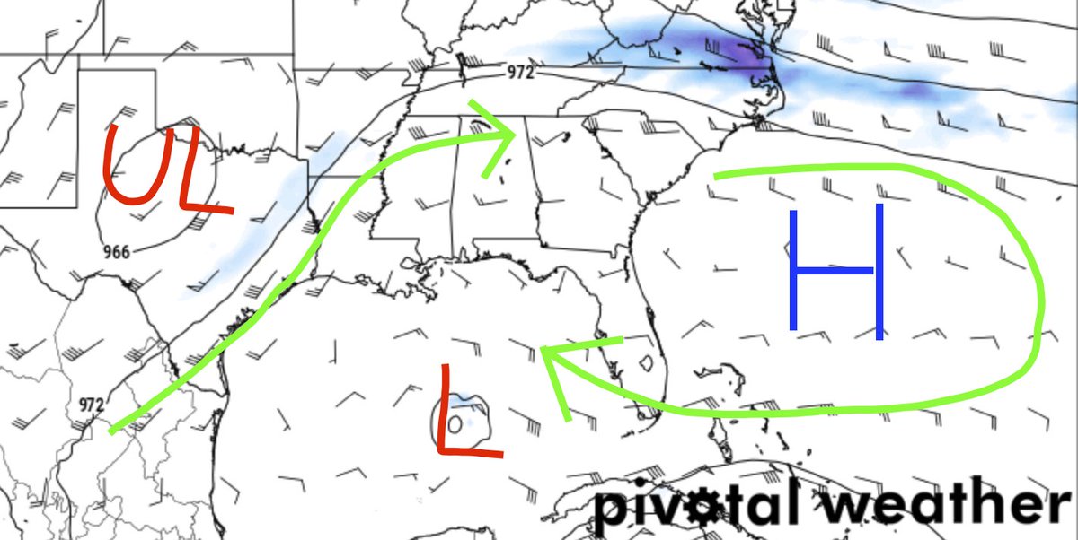
So this is kinda cool. Thanks to the College of DuPage Meteorology page, we can look back and see how this entire setup evolved. You may have to click/tap on it to get a complete, clear image.
You can see a little cluster of storms in Nebraska were the catalyst for the eventually development of an area of low-pressure in south Texas. And it is that upper-level low, that reinforced the shearing effect that is breaking apart Marco. It may also be indirectly responsible for the boost tot he ridging in the Atlantic that is helping to guide Laura further south on its journey, and further west in the Gulf.
Crazy stuff.
Current Forecast
Here is a quick look at the 10AM Advisories from the National Hurricane Center
Marco

Laura

Bottom Line
If you live anywhere from Corpus Christi to Mobile Alabama, keep up with the forecast for Laura. Now that Marco is dying, it will open the door to – perhaps – different outcomes not originally options while Marco was forecast to remain a tropical system.


