This isn’t going to be the typical “will it rain at my house” forecast. If you’re looking for a county-by-county breakdown of what to expect from Hurricane Ida, make sure to check out that post here.
Instead this is a look at all of the pieces to the puzzle that go into making that forecast as well as some extrapolations and estimations about where the forecast may go next.
The Setup
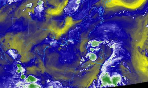
The setup across this region of the world – the Southeast, Gulf and Tropical Atlantic – features two ridges of higher pressure as well as one upper-level low and Hurricane Ida.

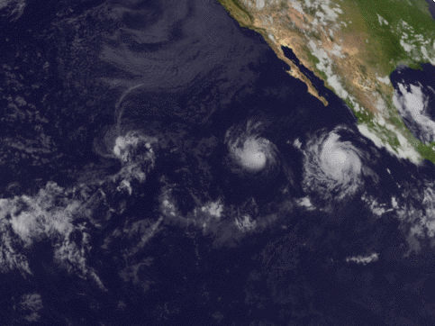
Ida is about to move over some very, very warm water in the Gulf of Mexico, too. This is why the NHC is concerned about Rapid Intensification. A look at the heat content of the Gulf and it is no wonder there is concern.

The track of Ida, when looking at the image above, move right over some of the warmest colors on the map. And it avoids all the bluer colors.
And when the forecast models see where Ida will be going and take all of the atmospheric factors and water temperature into account, it spits out something like this:

Then I spit out my drink.
For reference, here is a tweet about Hurricane Michaels numbers, which were markedly smaller than those above.
Recall that Michael made landfall as a Category 5 Hurricane with wind speeds that topped out at 160mph.
So the “top end” to Ida given the numbers the computers are spitting out as well as the atmospheric setup and seas surface – and sea depth – temperatures is quite high. The forecast calls for a Category 4, most likely because they want to ‘build up to’ forecasting for a Category 5.
You can almost think of it like the SPC, they don’t issue a High Risk on Day 3, they ramp up to a High Risk.
Puzzle pieces
The interesting thing about the forecast is that the ridge off the east coast was not anticipated to push as far to the west as it has. Though, it was also anticipated to be a bit stronger. Models a few days ago showed a more stout ridge that had just been eroded away on one side.


You can see the difference above, five days ago there was a notch where a system (Ida?) was going to be, while this morning Ida is still well to the south and there isn’t really much of a wall at all, it is almost an open door north into Florida.
So when is it moving northwest, and not north? A great question.
The 594m ridge that is off the Carolina coast is influencing it just enough and giving it just enough of a westerly push to give it a general northwest track.
The interesting thing is that most model guidance shows that 594m ridge sliding to the west during the next 48 hours. The HWRF pushes the “nose” of the ridge across much of Mississippi leaving the avenue north over parts of Louisiana.

And it is that nose that is also keeping Ida from blitzing north.
What could change to make the forecast change?
Forecasting the forecast! That is my favorite.
I know many people in Mississippi and Alabama have been (rightfully) concerned that this may turn quicker or move more northerly, increasing the local impacts.
Could that happen? Sure. It could. A better question is “what is the likelihood of that happening?”
That is a much more difficult answer to find.

The answer lies in how the ridge of high pressure that is currently sitting over the Carolinas slides to the west. And how the upper level low (not pictured) interacts with Ida in the next 24 hours.
If the ridge is troner inland, it slides more west, if the ridge is weaker inland, it slides more west.
On top of that, though, the upper level low is another cog in the equation.
The upper-level low may offer some very weak nudging that isn’t being picked up in the guidance well. They two may do a – very minor – Fujiwhara dance.
It isn’t going to be anything drastic, but it may be just enough to nudge it slightly more north, which would then pull it inland a bit more to the east.
But it may not be able to give much of a nudge, depending on the strength of the ridge.

This is exactly why the meteorologists at the NHC make the big bucks!
If I had to make the call, as much as earlier this evening I said I was concerned about easterly movement… I’m now wondering about more of a slightly westerly kick.
And then, once it gets inland, it may not peel back to the northeast as fast.
But, hey, this is all speculation.
Potential consequences of above-mentioned potentials
Potentials of potentials! Now we are talking!
If Hurricane Ida slides inland to the west and doesn’t curl back to the northeast, but instead just rides north, I don’t think it changes much at all. It still leaves many spots in a primo position to get tropical tornadoes.

That hodograph (upper right hand side of the above image) is long and arched and perfect for creating tropical tornadoes. And this was taken from a model that shows a more westerly landfall AND a due northerly track after landfall.
The only real change may be lower rainfall amounts for Alabama and southeastern Mississippi, and lower sustained wind for the same areas. But the end result will still be less-than-ideal conditions for a long period of time with a lot of downed trees, powerlines, and folks without power for – at least – a few days.
So, it really doesn’t change much.
What about if it slides north earlier and comes ashore farther east?
It spends more time over the very warm loop current. And likely ends up going through Rapid Intensification still.
However, this may result in a storm that goes through Eye Replacement while approaching shore (much like Katrina) and thus loses a bit of the top end ‘bite’ but widens the overall wind field.
But recall that in order for it to slide farther east in the short-term, it would then get shunted back to the west closer to landfall, so I don’t think it changes much for overall impacts.
Unless there is a big jog to the east with a, for example, Mississippi coast landfall. But that is highly unlikely given the overall setup. Same with an eastern Louisiana or Texas landfall. Possible? Sure. Likely? No. In fact, highly unlikely.
Final Verdict
I can’t really argue with the NHC. Given the data that is available, it looks like the forecast landfall point may shift back and forth, but we are talking about by 50 miles one way or the other – not hundreds of miles.

And once inland, it looks like a race to Vicksburg, regardless of landfall point.


