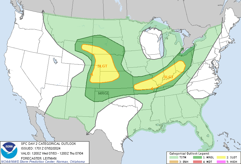
Similar to the conditions of the previous few days, storms, some severe, can be expected across the central portion of the US today particularly in the Northern Plains while heat continues to bake the South and Southwest. Additionally, we see severe storms possible across portions of the Mid-Atlantic as well. Will we see a pattern flipping allowing a break from this reoccurring pattern? Let’s take a look below and see.
Severe Storms Expected in the Northern Plains and Mid-Atlantic.
Two different areas of severe storms are expected to develop today. One region over The Northern Plains and another over the Mid-Atlantic region. Both regions have similar threats being primarily damaging winds, damaging hail, and an isolated tornado threat, but the focing mechanisms are different.

The Northern Plains storms will come as a result of diurnal heating (daytime heating) leading to destabilizing ahead of a weak cold front. As the front and an attendant shortwave progress through the region scattered storm development is expected which will eventually grow upscale and lead to potential mesoscale convection system (MCS) development. Once this change occurs, the damaging wind threat will dramatically increase while hail and tornado threats drop some. Importantly where this bow ends up could become the focus for the next day storm development so residents in the Northern Plains as well as those in the Midwest should monitor storm progression as it will directly impact how they conduct their day.
The second region of storms is a prime example of this situation with the expectation of an ongoing bowing MCS segment is expected to impact the area. This region, will see damaging wind gusts and small hail as the primary threat with an isolated tornado threat expected as well. These storms are expected to be weakening from the overnight into the early afternoon hours before a renewed surge of a cold front in addition to daytime heating ahead of this line helps reorganize storm development and destabilize the region once more. This new development could lead to a more widespread damaging wind, hail, and tornado threat, but exactly where this destabilizing occurs will be dependent on the progression of the line overnight as well as the position of the cold front in the afternoon. Residents should monitor this area to see where round one and potentially round two of storms could find themselves throughout the day.
Heat Across the South and Southwest
In what seems to be the story of the summer, the South remains hot. Extreme heat continues to plague the South and Southwest with little relief in sight. This region has been squarely under a ridge for the bulk of the summer with only small subtle shifts providing much int he way of relief. Unfortunately, we don’t expect much relief in the coming days as the ridge looks to remain parked overhead for the foreseeable future. The only relief, will be portions of the South and Southeast that find themselves under Northwesterly flow aloft. This pattern leads to divergence in the atmosphere and encourages storm development and thus relief from the heat. Another region where relief could be realized is in the desert southwest where the North American Monsoon is in full swing. This could lead to some cases of isolated flooding, but overall conditions will remain incredibly hot and uncomfortable for many. Remember to stay hydrated if you find yourself in such heat!
Extended Outlook
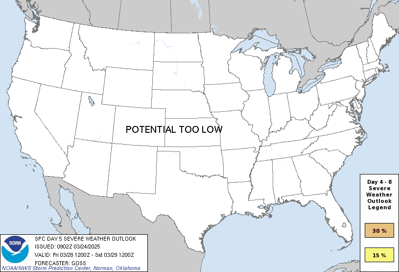
The pattern we currently have looks to remain in place for the time being with the only change being increased troughing over the Midwest. This may lead to an increase in storm chances for the region (which is currently shown in the SPC extended range) otherwise the pattern looks to remain the same. A large expansive ridge will remain in place across the Southwest and South as a series of troughs work their way across the Northern Plains and into the Northeast.
Travel Outlook
Travel may be impacted by severe weather across the Northern Plains such as the Dakotas, Nebraska, Kansas, Iowa, and Minnesota as well as in the Mid-Atlantic across North Carolina, Virginia, Georgia, Alabama, and South Carolina. Air travel though these regions could also be impacted as storms develop throughout the day. Heat could also prove to be a hazard for those that find themselves working predominately outside.
Conclusion
Storms continue across swaths of the country leading to damaging winds, large hail, and isolated tornados as the main threat. Additionally, heat continues to bake large sections of the country that remain stuck under the influence of a ridge. Travels through the states should remain aware of the many hazards currently impacting the US and plan for delays in their travels. Looking ahead, storm chances across the Midwest look favorable as enhanced troughing leads to a strengthening in the jet aloft. This increase should create a region for severe weather, but where exactly this materializes will be realized a bit more clearly once the threat is a bit closer.


