Keeping with the overall theme, the Pacific Ocean currently is, and will continue to be, a hotbed for tropical activity both in the near and distant future. Hurricane Dora remains (as of 8:35pm CDT) a category 4 hurricane and continues its journey westward through the Central Pacific. Back closer to the Mexican coast, more activity is expected and tropical development may be possible in the coming days. Over in the Atlantic Ocean however, conditions still remain mostly unfavorable for sustained tropical development over the forecast period.
Short-Term Outlook
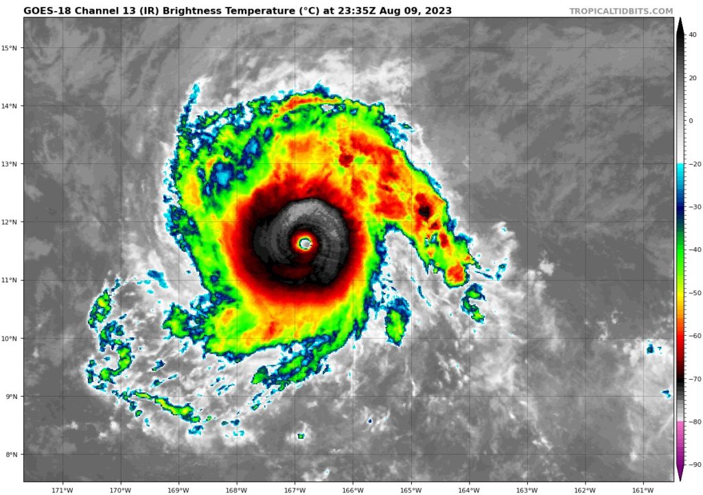
Beginning in the Central Pacific, as of 7:00pm CDT, Hurricane Dora remains a low-end Category 4 hurricane with sustained winds of 130 mph. Dora is currently located 900 miles southwest of Honolulu and is moving off to the west at 22 mph. Dora will remain as a major hurricane over the next couple of days before it runs into more unfavorable wind shear and slowly weakens heading into the end of the week and weekend. This storm will remain over open waters and should not pose a threat to any other islands in the Pacific.
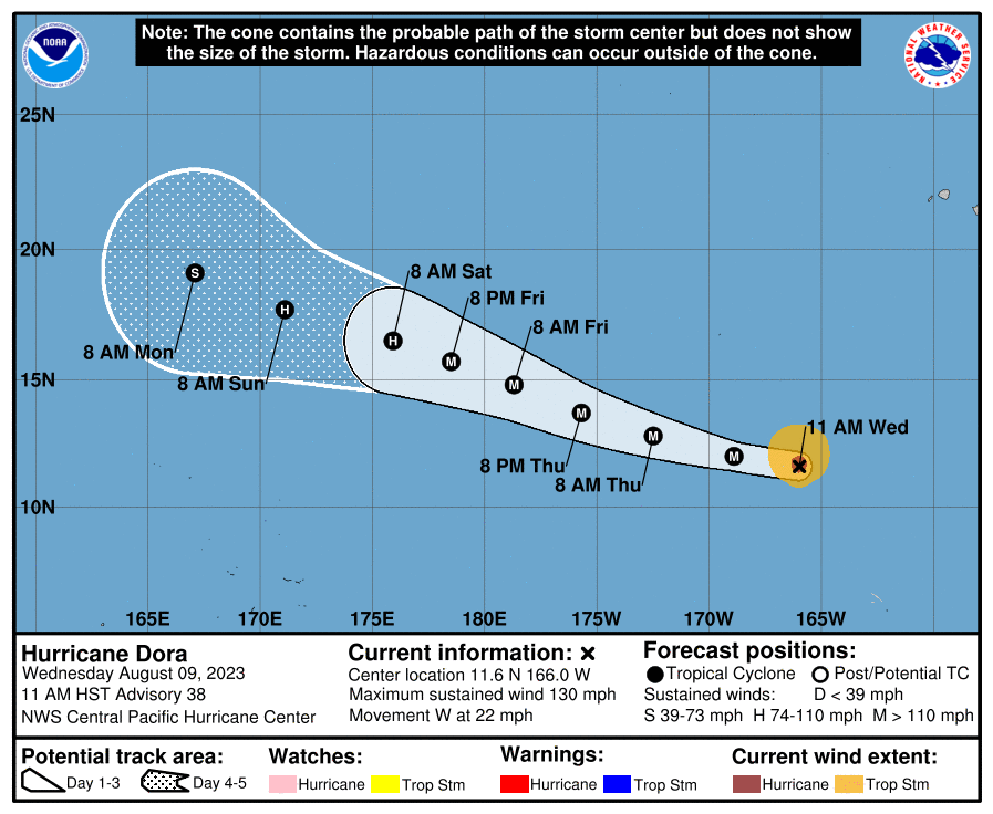
Editor’s Note: When Dora crosses over the International Dateline, it will be known as a Typhoon. This is the first time that an eastern Pacific hurricane has made it this far and crossed over the dateline since 1991 (that I could find). Hurricanes that form in the central Pacific cross teh dateline every few years. It will not get a new name, officially, but may be called something different locally. -Nick
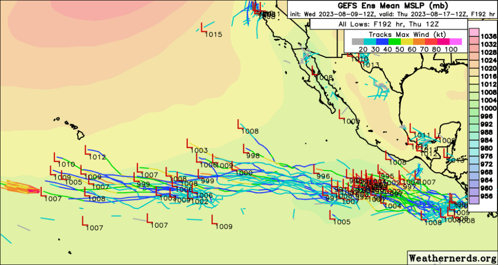
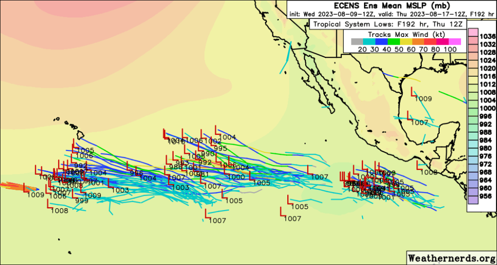
Back in the Eastern Pacific, several clusters of thunderstorms will try to get their acts together as the days progress. Very warm SSTs, minimal upper-level wind shear, and a relatively moist atmosphere will favor steady tropical development over the coming days. Organization is not anticipated within the short-term period, but there is strong agreement in at least one system developing by the weekend. These storms, if they do in fact become organized tropical systems, will generally move off towards the west into the Central Pacific at 10 to 15 mph.
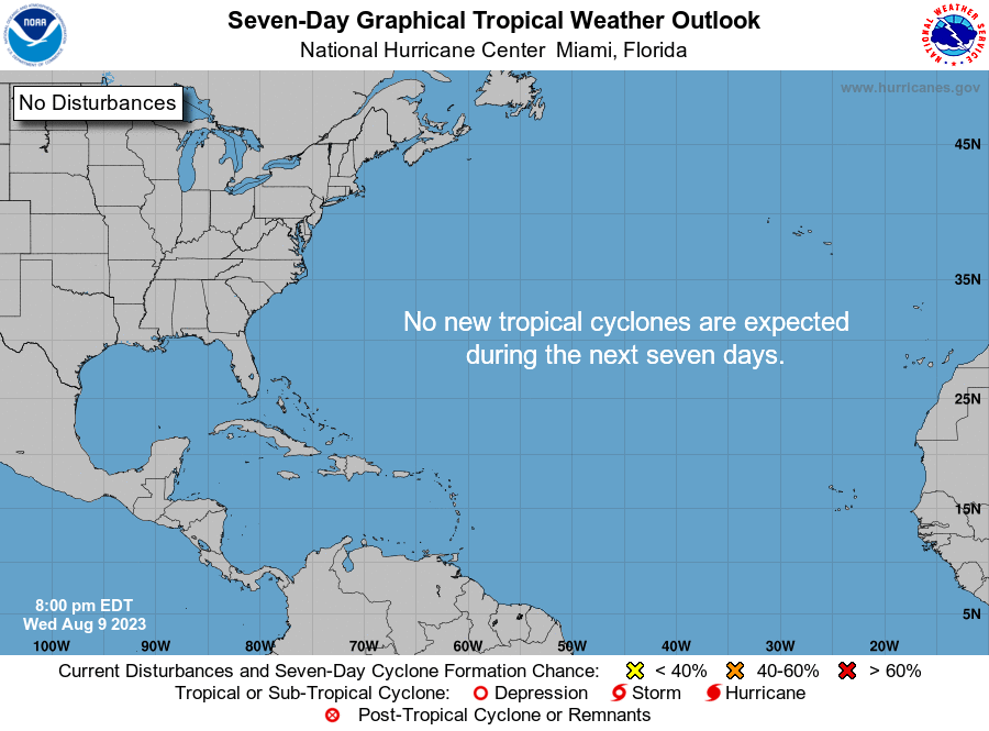
Over in the Atlantic, the same song and dance sung last week will be sung again this week. Very dry air and moderate wind shear will continue to keep the basin pretty quiet, in lieu of very warm ocean temperatures. Overall, this pattern will continue over the next week or two.
Extended Outlook
Most of the attention long-term will be in the Central and Eastern Pacific, where several disturbances may find themselves organizing into tropical storms by the weekend and into next week. Ensemble guidance is in strong agreement for at least one or multiple storms to develop out here with the very favorable conditions in place. As mentioned previously, these storms would generally take a westerly course as they progress.
On the other hand, the Atlantic will still look to remain largely devoid of organized activity. Conditions are too harsh at the moment to allow for any tropical waves coming off of Africa to intensify across the Central Atlantic. This peace overall looks to last long-term, especially with a vigorous subtropical jet and very dry air over the basin. IF we see any storms try to develop, they would most likely be closer towards the Caribbean Sea or Gulf of Mexico where conditions are slightly more favorable for tropical activity.
Conclusion
Hurricane Dora will continue to make its journey westward into open waters of the Pacific and gradually start weakening over the coming days. In the Eastern Pacific however, more unsettled activity will look to become the next round of tropical storms as they slowly intensify and progress westward into very favorable oceanic and atmospheric conditions.
The same cannot be said for any perspective storm in the Atlantic, where a strong subtropical jet (thanks to El Nino conditions) and very dry air over the basin will keep things at bay over the long-term period. We will see how long this lasts. but for right now, it does not look like this pattern will change anytime soon. By far, the Pacific Ocean will remain more conducive for tropical development than the Atlantic Ocean over the next couple of weeks.


