Overall Setup
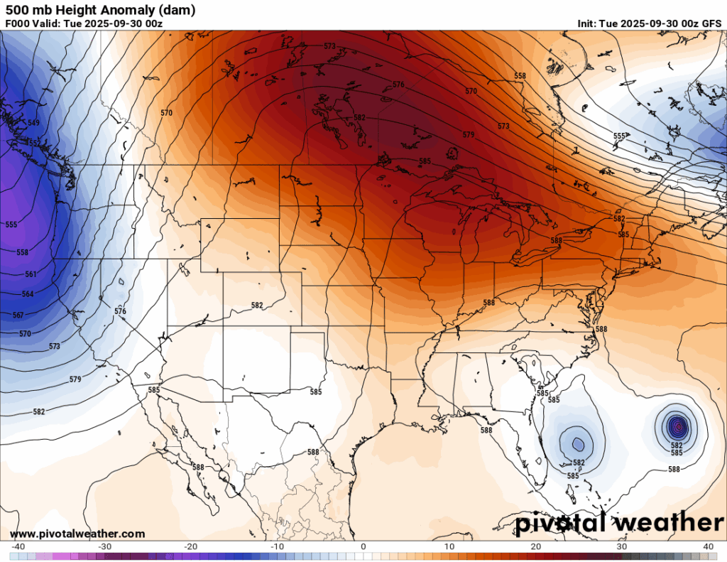
A strong ridge of high pressure stretching across much of the U.S. and into Canada is keeping conditions calm for most of the country, including our region. While a surface trough may spark a few very isolated sprinkles, the majority of us will stay dry and enjoy a mix of sun and clouds.

Tonight’s Forecast
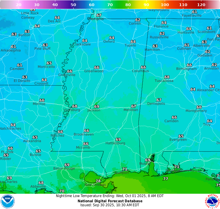
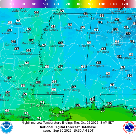
The clouds that we saw today will stick around through the overnight and low temps will generally drop to the high 60s. That surface trough I mentioned tries to squeeze out a few showers overnight, but not much at all is expected.
Tomorrow’s Forecast
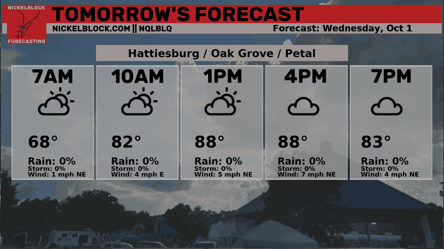
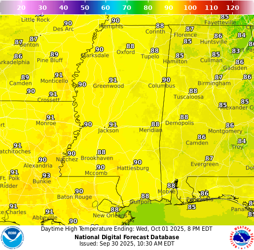
Highs tomorrow will reach the upper 80s under a mix of sun and clouds, with humidity staying fairly manageable. By mid to late afternoon, around 3-4 PM, a few showers could develop, so some spots could see some quick rain, while others stay dry. Overnight, skies will gradually clear and lows will drop into the middle/upper 60s.
Thursday’s and Friday’s Forecast
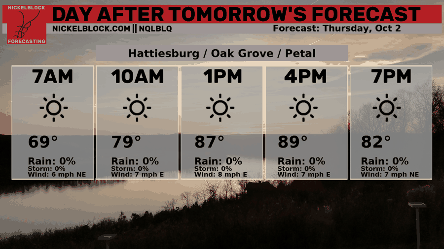
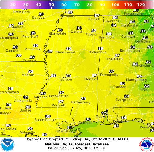
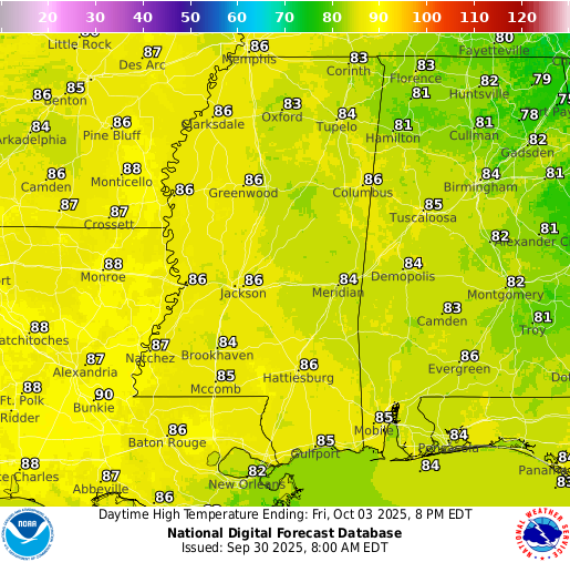
Thursday and Friday will be dry with lots of sunshine. Highs reach the upper 80s Thursday and mid-80s Friday, but with dew points in the 50s, it will not feel humid! With moisture that low, it’s tough for rain to develop, so we won’t see any.
Extended Local Outlook
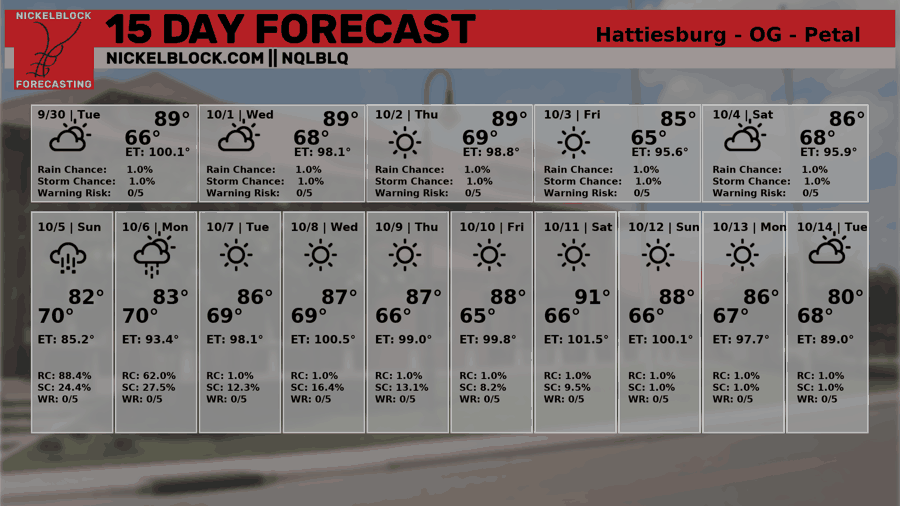
Saturday continues to have nice weather similar to Friday’s with the lower humidity and dry conditions. We are watching an area of low pressure that could form off of a stationary boundary over the northern Gulf on Sunday, which could potentially bring us some increased rain chances for Sunday and Monday. We are still pretty far out, so we will keep you updated with the most accurate forecast throughout the week.
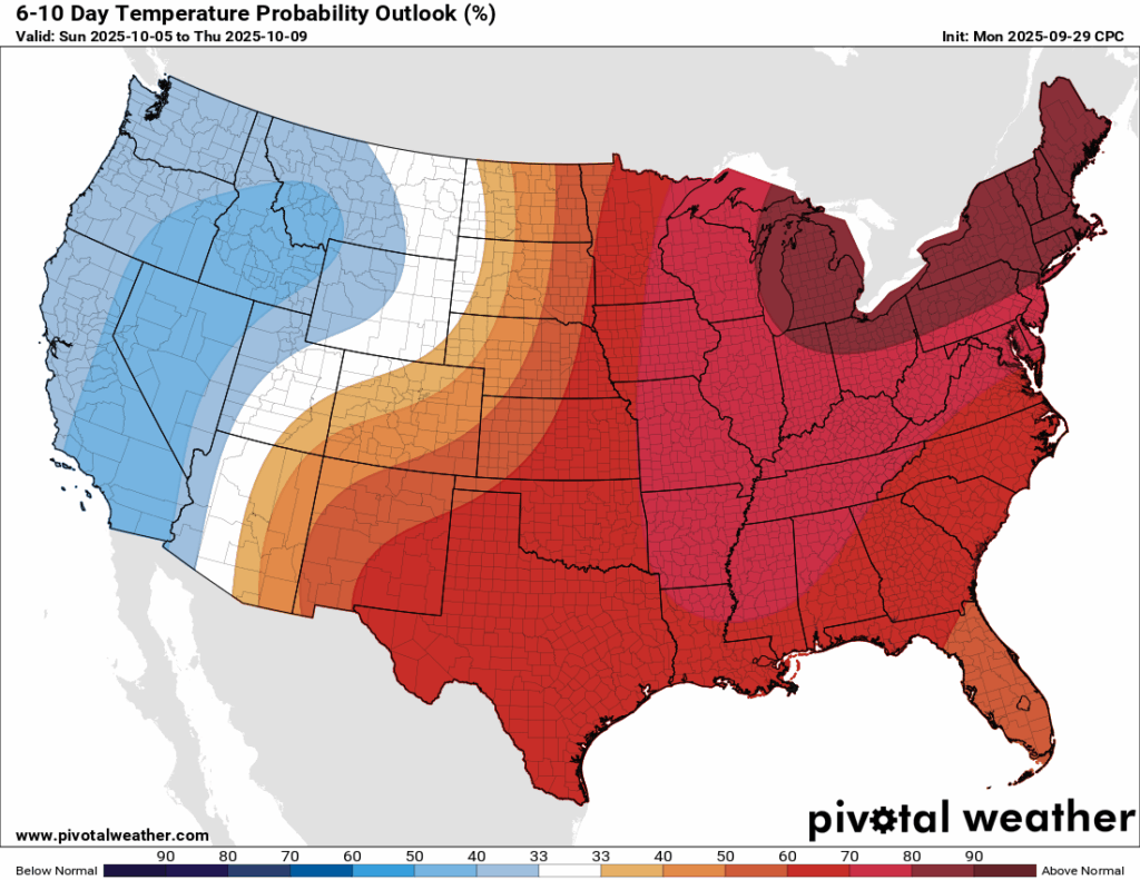
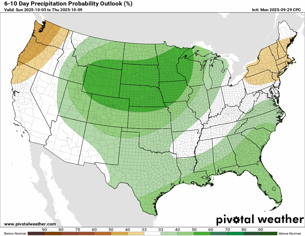
The 6-10 day outlook keeps our region warmer than normal, which I know isn’t the best news if you’re tired of the heat. The good news is that the precipitation outlook is finally showing some darker shades of green, signaling a better chance for above-normal rainfall. This is likely tied to the stationary front expected to linger over the northern Gulf, which could bring rain not only Sunday and Monday but also into early next week. Rain chances in the 15-day forecast are running higher than usual

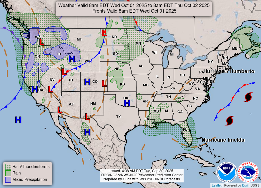
Latest Tropical Update
Atlantic:
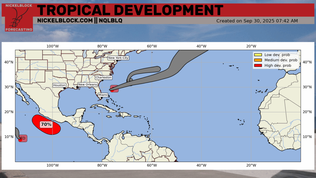
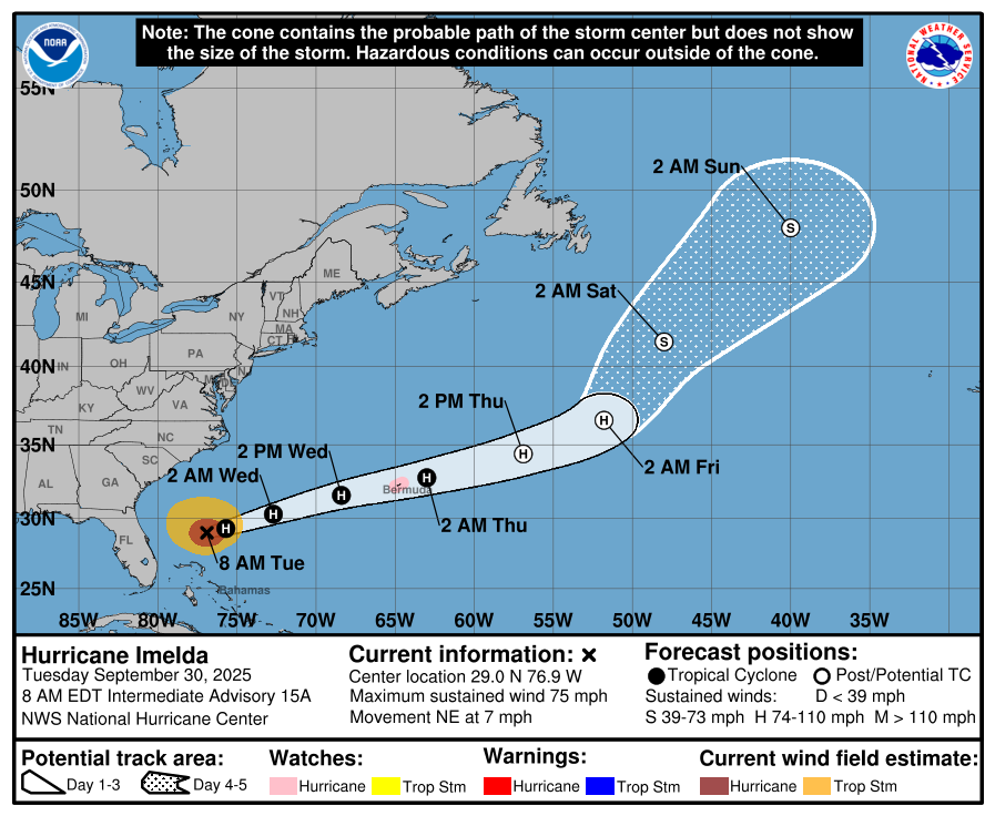
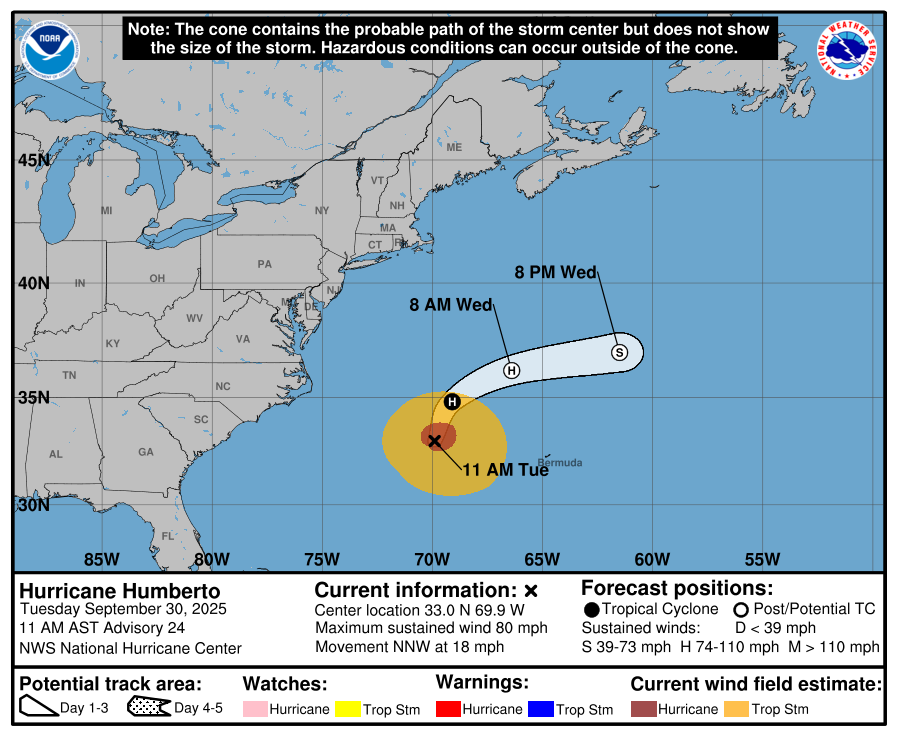
Imelda has spared the Carolinas, but is now a threat to Bermuda as the island is in the direct path of the forecast cone. Hurricane Warnings are now in effect for the island as Imelda is still expected to be a Hurricane by the time it approaches Bermuda. We thank Humberto for most of the reason why Imelda turned out to sea, which has been downgraded to a Cat 1 Hurricane earlier this morning while moving out into the open Atlantic north of Bermuda. No other areas to watch are currently outlined, but I would expect more storms to ramp up soon as the Atlantic is fairly conducive for development right now.
Eastern/Central Pacific:
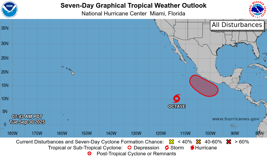
In the Eastern Pacifc, we have Tropical Storm Octave that will spin around in the open waters, capping off as a Tropical Storm before diminishing. To it’s east, there is an area to watch with a high probability of development. This system is expected to ride up the coast to the northwest and it’s moisture could eventually cause some flooding concerns in the southwest into Texas after it weakens.
REGIONAL DAY TO DAY FORECAST
Tonight: Mostly cloudy with lows in the upper 60s. A passing shower is possible. North winds around 5 mph, becoming calm in the evening. Chance of rain 10 percent.
Wednesday: Mostly sunny with highs near 90. A passing afternoon shower is possible. Calm winds becoming east-northeast around 5 mph in the morning. Chance of rain 20 percent.
Wednesday Night: Mostly clear with lows in the mid 60s. East-northeast winds around 5 mph, becoming calm in the evening.
Thursday: Sunny with highs in the upper 80s. East winds 5 to 10 mph.
Thursday Night: Mostly clear with lows in the low 60s. East winds around 5 mph.
Friday: Sunny with highs in the mid 80s. East-northeast winds around 10 mph, with gusts up to 20 mph.
Friday Night: Mostly clear with lows in the mid 60s. East-northeast winds around 5 mph.
Saturday: Sunny with highs in the upper 80s. East winds 5 to 10 mph, with gusts up to 20 mph.
Saturday Night: Partly cloudy with lows in the upper 60s.
Sunday: Mostly sunny with highs in the mid 80s. Chance of showers and thunderstorms. Chance of rain 30 percent.
Sunday Night: Partly cloudy with lows in the upper 60s. Chance of showers and thunderstorms. Chance of rain 30 percent.
Monday: Mostly sunny with highs in the upper 80s. Chance of showers and thunderstorms. Chance of rain 30 percent.


