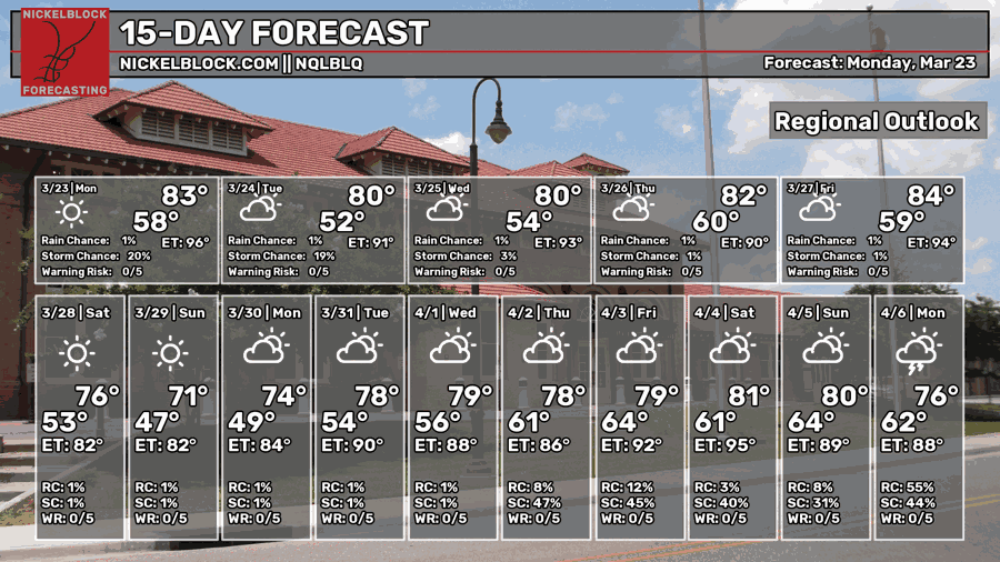
We’re still stuck in a warm spot for a while, but overall it’s going to be a beautiful weekend ahead. We’re going to stay dry for the most part except for a very slim chance of rain Wednesday evening. The good news is that by this coming weekend, temperatures will fall back around 5-10 degrees thanks to an incoming cold front, so if you want to be outdoors, it’ll be the perfect time!

Today
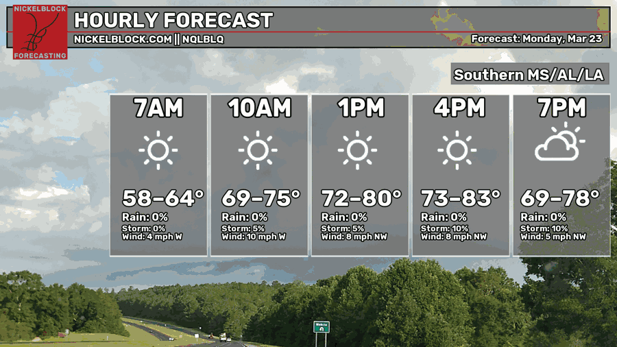
There’s some patchy fog around this morning, so be careful on your commute! Otherwise, we’re gearing up for another warm day in the low 80s across the Pine Belt. A few clouds in the sky with winds out of the southwest. Tonight, we’ll fall into the mid to upper 50s.

Tomorrow
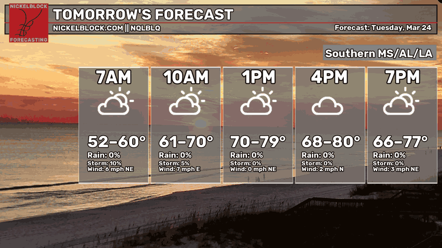
We’ll have a brief period of even drier conditions on Tuesday morning with northeast winds following a stalled front. As the front moves out, we’ll have partly cloudy skies during the day keeping temperatures down a hair around 80. Afterwards, the high pressure system sets in bringing more easterly winds. Overnight, temperatures fall into the upper 50s.
Wednesday
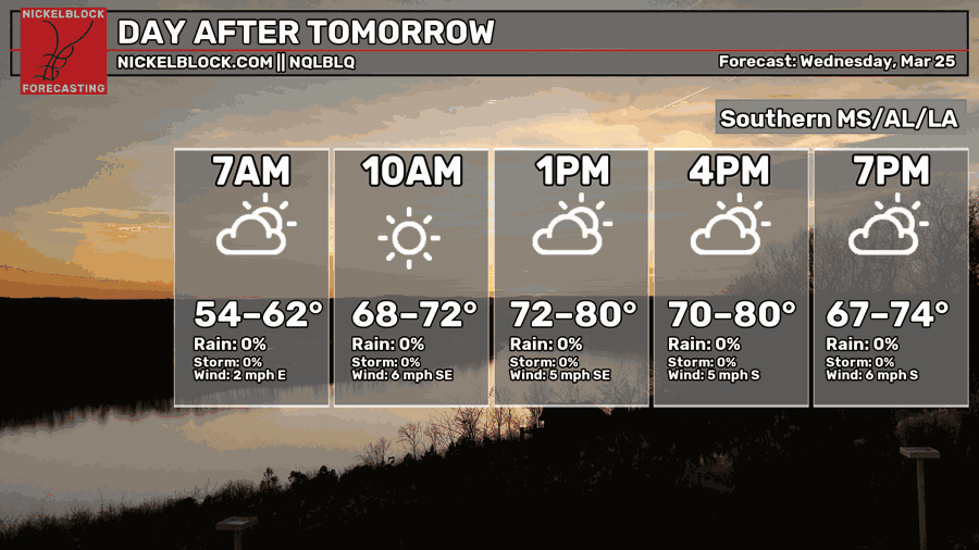
It’s going to be another warm one, however that stalled front I mentioned earlier is hanging around the Gulf coast and may actually contribute to a few possible showers Wednesday afternoon. I say “may” because it’s looking pretty conditional as there isn’t a lot of available convection to work with, but we may see a few pop-up showers across the Pine Belt and coastal areas. Otherwise, we’re going to warm up a bit to the low to mid 80s with partly cloudy skies. Overnight, we’ll fall back into the 60s.
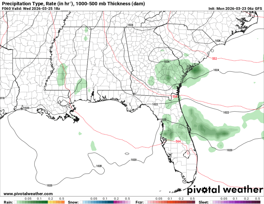
//Courtesy: Pivotal Weather
Thursday and Friday
Another couple of warm days are possible Thursday and Friday with a building surface high in the Gulf. Temperatures will warm up into the mid 80s and lows in the low 60s. All in all, it’s going to be very warm for March and early Spring for that matter. The good news? Another cold front! The bad news? No rain! Yeah, this thing dries out as it moves southward towards our neck of the woods, so we likely won’t see any rain as it passes through. On the line of the good news, though, is that the weekend will be much cooler than Thursday and Friday with a high in the mid 70s.
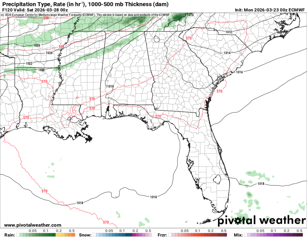
//Courtesy: Pivotal Weather