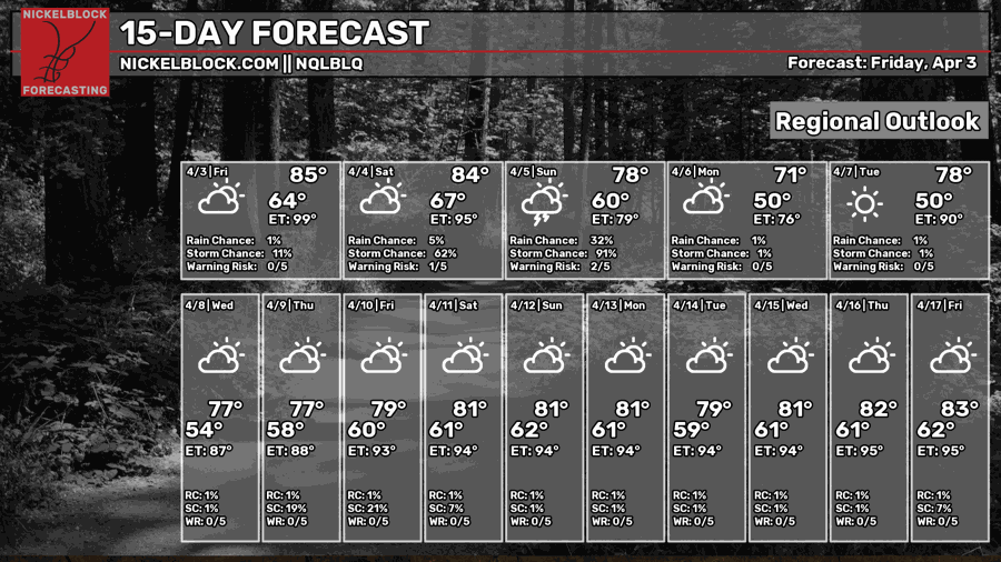
Good Friday is looking fairly humid as more southerly wind brings Gulf moisture to the Gulf South. The good news is that we won’t get much rain today! The bad news? Most of it is coming in tomorrow. It also looks like the morning part of Easter will get rained out too, so you may want to have your Easter egg hunt later in the day. Otherwise, next week is looking fairly pleasant!

Today
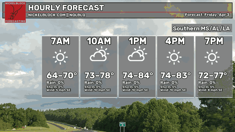
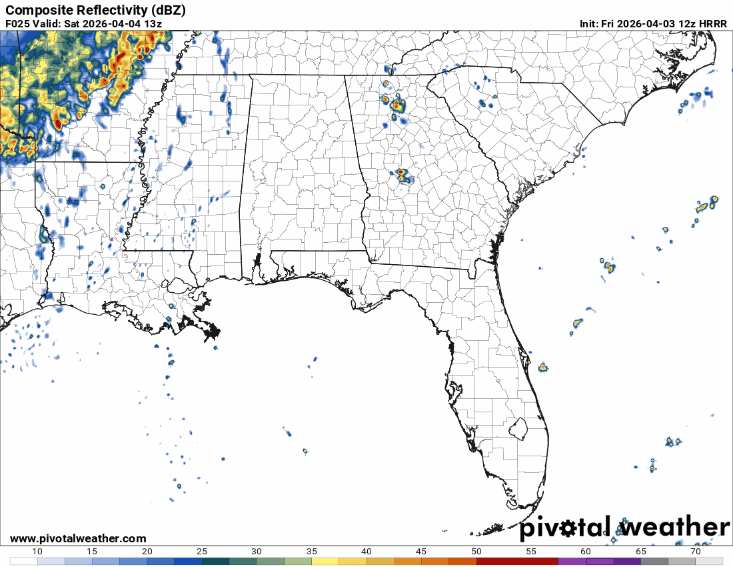
Today will be a partly cloudy day with temperatures in the low to mid 80s. Most of the rain will hold to the west at the MS/LA border, so it’ll be a more humid day than anything. Overnight, we’ll have clear skies with temperatures reaching the mid 60s.

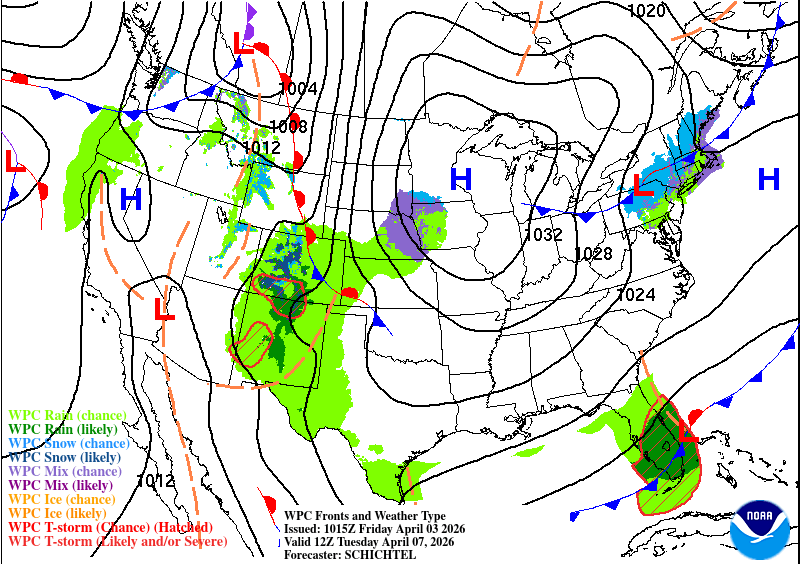
Tomorrow
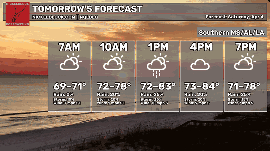
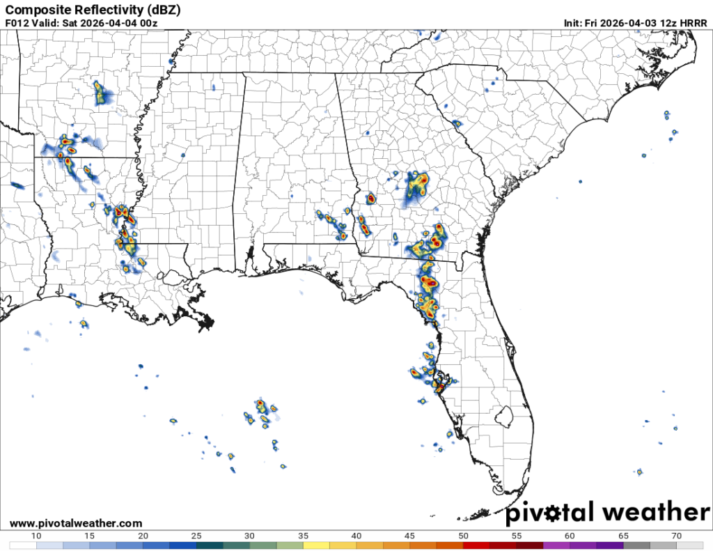
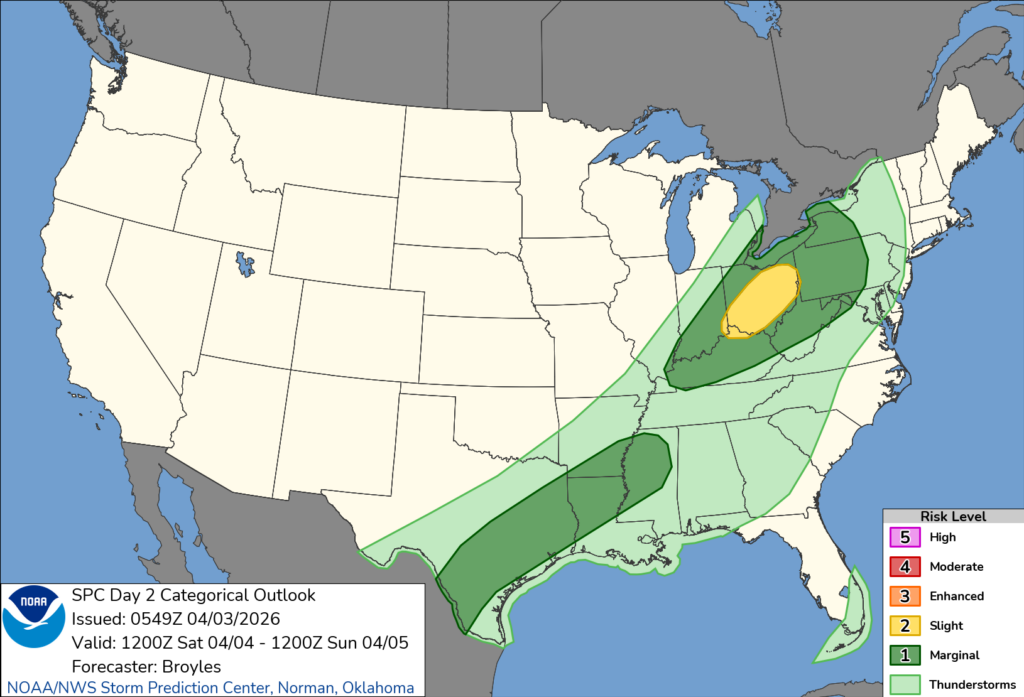
The rain will move in by the late morning hours tomorrow, so be aware if you’re outdoors. A few stray showers will begin at that time before we move into more clustered cells by the afternoon. The good news is that we are outside of the severe risk. The SPC has placed the Marginal Risk (1/5) further north and west from our area as some cells are forming ahead of the line. We’ll still see some of those reach the Pine Belt, but their strength will wane as they reach us. We need to look out for lightning and heavy rain.
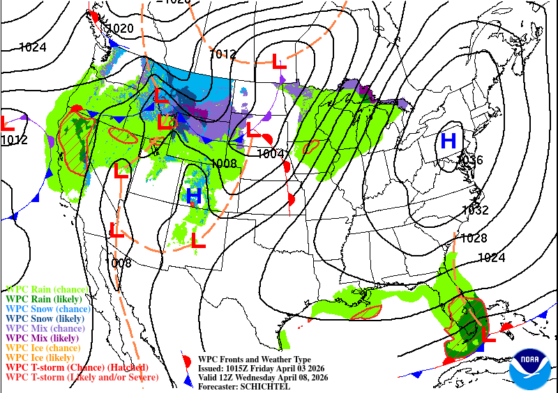
Sunday
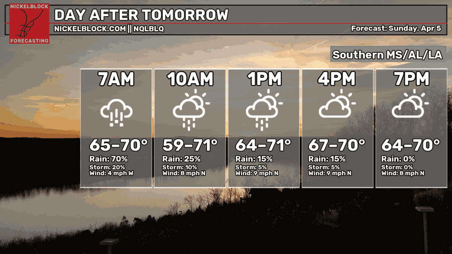
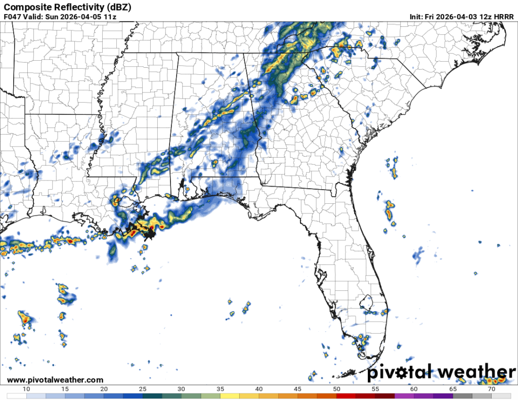
Starting off your Easter morning, it’s going to be pretty soggy. Rain will continue through 6-8am, so if you’re going to the sunrise service, bring your umbrella and a rain coat. Afterwards, a few strays will move through towards the afternoon before we clear up by the mid-afternoon. Highs will be in the low 70s with winds shifting towards the north. Overnight, we’ll fall around 50.
Next Week
After the cold front moves in, we can expect a brief cooldown and drier conditions. A large surface high pressure system will move in from the Canadian Rockies on Monday and move further east through the week. We’ll start off temperatures in the low to mid 70s on Monday and eventually reach the low 80s by the weekend. It’s a fairly gradual shift, however due to the high pressure moving further east, it will bring more Gulf moisture reducing the temperature range from the 70s-50s pattern to an 80s-60s one. Little rain is expected as well and it will be relegated to the coastline thanks to the high pressure’s influence.
Extended outlook
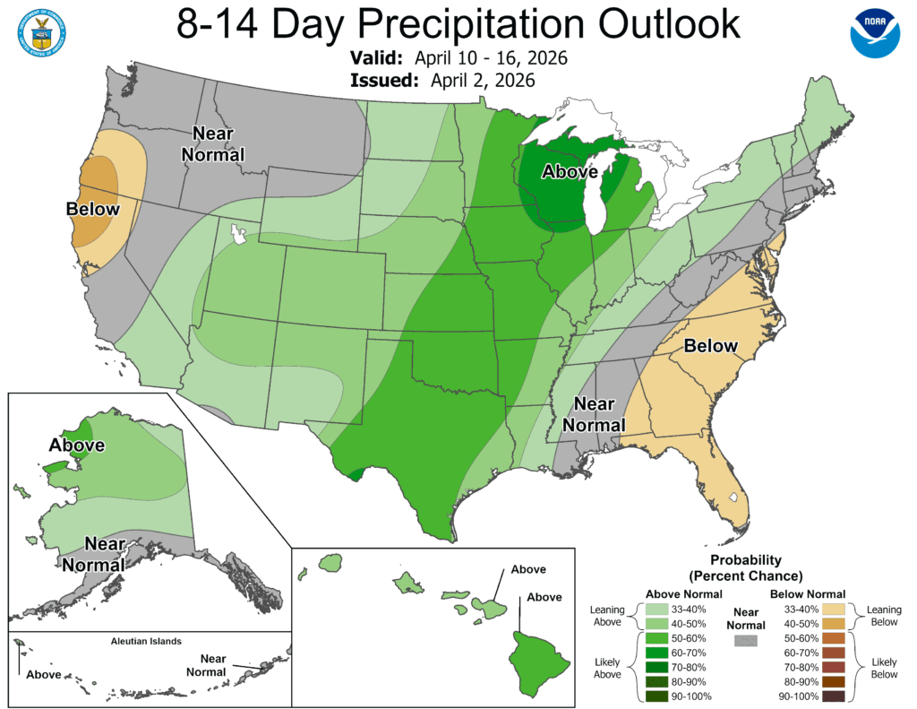
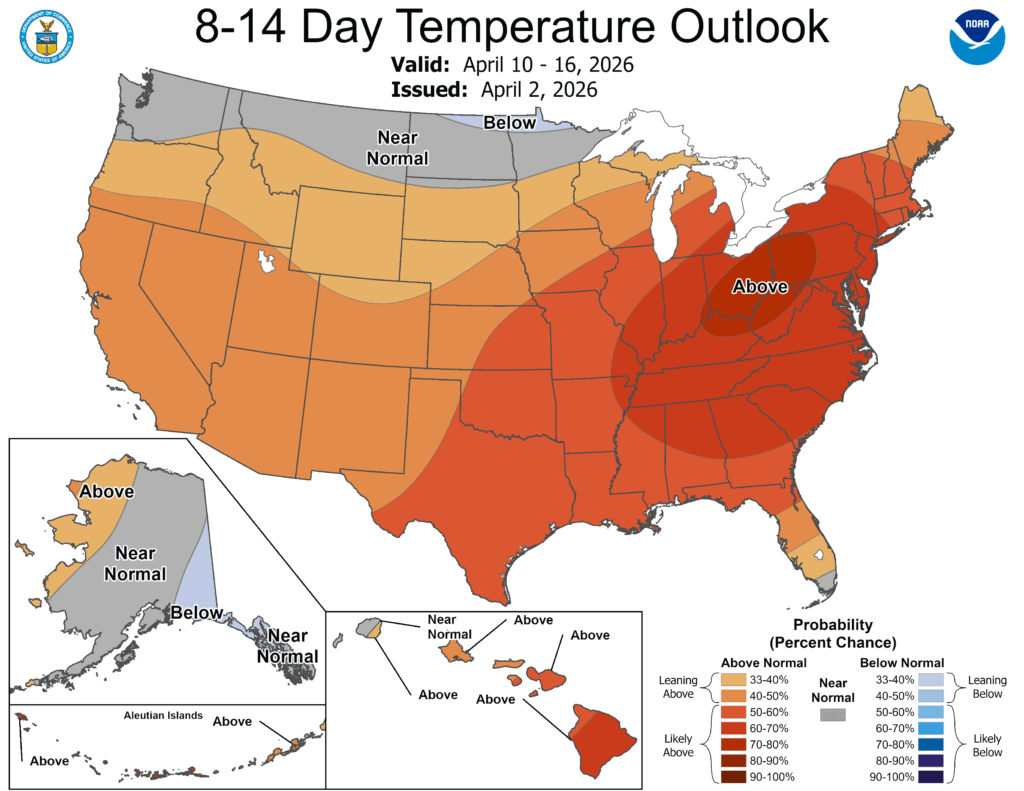
Like I mentioned about the high pressure’s influence, it will have a direct influence on the temperature and precipitation over the next 2 weeks. The high pressure will keep the rain to our west towards the plains and the Great Lakes region keeping our overall totals lower. Just keep this in mind as we may have another fire weather problem again in the next couple of weeks.