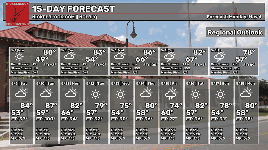
With the cool but wonderful weather we had during the weekend, we’ll have another day or so of some pleasant weather before another chance of severe weather. Fortunately, and unfortunately, this will hang around to the end of the week as the front begins to sag after it’s stretched out. We’ll have to deal with a little extra rain, especially near the coast, for the end of the week.

Today
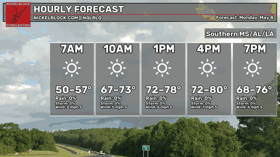
Expect another mostly clear day today with highs in the upper 70s to just around 80. Winds will be out of the south around 5-10mph, so not much of a breeze. Overall, a beautiful day! Overnight, we’ll fall into the mid 50s with increasing clouds.

Tomorrow
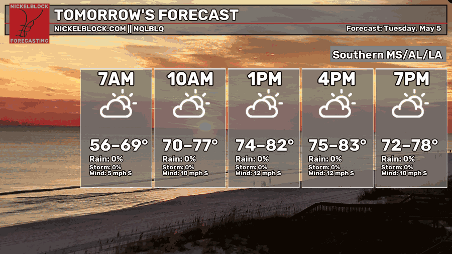
Upper level clouds will move in Tuesday morning signifying the incoming front just behind it. Otherwise, winds will pick up during the day from the south with a high in the low 80s. Overnight, we’ll fall into the mid 60s with more humid conditions.
Wednesday and the Severe Weather Threat
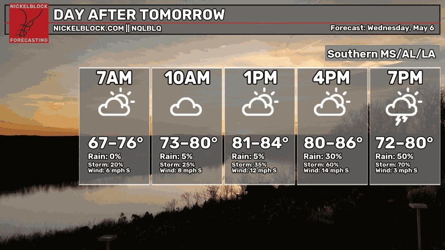
Low level clouds begin to move in early Wednesday morning ahead of the front. Our first window of storms will begin in the mid afternoon and continue overnight with a second round. Highs will be in the mid 80s during the day, and winds will be out of the south around 5-15mph.
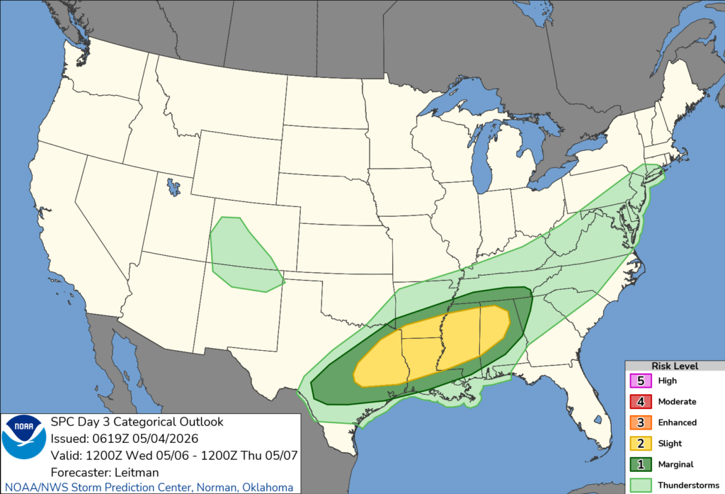
The Storm Prediction Center has placed a Slight (2/5) risk for most of Mississippi/north Louisiana and a Marginal (1/5) risk for the Pine Belt and southeastern Louisiana. Depending on how the storm system gets its act together, I wouldn’t be surprised if the Slight risk is extended to the Pine Belt.
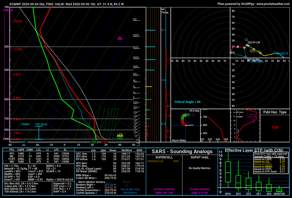
So far, we’re under all storm mode possibilities for this incoming system. The more likely risks look to be high winds, hail, and heavy rainfall. A tornado is also possible. Looking at the Skew-T’s leading up to the storm, the vertical wind profile supports some straightline wind development and a possible tornado. A dry spot in the middle atmosphere would also help with hail accumulation.
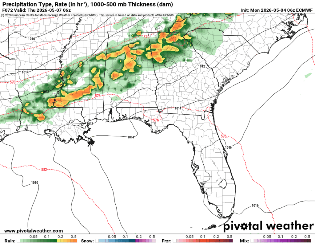
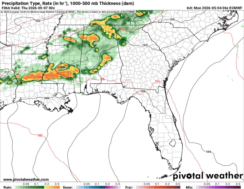
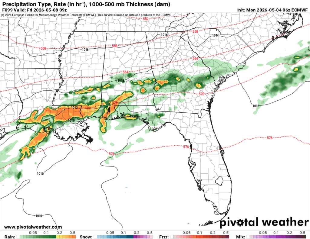
The frustrating part of this system is that it comes in two waves that have the same amount of moisture inflow. The dewpoints don’t drop because the front begins to slow as it moves towards the Pine Belt which keeps the flow moving in. This creates an opportunity for the front to churn out multiple rounds of showers and thunderstorms. The bad news is that it looks like the first two rounds of storms are the most severe. These look to hit Wednesday evening and past midnight Thursday morning. The next round mid-Thursday morning looks to develop and dump a lot of rain.
Thursday and Friday
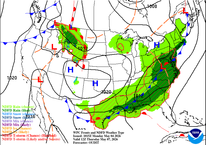
Looking at the front map from the WPC map above, we can see the front sags towards Mexico keeping the moisture in the southeast and Atlantic coast. This will be instrumental in the rain chances we see Thursday and Friday as it really doesn’t move much allowing more moisture to move in around it. The storms will move in from the west on Friday as the front gets a push from a high pressure system behind it.
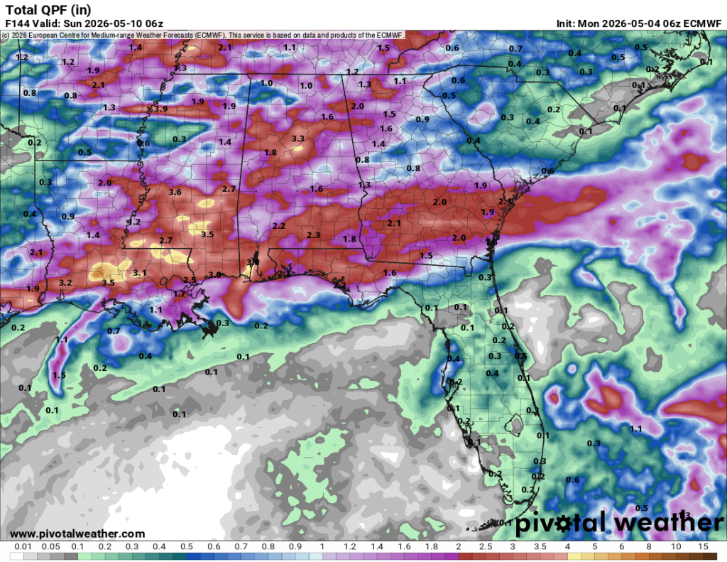
Like I mentioned earlier, we have a chance for heavy rain on Wednesday all the way through Friday, so we can expect multiple inches of rain over a 72-hour period. Much of Louisiana and the Mississippi coast will see a fair chunk of the rain with many of us in the Pine Belt receiving up to 3.5″. The weather pattern will also change a bit with less of a diurnal range. Highs will be in the mid to upper 70s with lows in the upper 50s to low 60s.