Well the rain has certainly lived up to expectations…
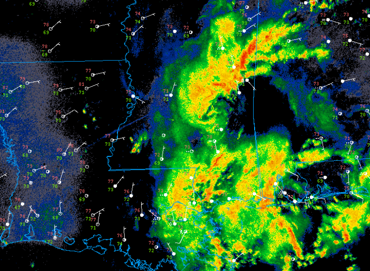
These thunderstorms are associated with mesoscale convective vortex (mcv) that is slowly drifting north. Mcv’s are smaller scale areas of low pressure that often form from a large complex of thunderstorms. In this case, the mcv may provide just enough wind shear for storms to organize long enough to produce a brief tornado or a damaging downburst.
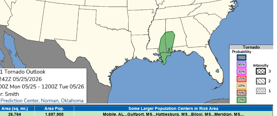
The SPC has the area outlined for a marginal risk of severe weather due to this threat. This area of convection will likely persist into the evening before weakening with the loss of daytime heating. The overnight hours should be fairly dry until thunderstorms redevelop by late morning tomorrow.
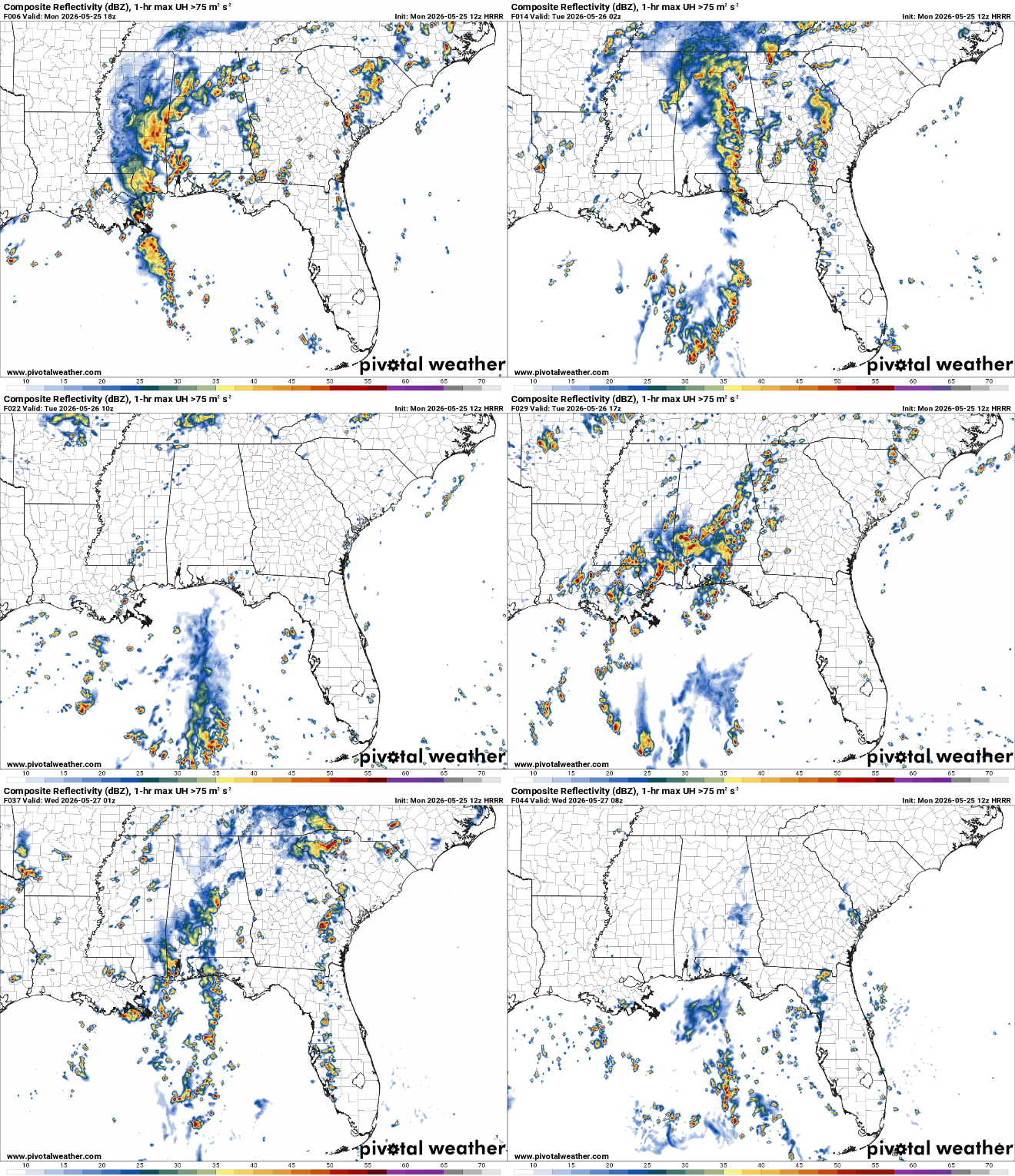
The main threat with these storms will be flooding. There is currently a flash flood warning for Hancook and Harrison counties in Mississippi. Radar indicates that over five inches of rain may have fallen in this area. Be cautious in low lying areas or along rivers and creeks.
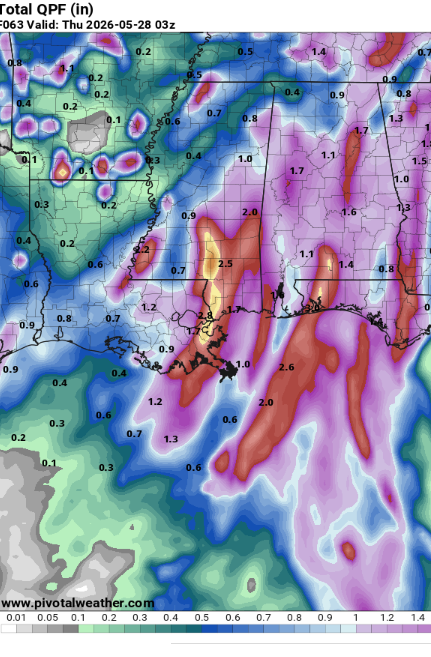
Models indicate that areas to the south and east of Jackson will likely pick up the most rain (potentially exceeding six inches over the next couple days) while areas further to the northwest (such as Transylvania, LA) may only receive a few tenths of an inch. This is good news for drought relief but bad news for those hoping to spend time outside.
Highs are still expected to be around 80 depending on how much cloud cover a specific area sees. Winds will be light outside of thunderstorms and humidity very high so it will definitely feel like a sauna out there even if its not raining.


