If you’re like me and enjoy being outdoors not completely soaked, then you’re in luck! Unfortunately, we have to suffer through one more day of rain, but we’re in for some drier (and hotter) weather this weekend going into next week.

Today
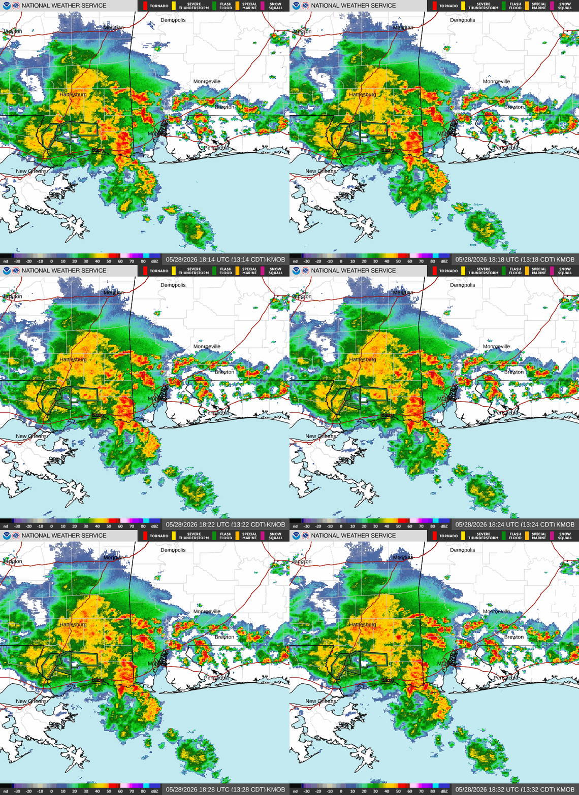
Right now, an area of heavy downpours and thunderstorms is situated in the area bounded by Laurel, Mobile, and Picayune. Localized flooding is likely, especially considering the amount of rain our area has gotten over the past week. They are moving north/northeast and will reach the Meridian area by 4 pm.
This is being caused by an area of storms extended from a trough over Kansas. Tonight, these storms will make their way further northeast, where a stationary front will develop over Georgia and the Carolinas, resulting in lingering storms in that area. A stationary front develops when you have two air masses, but neither of them are strong enough to displace each other, resulting in a stalled front.
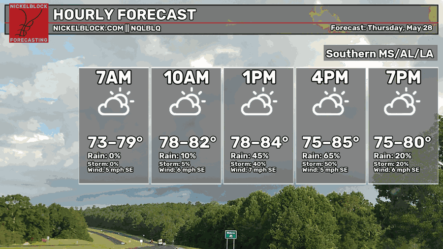
Later today, temperatures will range from the mid 70s to the mid 80s. The warmest temperatures will be further east in the Florida panhandle and southern Alabama as the heavy rain is likely to miss that area. The coolest temperatures will be mostly in the southern half of Mississippi and southwestern Alabama, the same areas getting rained on as we speak.

Tomorrow
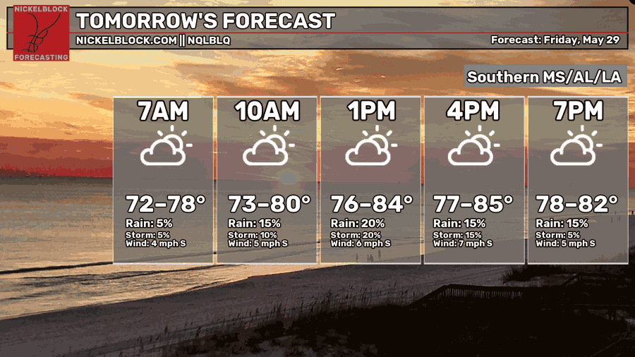
I mentioned previously that a stationary front separates two air masses that are not strong enough to displace each other. Tomorrow, the gulf coast is going to be in the area of high pressure, meaning you can expect less rain, sunnier skies, and warmer temperatures, especially the further west you go.
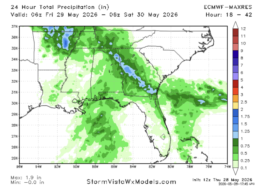
Some pop up storms are possible tomorrow, but they will not produce as much rain as the storms today. Eastern Louisiana and southern Mississippi are predicted to receive very little, if any rain. The area you can expect to see have the highest totals will be along the coast of Alabama and the areas surrounding Pensacola. The greatest chance for rain will be in the early afternoon.
Drought Update
We got a new drought monitor update today!
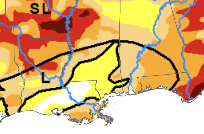
Significant improvements to the drought have been made since last week. D3 conditions have been completely eliminated in Alabama, most of southern Mississippi is now in D0 conditions, and most of eastern Louisiana has seen a 1 category improvement.
Of course, this is due to the rains over the past week. The rain has certainly improved the situation, but we are not out of the woods yet.

Extended Outlook
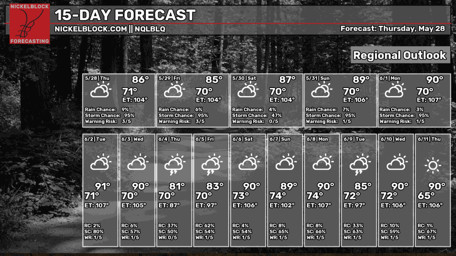
This weekend, the weather is looking much better for outdoor activities than today and the past week. Highs will be slightly cooler than normal with low rain chances. On Monday and Tuesday of next week, a trough over eastern Canada and the northeast will deliver cooler temperatures and lower humidity to areas northeast of us, but will likely not make much of a difference for the gulf coast.
In general over the next 2 weeks, the weather looks more pleasant. Temperatures look to be around normal for this time of year, with most days having highs in the upper 80s and low 90s with only slight chances for rain. This is because a ridge of high pressure may form over the southwest and the gulf, while troughs of low pressure may develop over eastern Canada as well as the pacific northwest/west. This keeps the heaviest rain to our north, as rain usually develops at the boundary between two air masses of different temperatures.
Pop up storms are still likely, as usual, but there won’t be a pattern that produces excessive amounts of rain.
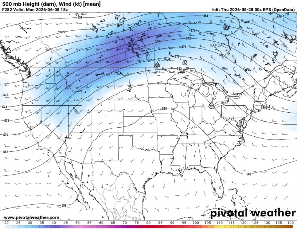
While this is still aways out, this is the general pattern that some models are hinting at for early June. A ridge of high pressure over the gulf is bringing hot air further north and preventing a rainy pattern from developing, which is why we can’t forget about drought just yet.


