It looks like we dodged a lot of the potential storms for tonight. While it did get plenty hot and humid, we may not be visited by a cluster of storms tonight descending this way from Arkansas. That is good news for those of you still waiting for the puddles to dry up from all the recent rains.
But some model guidance is hinting at a chance for a round of storms tomorrow night.

TONIGHT
A few scattered storms will be possible tonight. It looks like the seabreeze didn’t make a lot of headway today, so there shouldn’t be too many lingering boundaries to act as catalysts for storms this evening and into the overnight hours.
The latest HRRR model suggests a few lingering storms near Jackson, but aside from that prety quiet.
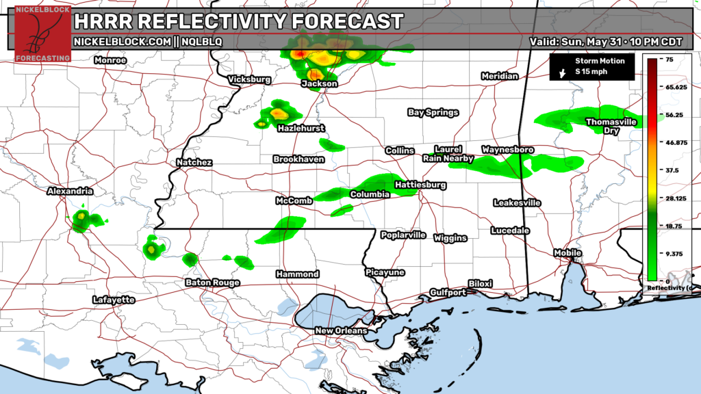
It is worth noting that the HRRR has been mighty aggressive (incorrectly so) with the chance for storms today, so I don’t give it much credence right now, but you may catch some rumbles of thunder tonight.
TOMORROW
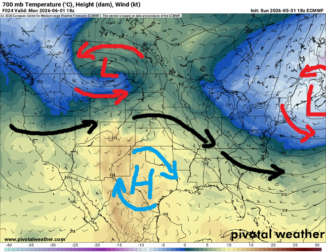
Tomorrow is the first day of Hurricane Season! But don’t worry, nothing tropical to worry about. Actually, it will look a lot like today. Afternoon storms may struggle a bit to develop given the opposing forces at work. We have a northwest flow aloft (shown on the 500mb map below) and a low-level southerly flow off the Gulf.
So even with a seabreeze tomorrow, we may see limited storm development. Until the evening when a potential cluster of storms drops our direction from Arkansas.
Afternoon highs will peak between about 85F and 95F, depending on your location. Folks closer to the water will be a bit cooler and if you live out in western Mississippi and central Louisiana, you’ll be a bit warmer.
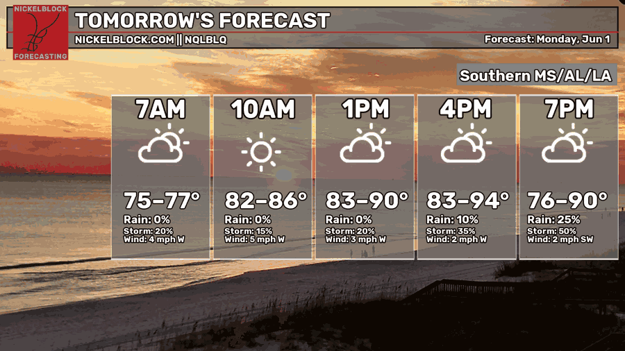
We will hold a 10- to 20-percent chance for rain through the day with a better shot into the evening hours. Right now it looks like that extra shot for storms will come from an MCS dive-bombing the Gulf. An MCS, or mesoscale convective system, is just a fun fancy weather term for “organized cluster of storms.”
In this case, one would develop in Missouri and cruise through Arkansas and Tennessee and slide south toward us.
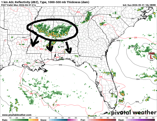
Again, the latest HRRR model (above) is the most aggressive with the shot for storms and has been a bit too “hot” with things lately, so the storm chance is a bit more “TBD” than normal.
But hang in there, we will know more tomorrow as things develop to the north.

DAY AFTER TOMORROW
So far, Tuesday looks relatively benign. Hit and miss storms. Maybe another MCS trying to dive our direction fromt eh north, but that is looking like a less than 20-percent chance. So we will call it about a 10-percent shot for rain in the afternoon with highs around 85F to 90F again.
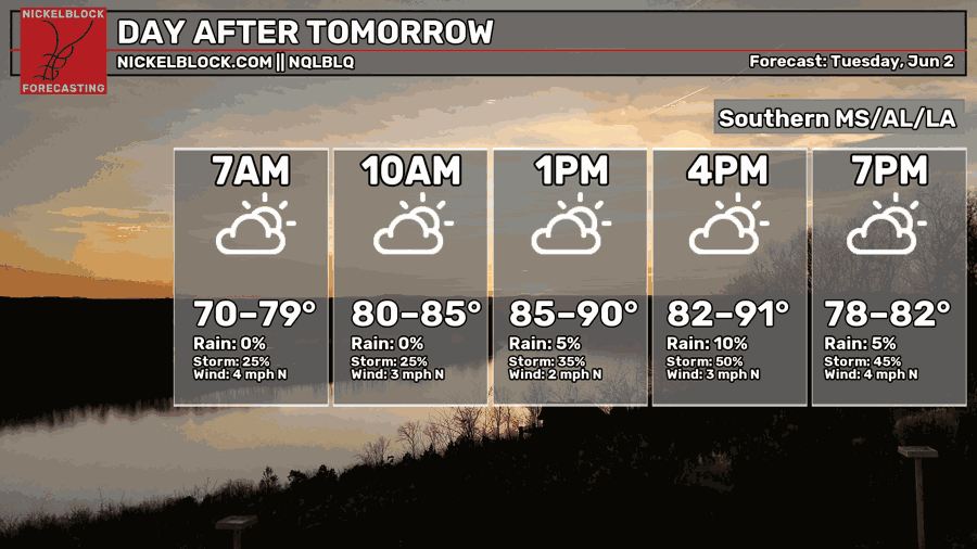
I will say that highs around 90F with all of this humidity will make it feel like close to 100F for some spots. So if you are going to be outside, please take it easy and make sure to stay hydrated and hang in the shade when possible.

EXTENDED OUTLOOK
Beyond the next few days, the pattern gets a bit more diffuse. By the time we get toward later this week, we get into a bit of a “weird-looking” pattern. The 500mb map here shows a trough over in Mexico so we are in a southwesterly flow aloft. But we also have slight ridging across our area and a trough to the east off the coast of the Carolinas.
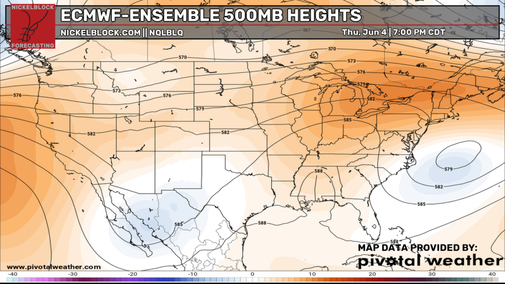
“What does that mean for us, Nick?”
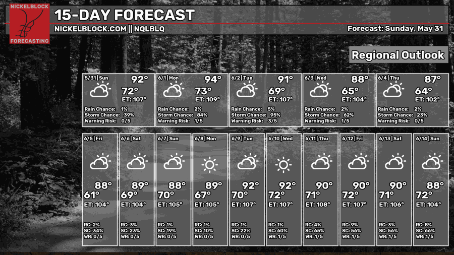
For real here? Not sure. Its a bit of an oddity. No oddity that is bad, either. Just peculiar. Though, it doesn’t last long. By next Monday we have a very -very- typical Summer pattern: Big ridge in the Gulf.
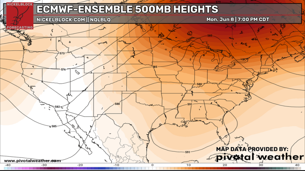
And this would spell highs around 90F and a slight chance for afternoon storms. And looking at the 15-day outlook, by golly, that is the forecast! I will say the “chance for rain” next week is probably higher than shown. Models do tend to struggle this far out with summertime convection, so expect a 10- to 30-percent shot for rain on any given day.