As we head into the holiday weekend, the summer heat pattern will remain firmly in place across our area. The same area of high pressure that’s bringing this intense heat will also keep most thunderstorm activity at bay through the weekend. So while it’ll be hot, at least your holiday plans are unlikely to be stormed out!

Today
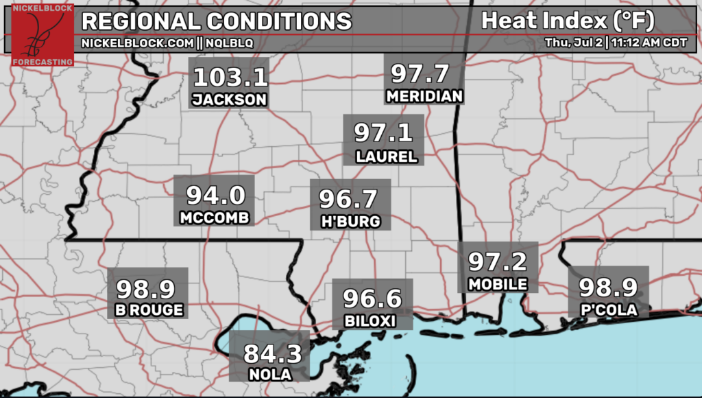
Currently, conditions are very, very warm across Southern LA/MS/AL with a small band of storms affecting Southern Louisiana.
We can clearly feel the heat from the high-pressure system seated over the Eastern United States, as heat index values reach into the upper 90s across our area. And take a look at Jackson, MS right now: 103.1 degrees is the real feel when you walk outside. Crazy! The pattern for today: storm chances will be low, but heat will be high.
Tonight
Tonight, expect warmer temperatures with a few weak scattered showers across the area. Nothing too crazy to worry about, make sure you are staying hydrated and taking breaks during outdoor activities.
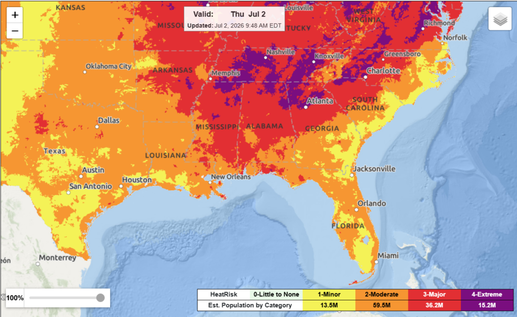
Although the NWS HeatRisk forecast isn’t as intense as it was earlier this week, it is still something to talk about. The HeatRisk takes humidity, heat duration, time of year, risk for heat complications, and how far above average the temperatures are for an area. This shows on the graphic the potential risk level for heat-related impacts to occur over a 24-hour period. As seen above, a majority of our area is in the moderate heat risk category with some variation depending on where in the region you are.
Tomorrow
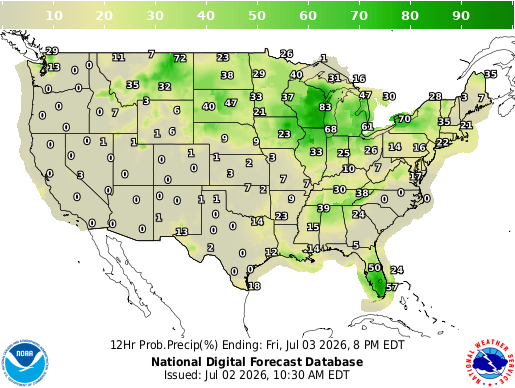
Looking ahead to our Friday forecast, again, expect warm temperatures with a chance of isolated showers to temporarily cool down your day. Below, we see very low probable precipitation percentages, but the chances aren’t 0, meaning some areas might get lucky with a small sprinkle and some cloud coverage.
Our GFS 2m temperature forecast predicts, you guessed it, hot temperatures across the South. Peak hours tomorrow will have temperatures in the low to mid 90s across our entire region. As a reminder, this GFS model measures dry-bulb temperatures which is the actual temperature of the air not taking humidity into account. This being said, real-feel temperatures could reach 100 degrees tomorrow across portions of the gulf coast.

JULY 4TH
The day I’m sure everyone has been waiting for will be perfect for outdoor water activities, emphasis on the water. Below, we see the heat index values for Saturday exceeding 100 degrees in much of our area. This means the risk for heat-related illnesses will be high and to definitely take time to cool off by going inside or jumping in the lake. If you are celebrating 250 with some cold drinks, remember your drink may be ice cold, but that doesn’t mean it’s keeping you hydrated. Grab some water too!
On the precipitation side, storms for Saturday are like that one friend who is always “maybe” coming to the party. Meaning very scattered storms where your party could get rain and the neighbors’ shindig down the street won’t. Don’t let that ruin your plans though, as these storms will be relatively short-lived and carry a small threat for lightning. More on that in my 4th of July regional forecast that will be posted early Saturday morning, giving you an early and accurate idea of what’s to come for the day.
This composite reflectivity forecast essentially shows the “worst case scenario” for Saturday’s storms. Some may see isolated storms on Saturday evening while we get ready to set off fireworks after the sun goes down, but during the day, the skies seem relatively calm.

Extended Forecast
Although most of us are just worried about the weather for the 4th, looking forward to Sunday and beyond we see temperatures slowly returning to normal along with our afternoon thunderstorms making a reappearance.

Our 8-14-day temperature and precipitation outlook shows us returning to near normal over the next two weeks which will feel great after the stifling heat we’ve had recently. Now this doesn’t mean that temps will be any cooler than average, they will actually still be warmer than the climatological average, but at least we will no longer be in a heat wave.
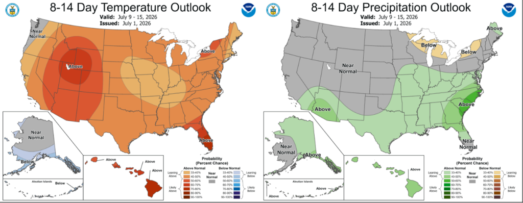
As far as precipitation goes, we will return to a little above average for our rainfall totals over the next two weeks. This most likely means a flip back to the typical afternoon thunderstorms that we are all used to. Happy (almost) 4th!


