Current Conditions
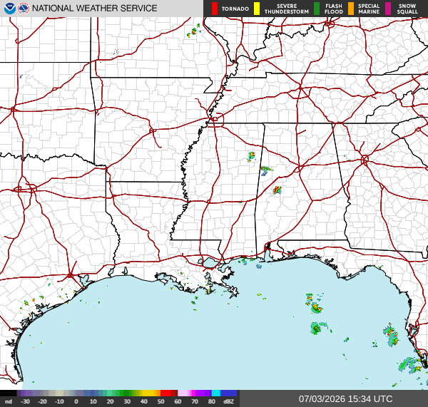
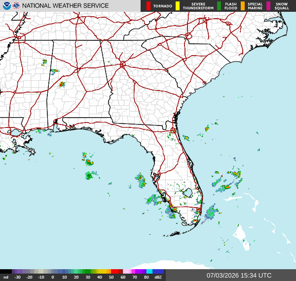
As this is being written, not much is going on in the Southern region. Isolated thunderstorms near the MS/ AL border. Showers and thunderstorms near the Southwestern coast of FL. Patches of showers scattered throughout Southern FL.
Tonight
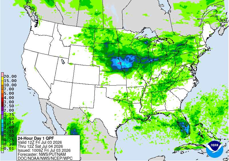
Scattered thunderstorms throughout our region until around 11 pm. Mostly impacting Central TN and FL, Southern LA, and Northern MS, AL, and GA. Isolated showers and thunderstorms in Western TX and Central AR.
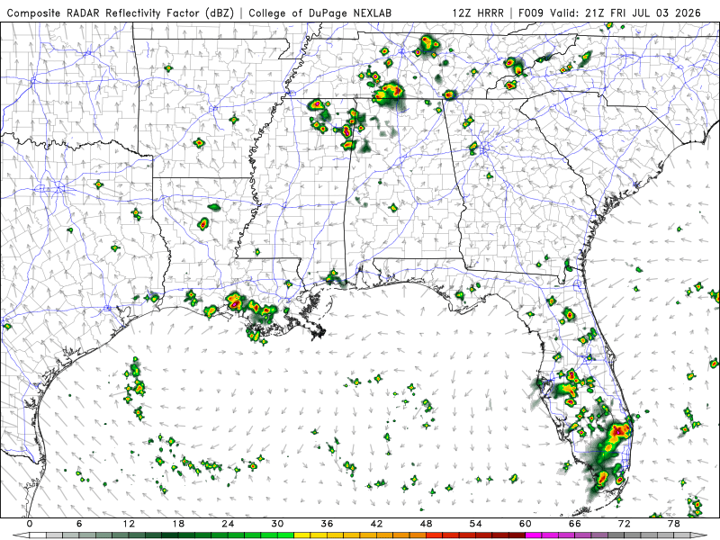
We have a high-pressure system in the Gulf that is fueling the afternoon and evening storms in the South. The high-pressure system is making the Northern storms linger rather than move in a specific direction. Looks like from today into tomorrow morning, the total amount of precipitation in the Southern region is mostly under 1.50 inches. FL will be receiving the most rain over the next 24 hours.
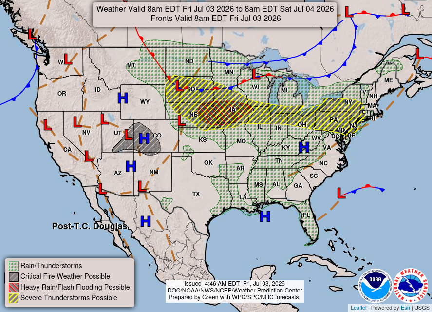
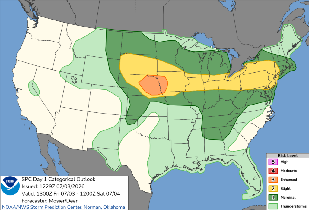
The SPC has most of our region under general thunderstorms, with TN and Northern MS, AL, and GA under a marginal risk. This means some storms could be capable of producing damaging winds and severe hail, and a localized tornado threat could develop.
Extended Regional Outlook
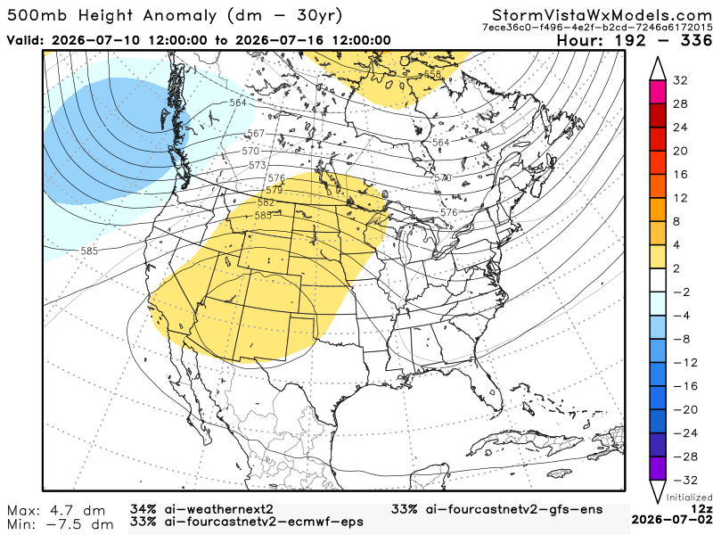
The CPC outlook has our region experiencing above-average temperatures and precipitation from July10th to July 16th.


Below, we have 3 of the most accurate models blended into one model. This model gives us an idea of the possible outcomes from July 10th to July 16th (7 am). Based on this blend of models, the Southern region will experience warmer and humid temperatures. We can expect typical summertime thunderstorms from the sea breeze here on the Gulf Coast.
3 Day City Forecast
Houston, TX: Mostly sunny with highs in the mid-90s. Partly cloudy nights with lows in the upper 70s. Patchy smoke Saturday night. Slight chance of thunderstorms Sunday afternoon. Relatively calm winds.
Shreveport, LA: Highs in the mid-90s. Slight chance for showers and thunderstorms over the next 3 days, including tonight and Independence Day. Highest chance on Sunday. Lows in the mid to upper 70s. Partly cloudy Sunday night. Calm winds.
Baton Rouge, LA: Highs in the mid-90s. Sunny today and Independence Day. Slight chance of thunderstorms on Independence Day in the afternoon. Thunderstorms likely on Sunday, including Sunday night. Lows in the mid to upper 70s. Partly cloudy tonight and Saturday night. Calm winds.
New Orleans, LA: Highs in the lower 90s. Slight chance of thunderstorms every day. Likely chance on Sunday. Lows in the upper 70s. Mostly clear tonight and Saturday night. Slight chance of thunderstorms on Sunday. Calm winds.
Jackson, MS: Highs in the lower to mid-90s. Mostly sunny today and on Independence Day. Chance of thunderstorms on Independence Day and Sunday. Lows in the mid-70s. Partly cloudy tonight and Saturday night. Thunderstorms likely on Sunday night. Calm winds.
Birmingham, AL: Heat advisory in effect till Saturday night. Highs in the mid-90s. Chance of thunderstorms today and on Independence Day. Lows in the mid-70s. Chance of showers Saturday night, and a slight chance for thunderstorms and showers Sunday night. Calm winds.
Mobile, AL: Highs in the mid-90s. Slight chance for thunderstorms today and on Independence Day. Thunderstorms likely on Sunday. Lows in the upper 70s. Mostly clear nights. Slight chance of thunderstorms on Saturday night. Relatively calm wind.
Atlanta, GA: Heat advisory in effect till Saturday night. Highs in the mid to upper 90s. Slight chance for thunderstorms today and likely on Sunday. Lows in the mid to upper 70s. Slight chance for thunderstorms tonight and Sunday night. Calm winds.
Tallahassee, FL: Highs in the mid to upper 90s. Slight chance for thunderstorms the next 3 days. Lows in the mid-70s. Mostly clear tonight. Slight chance for thunderstorms Saturday and Sunday night. Calm winds.
3 Day Traveling Forecast
KHOU – Houston: Slight chance of thunderstorms on Sunday. Possible delays at the airport due to lightning. No weather anticipated today or on Independence Day!
KSHV – Shreveport: Slight chance for showers and thunderstorms the next 3 days, including tonight and Independence Day. Possible delays at the airport due to lightning.
KBTR – Baton Rouge: Slight chance of thunderstorms on Independence Day and a likely chance on Sunday. Possible delays at the airport due to lightning. No weather anticipated today!
KMSY – New Orleans: Slight chance of thunderstorms the next 3 days. Likely on Sunday, including Sunday night. Possible delays at the airport due to lightning.
KJAN – Jackson: Chance of thunderstorms on Independence Day and Sunday, including Sunday night. Possible delays at the airport due to lightning.
KBHM – Birmingham: Thunderstorms are expected over the next 3 days. Possible delays at the airport due to lightning.
KMOB – Mobile: Slight chance of thunderstorms today and on Independence Day, including Saturday night. Thunderstorms likely on Sunday. Possible delays at the airport due to lightning.
KATL – Atlanta: Slight chance of thunderstorms today and Sunday, including Sunday night. Possible delays at the airport due to lightning.
KTLH – Tallahassee: Slight chance of thunderstorms the next 3 days, including Saturday and Sunday night. Possible delays at the airport due to lightning.
Today’s Interstate Forecast
I-10: Scattered showers and thunderstorms in Southern MS and LA this afternoon into the evening. The storms in Southwestern LA should clear out around 10 pm.
I-20: Scattered showers and thunderstorms near the AL/GA border around early evening. Will be cleared out around 11 pm. Isolated showers and thunderstorms near the TX/ LA border. Should clear out around 10 pm.
I-49: Thunderstorm in Southern LA in the evening. Should be mostly clear by late evening. Isolated thunderstorm near TX/ LA border around late afternoon. Should be cleared out around 8 pm.
I-55: Possible scattered showers near Southern LA during the afternoon. Isolated thunderstorm near Central MS in the evening. Should be clear by 8 pm.
I-59: Isolated showers and thunderstorms in southern MS in the afternoon. Scattered showers and thunderstorms in Northern AL in the evening. Should clear out around 10 pm.
I-65: Showers and thunderstorms in AL and TN starting around late afternoon. Should start to clear out around 9 pm.
I-75: Scattered showers and thunderstorms in FL throughout the day. Showers and thunderstorms in Northern GA around late afternoon. Should clear out around 8 pm.
PSA: Make sure you stay cool and drink plenty of water. It’s extremely hot outside, so have a place where you can cool off that’s not the shade.


