Good afternoon! As of 3:15 CDT, conditions are sunny and hot for most places, with most areas seeing temperatures in the upper 80s and lower 90s.
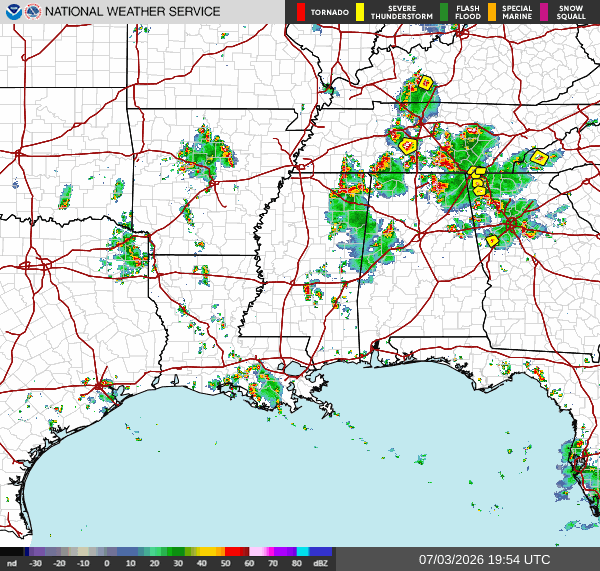
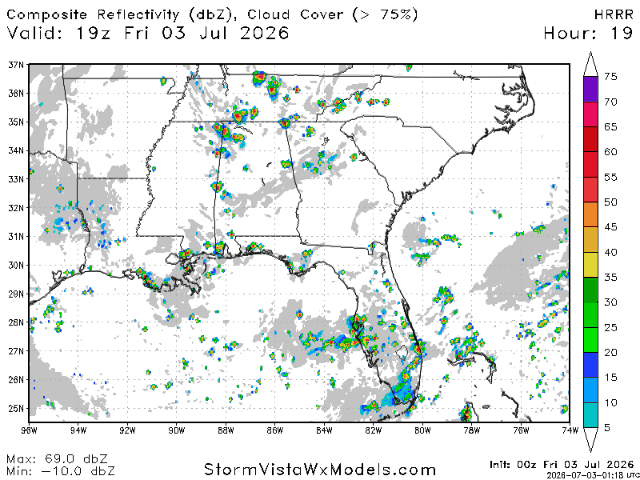
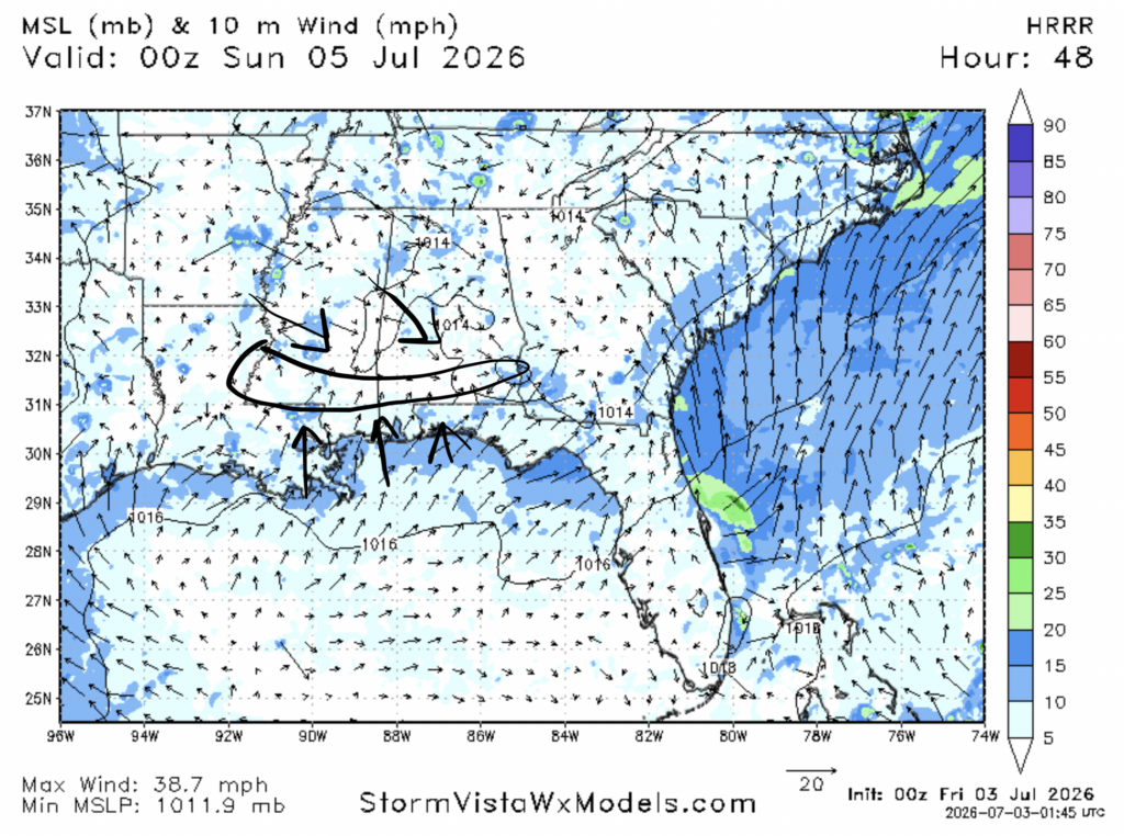
We also have a few areas of storminess, mostly in southeastern Louisiana southwest of New Orleans near Alexandria, as well as northwest of Birmingham and in northeastern Mississippi. There’s also a few storms between Jackson and Laurel.
Moving into tonight, some of these storms will linger, possibly bringing heavy rains, gusty winds, and lightning to some places. I anticipate that most of these storms will be too far north for our area as those areas are closer to the boundary between the ridge we’re stuck under and an area of low pressure to the northwest of us. Nonetheless, some storms are possible closer to the coast due to the sea breeze which helps humid air rise.

4th of July
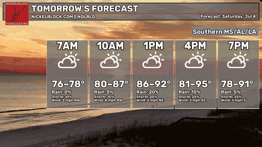
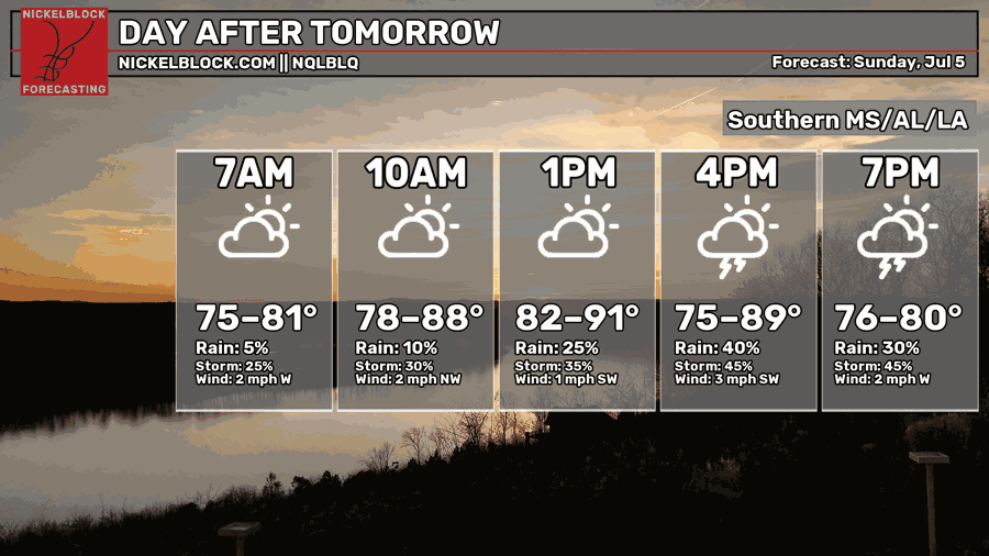
For your 4th of July celebrations, expect some hot and potentially stormy conditions. High temperatures will be in the lower 90s for most of our region, with some areas cooler than that, and some areas slightly hotter than that. Temperatures should cool down some in the evening when most firework celebrations take place. Unfortunately, the air won’t be too much more comfortable as the humidity will still make things feel very sticky.
Some pop up storms are possible tomorrow evening going into the night, coinciding with firework shows. I suspect that a hot spot for storms tomorrow evening will be just north of the coast in the area from Natchez to Laurel to Andalusia. This is because of the sea breeze which brings in moist air from the gulf which will collide with drier air circulated from the ridge we’re under. The dry air will sink under the moist air, forcing it to rise, creating storms.
A good portion of these storms will develop between 4 and 8 pm tomorrow night, so we can hope that most firework shows will remain undisrupted.
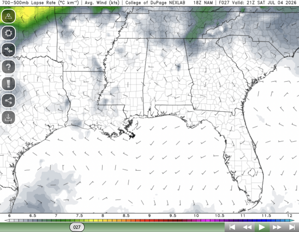
Luckily these storms likely won’t be too strong as mid-level lapse rates, a measure of how fast air is rising in the mid-level atmosphere, doesn’t look very strong tomorrow night.

Sunday
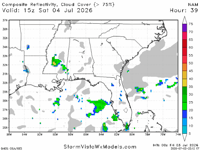
Heading over into Sunday, you can expect temperatures to cool down a bit from yesterday and today, We’ll likely see high temperatures in the upper 80s and low 90s for most places and morning lows in the mid 70s. By Sunday, the ridge which has been delivering heat for our region and record heat for the mid-Atlantic and northeast will shift further to the east. Therefore, you can expect the warmest temperatures to be further east, particularly in Alabama and the Florida panhandle.
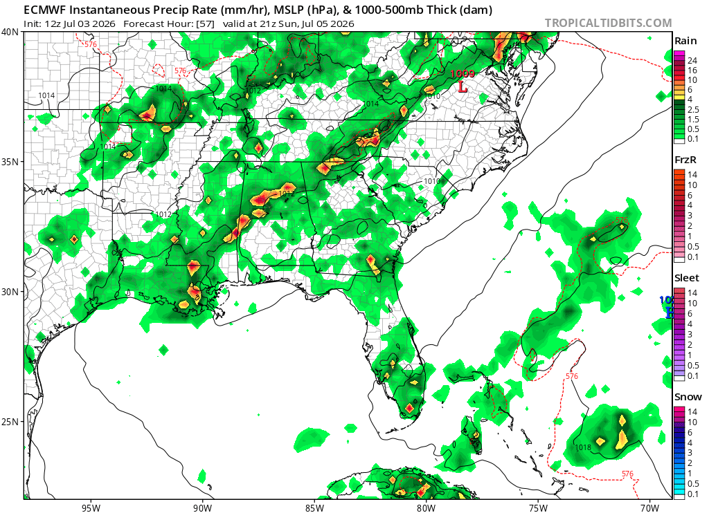
As for storms, the ECMWF model shows a significant chance of an area of storminess from southeastern Louisiana all the way up to Birmingham. This “line” of storms represents the boundary between high pressure and low pressure. The areas south and east of the line will continue to experience more hot conditions on Sunday, while the areas north and west of the line will experience temperatures closer to normal.
These storms will likely be gone by 9-10 pm on Sunday night.

Extended Outlook
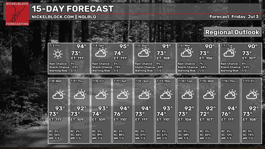
Overall, temperatures look seasonable to slightly above normal for the next two weeks, with pretty much everyday likely to see a high temperature in the low-mid 90s. Although we have seen some storminess over the past few days, particularly in Louisiana, it looks like we might see an uptick in storminess in the next 2 weeks.
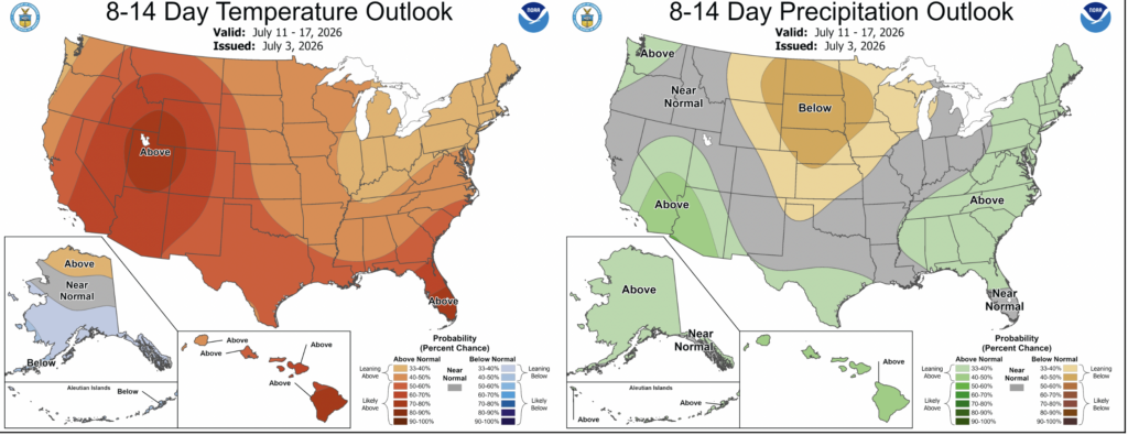
The Climate Prediction Center has forecasted above normal temperatures and slightly above normal precipitation for our region in mid-July.
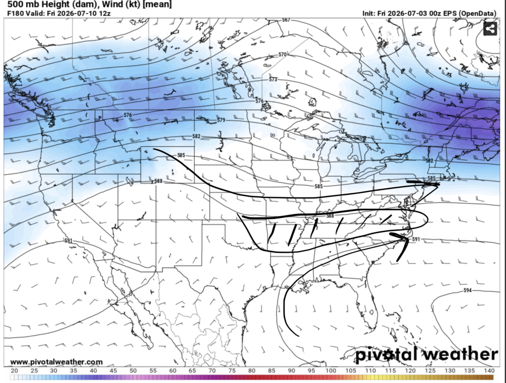
Over the next couple of days, the ridge of high pressure we’ve been under for almost a week will start to weaken. A more moderate pattern will take its place, allowing our region to be closer to the boundary between high pressure centered east of the Bahamas and low pressure centered over the upper midwest and Canada. This will allow temperatures to cool slightly and higher chances of rain to return.
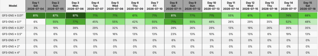
The GFS ensemble model has picked up on this as well, suggesting that everyday in Hattiesburg from tomorrow until July 18th has a greater than 50% chance of seeing at least some measurable rainfall.
Happy Fourth!


