The National Hurricane Center is not anticipating any tropical cyclone activity for us during the next seven days.
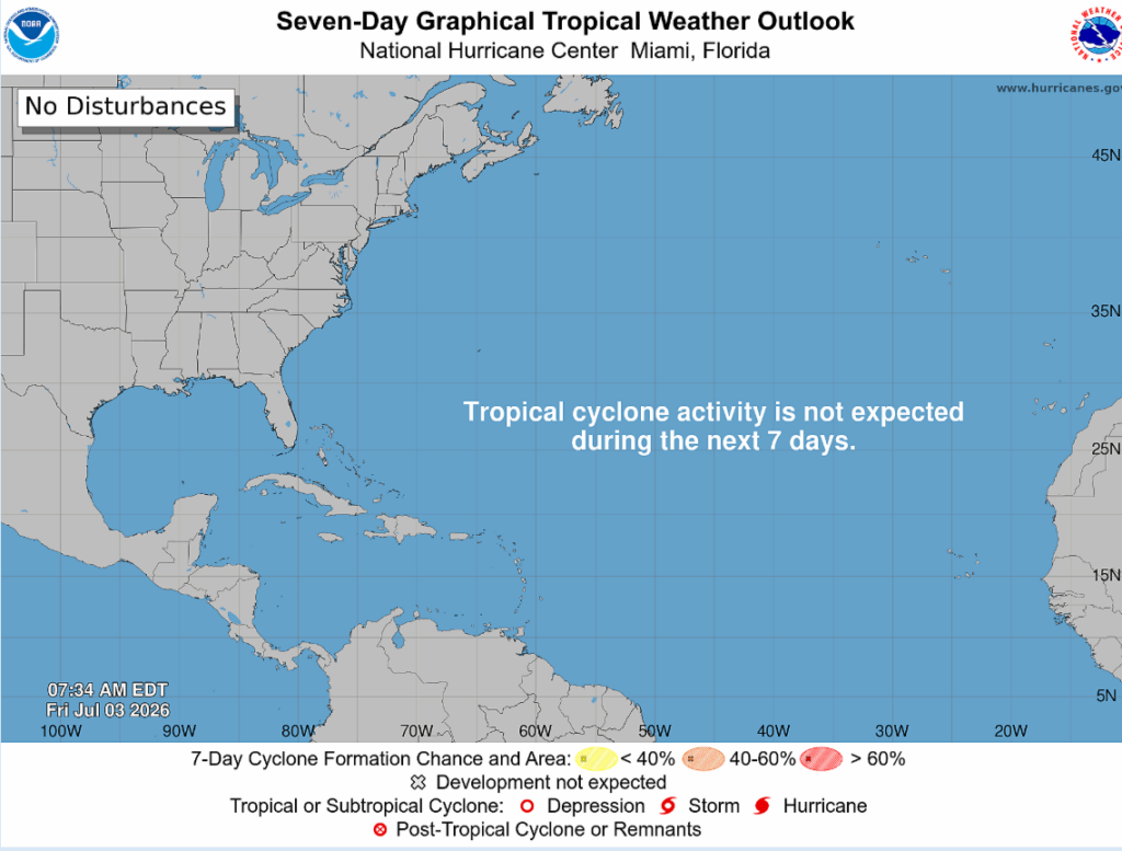
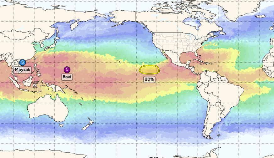
The Pacific has a lot going on right now as Guam braces for Super Typhoon Bavi and Tropical Storm Maysak moves into Hainan. For us in the short term, the Gulf and Caribbean remain mostly clear.
NHC noted two tropical waves, but there’s no real concern with these early-season systems. One reason is that we currently have above-normal wind shear across the region. This wind shear will keep any potential development in check through the upcoming week.
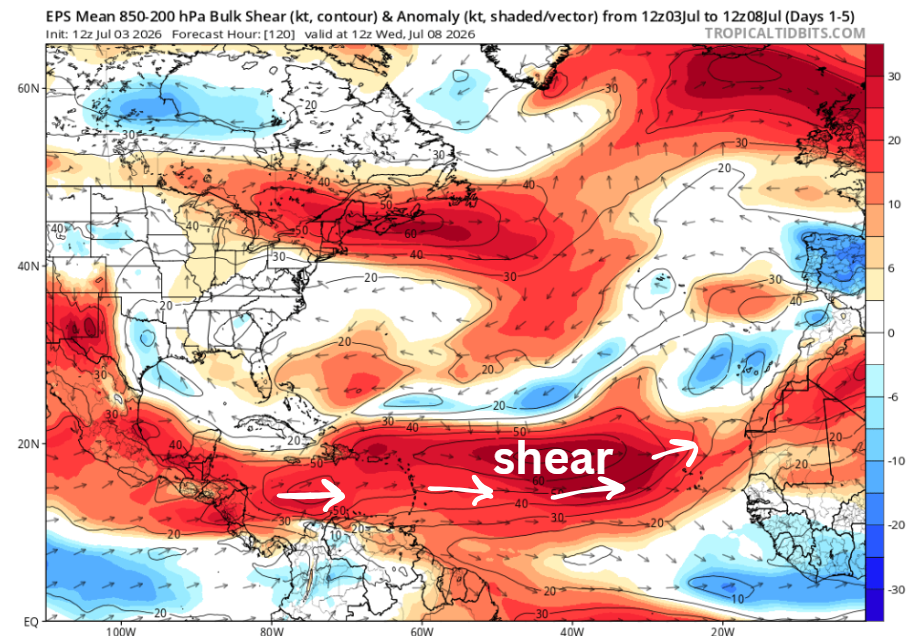
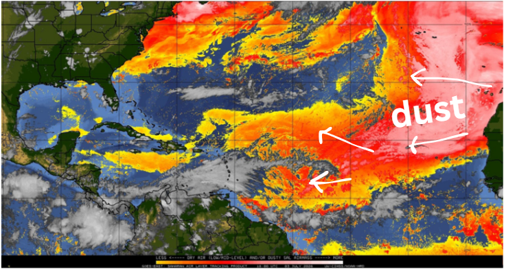
As well as a lot of Saharan dust and dry air moving off Africa and lingering over the main development region (MDR), keeping it largely inactive… for now. Long-range forecast models suggest the dust will continue to be a factor through much of July.
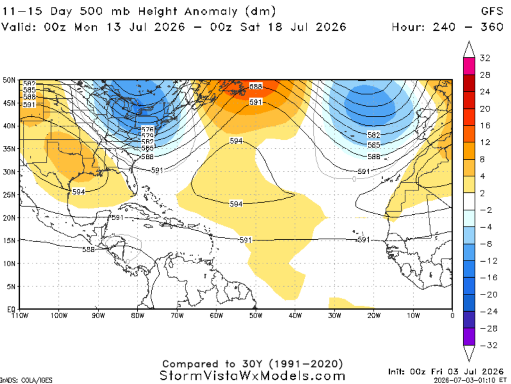
Taking a peek at mid-July and its large-scale pattern, we see positive 500mb height anomalies (orange) over the central/north Atlantic, indicating a ridge. This would be favorable for steering storms west. Though this is just one piece of the puzzle that is hurricane forecasting. As Saharan dust that is helping keep things quiet now is forecasted to stick around through much of July, which would slow down any storms from intensifying. So, in summary, quiet now, but worth monitoring as we move forward through hurricane season.