
Tomorrow’s Overall Setup
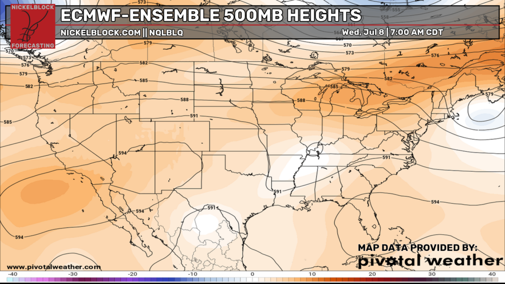
Hey everyone! Starting off with the 500mb setup, ridging is spread across a good chunk of the country, especially across the southern U.S., keeping the heat and humidity locked in. Thankfully, much of the East has cooled down after that intense heat wave, which brought record-breaking temperatures to many locations.
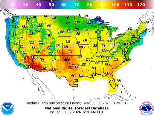
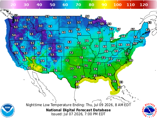
At the surface, there are still a few fronts and boundaries around, so Wednesday will not be totally quiet. The best rain and storm coverage looks from the Plains into the Midwest and Great Lakes, with some heavier rain possible there, while scattered showers and storms also stretch through parts of the South and Southeast. Temperature-wise, it’s another hot July day with 90s across the South, Plains, and parts of the East, and a warm, muggy night expected for many areas. The Northeast is noticeably cooler tomorrow and tomorrow night.
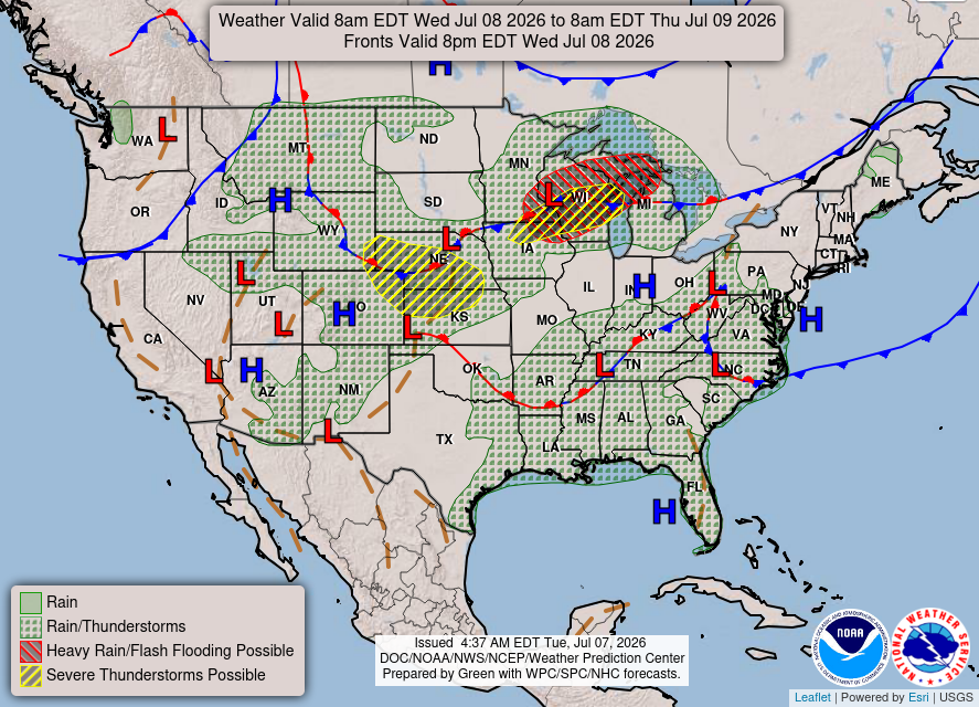
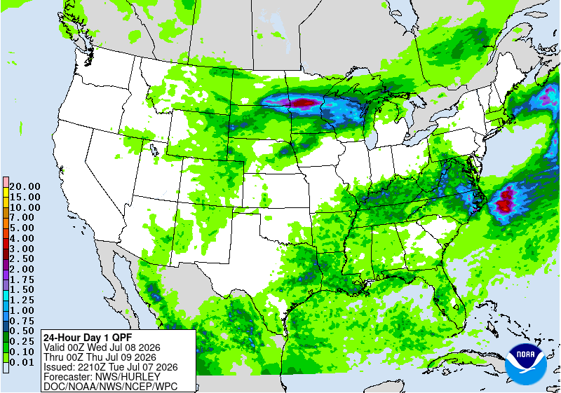
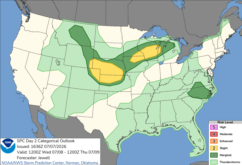
The SPC has issued a Slight Risk out for parts of the Central Plains and Upper Midwest on Wednesday. The main thing to watch will be clusters of storms that could bring damaging winds and some hail, especially from Minnesota, Wisconsin, and Iowa back into parts of Nebraska, Kansas, and Colorado later in the day and into Wednesday night.
There is also a 2 percent tornado risk threat up in Wisconsin and Minnesota, and even though it’s low, it’s still important to be prepared. There is also a Marginal risk of severe wind gusts down in southern Virginia and much of North Carolina, for afternoon storms that could become severe.
Thursday’s Weather
By Thursday, the pattern stays unsettled for a lot of the country, but the focus shifts a bit more into the Plains, Midwest, Great Lakes, Ohio Valley, and Northeast, where several boundaries will keep rain and storms around. The South and Gulf Coast still look hot and humid with scattered storms possible, but not a washout everywhere. Temperatures stay very summer-like with widespread 90s across the southern half of the U.S., and another warm/muggy night for many spots.
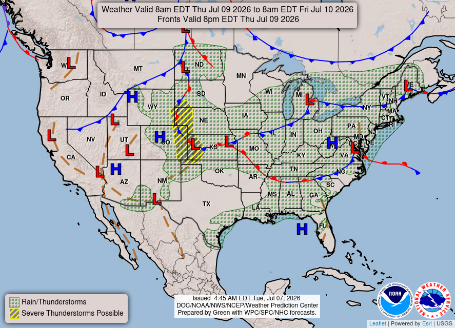
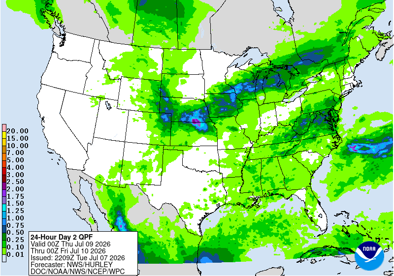
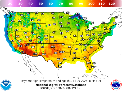
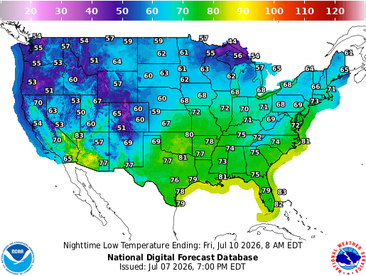
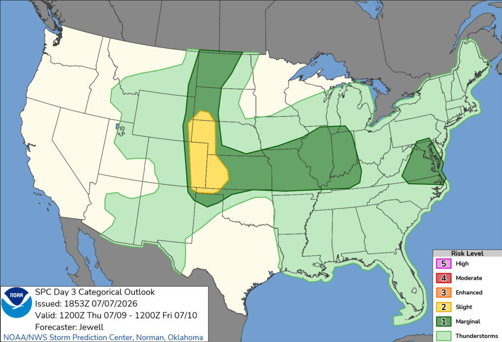
The SPC also has a Slight Risk out for parts of the Central High Plains on Thursday. Storms look to develop later in the day from eastern Wyoming and Colorado into western Nebraska, Kansas, and the Oklahoma Panhandle, with large hail possible early before the threat turns more toward damaging winds. Farther east, a few strong-to-severe storms may also move through parts of the Midwest and the Mid-Atlantic, with gusty winds as the main concern.
CONUS Weekly Temperature & Precipitation Outlook
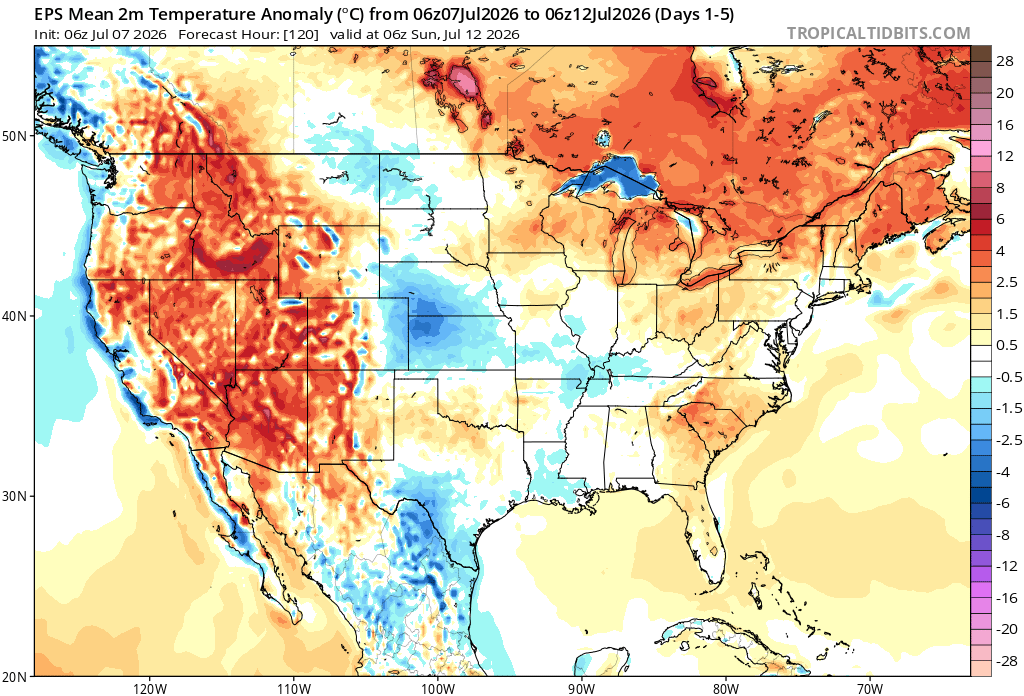
Here’s a look at the EPS modeled temperature anomalies through Sunday. Red indicates above-average temperatures on average for the week, white indicates average temperatures, and blue indicates below-average temperatures.
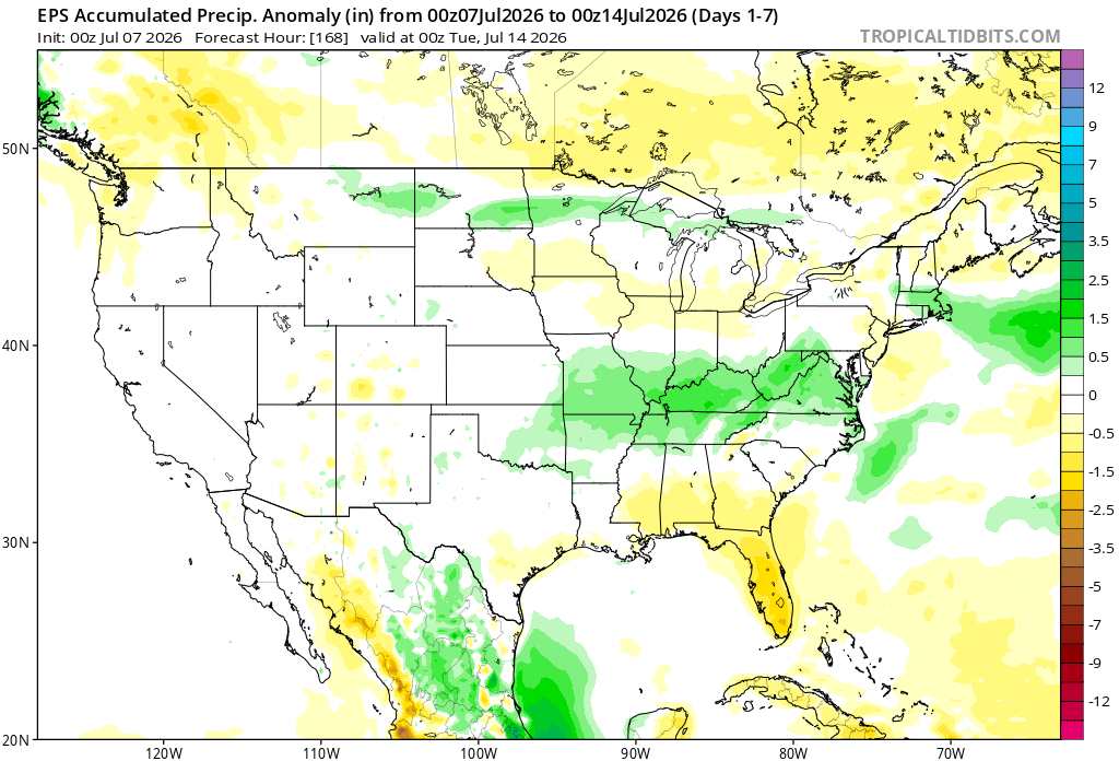
Here’s a look at the EPS modeled precipitation anomalies through next Tuesday. Green indicates above-average precipitation, white indicates average precipitation, and yellow indicates below-average precipitation. Let’s look into the details by region:
Weekly Outlook: Western & Central United States
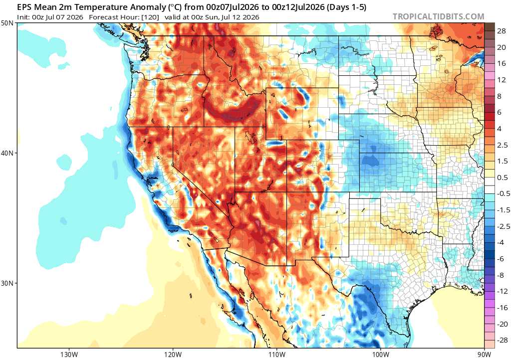
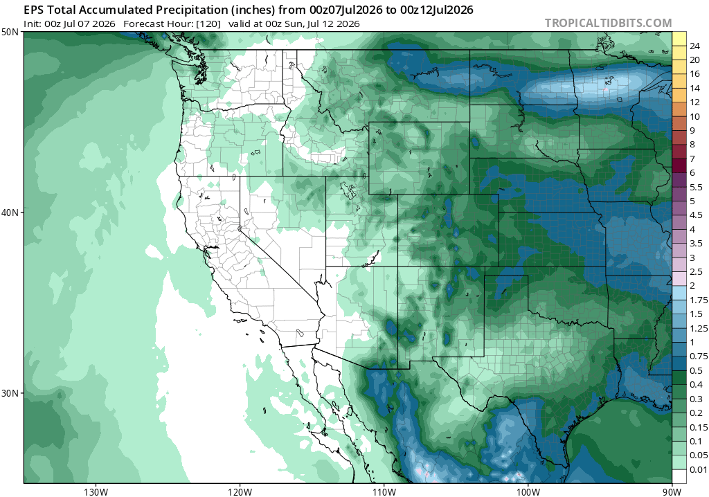
For the western and central U.S. this week, the main story is the heat out West, with temperatures running above average for a lot of the region. Farther east, it looks a little cooler and more unsettled, with more clouds and storm chances around. Rainfall also looks more active through the middle of the country, while the far West stays mostly dry.
Weekly Outlook: Eastern United States
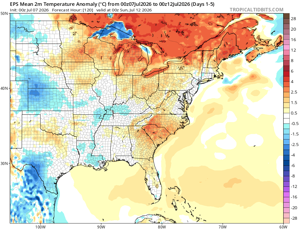
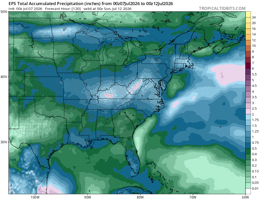
For the eastern U.S. this week, it looks warmest farther north, while parts of the South are closer to normal or a little cooler at times because of clouds and storm chances. Rainfall looks fairly active across a lot of the East, especially from the Gulf Coast up through the Mid-Atlantic and Northeast, so it’s not a dry pattern. Overall, expect a humid week with rounds of showers and storms around, but not raining the whole time everywhere.
Extended Outlook
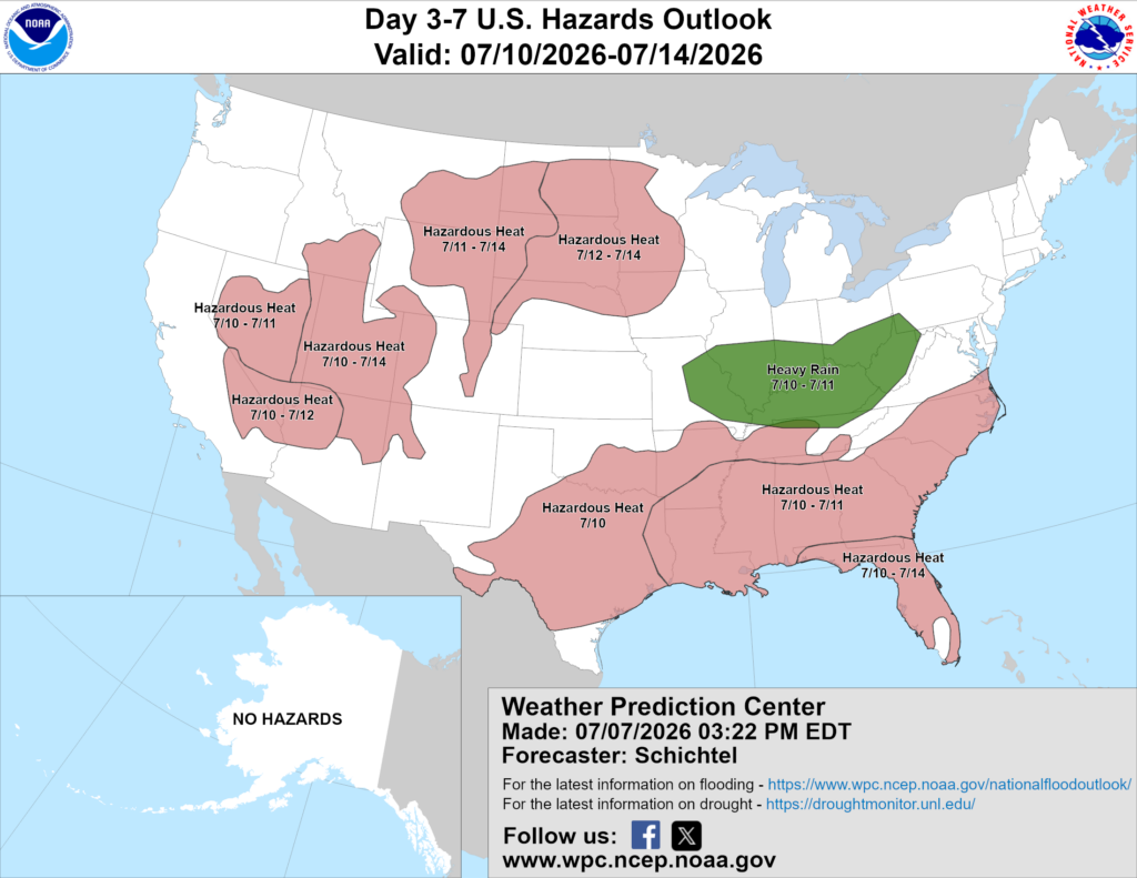
Above is a look at the U.S. Hazards Outlook from NOAA, highlighting areas of more impactful weather to be aware of over the next 3 to 7 days.
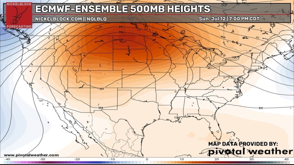
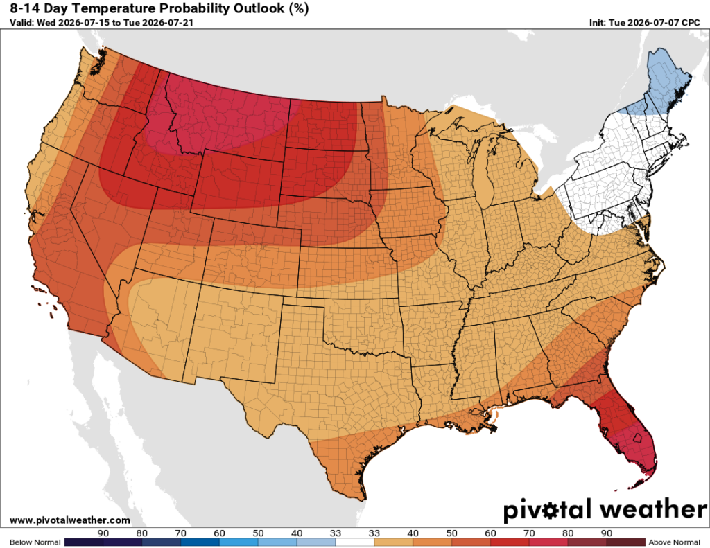
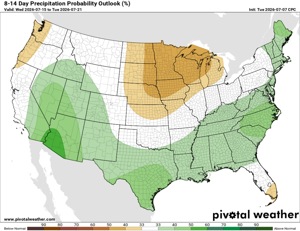
Looking ahead into the 8–14 day period, a ridge will build out west, allowing warmer air to build across a good chunk of the country, especially out West. The Northeast may be one of the few areas closer to normal or a little cooler. Rain chances also look more active across the South and East, while parts of the northern Plains and Upper Midwest lean a bit drier.
Thanks for tuning in to this National Forecast! Tune in to our local, tropical, and regional forecasts to stay updated on the latest!


