Welcome to today’s forecast refresh! Let’s take a quick look at what’s changed since yesterday’s forecast and what those updates mean for the next several days.
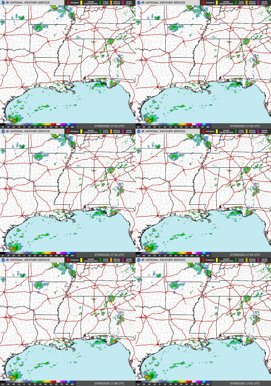
Currently, we are seeing isolated thunderstorms impacting Southern Louisiana, and a bigger cell impacting the Florida Panhandle. I’ll tell you one thing, the storms in Tallahassee right now are electric! They’ve been producing an incredible amount of lightning, and later in the forecast I’ll break down exactly why we’ve been seeing so much of it lately.
Overall, conditions seem to be following what was forecasted yesterday in the Local Forecast. Warm temperatures and high humidity are making it feel way hotter than it should be and also fueling scattered afternoon thunderstorms.
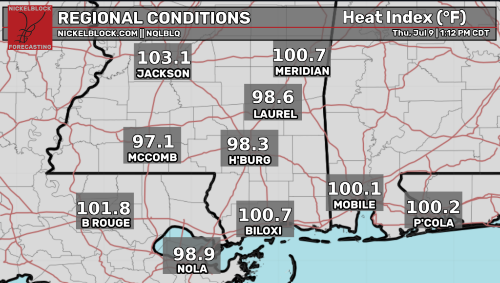
We are seeing hot real feel temperatures across the region thanks to the high heat and humidity. There is a chance for relief as afternoon thunderstorms build and travel across our area later in the day.
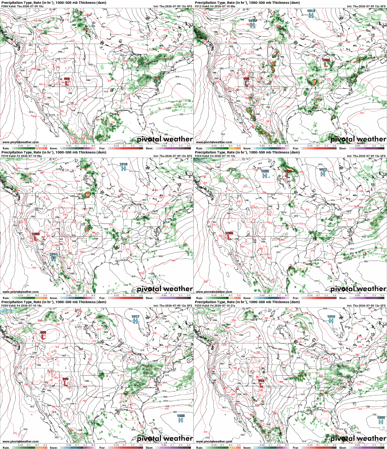
Starting around 3pm, folks in Southern LA can expect some stronger thunderstorms pushing off the Gulf that will continue to build and travel Westward as the afternoon continues. New Orleans, Baton Rouge, and South Alexandria will most likely see the heaviest rain this afternoon. Above is our forecast looking into Friday where things seem to stay consistent with our mid-summertime pattern. For tomorrow, expect a hot, sunny day with thunderstorms popping up throughout the afternoon.
Why is there so much lightning?
I’ve heard this question a lot lately, “Why did the storms this past week have so much lightning?” My dad asked me this exact question this morning, and I also heard it from family friends at a 4th of July party. Now, this might mostly be a Florida thing, but it is for sure something useful to understand when living in the South.
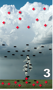
The short answer is that these thunderstorms are developing very rapidly, producing strong updrafts that carry moisture high into the atmosphere. As the water droplets freeze into ice crystals and soft hail (graupel), these particles collide with one another, separating electrical charges. This process leaves the upper portion of the cloud positively charged and the middle to lower portion negatively charged. As the difference in charge grows, it eventually becomes strong enough to overcome the insulating properties of the air, resulting in lightning. Because these storms are growing so quickly and have such strong updrafts, charge separation occurs more efficiently, leading to frequent lightning.
The recent increase in lightning can also be attributed to the highly unstable atmosphere created by intense heat, abundant moisture, and favorable wind shear. The hot, humid air fuels powerful updrafts that rapidly build thunderstorms into the colder upper atmosphere, where more ice particles form. These strong updrafts increase collisions between ice crystals and graupel, strengthening charge separation and producing more lightning than in weaker storms.
The combination of factors listed above is part of what makes Florida the lightning capital of the United States and fuels over 1 million cloud-to-ground lightning strikes per year in the Sunshine State alone.


