Bring an umbrella this week to shade yourself from the sun and to protect yourself from an afternoon shower. Through the end of the week, expect very typical hot summer days with isolated afternoon and evening storms. Severe weather is not expected, but storms could still bring the usual threats of heavy rainfall, gusty winds, and frequent lightning.
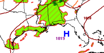
High pressure over the Gulf will funnel warm, tropical moisture inland, keeping humidity high. So be sure to watch out for heat indices around 105! Meanwhile, southwesterly winds will help push the sea breeze farther inland each afternoon, with storms developing near the coast in the morning before shifting farther inland during the afternoon.
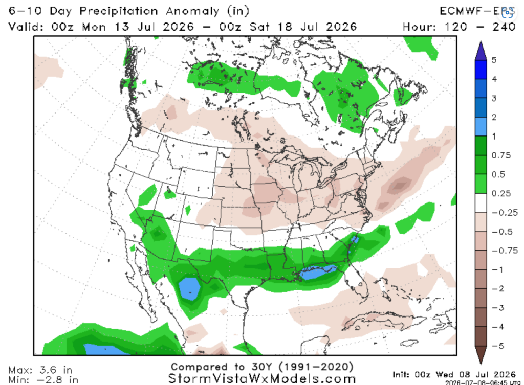
Beginning next week, the composite maps below show the arrival of a ridge over the western U.S. (below right).
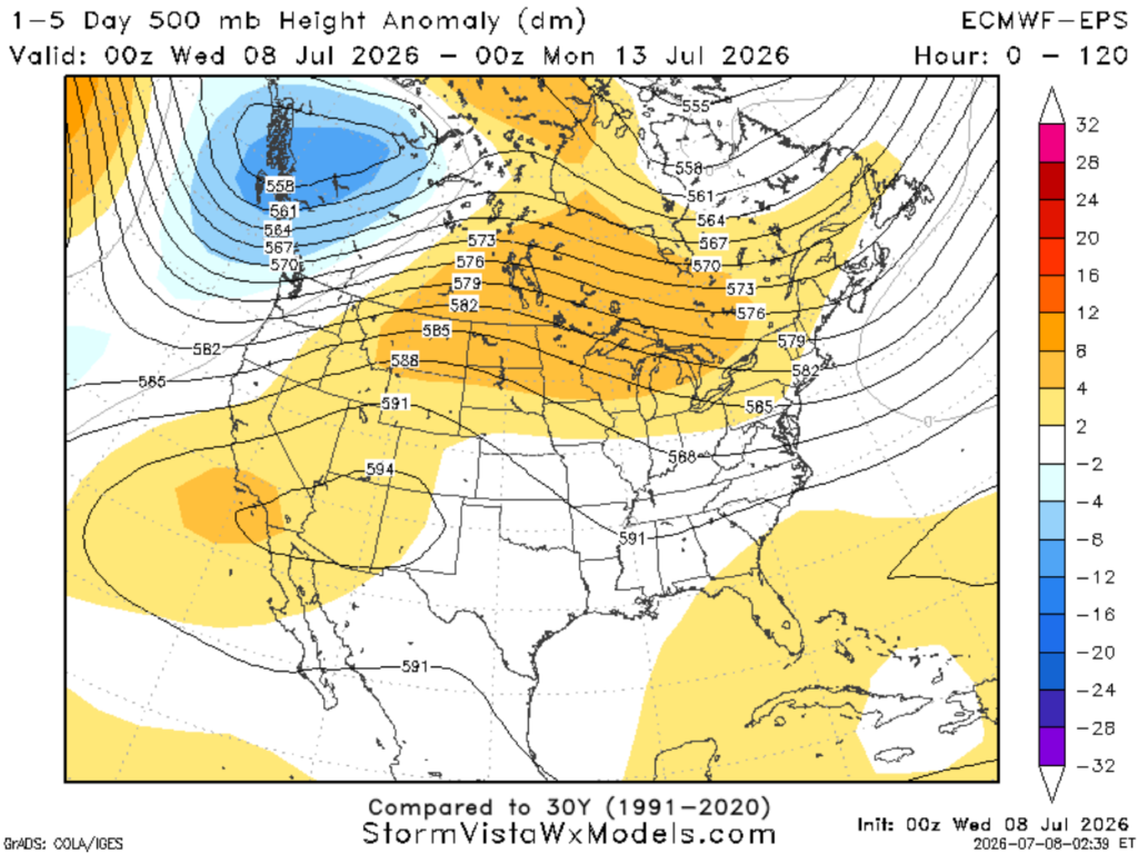
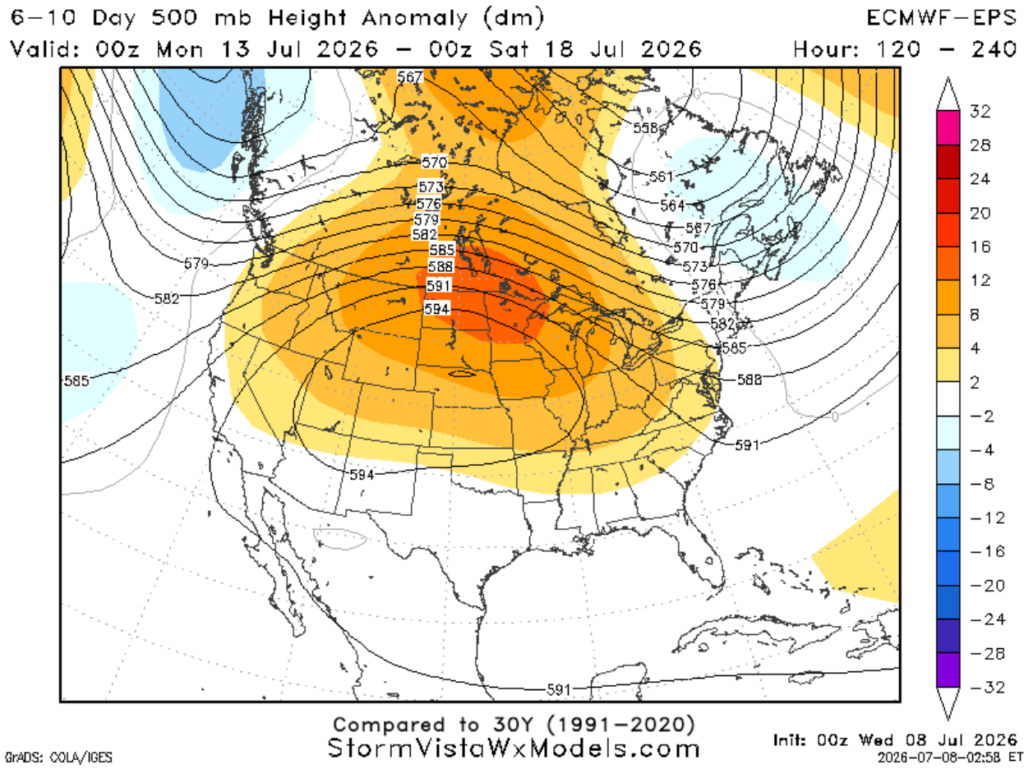
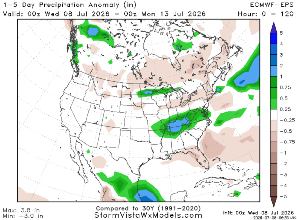
This pattern change will move us from normal precipitation (below left) to above normal precipitation (below right) as a trough rotating around the ridge pushes a cold front into the region during the Mon-Tues timeframe. Unfortunately, this points to the return of more widespread showers and storms.
3-DAY TRAVEL FORECAST
AIRPORTS
KIAH / KHOU (Houston) – Afternoon showers and storms are possible each day, with the exception of Friday, when storms are expected as early as the morning. Some intermittent flight delays are possible due to lightning.
KSHV (Shreveport) – Lingering storms tonight lasting until shortly after sunset could cause intermittent flight delays. Other than the heat, no weather-related issues are anticipated through Friday.
KBTR (Baton Rouge) – Afternoon showers and storms possible each day. Some intermittent flight delays are possible for lightning. But most flights between 5a and 12p should not be impacted by weather.
KMSY (New Orleans) – Afternoon showers and storms possible each day. Some intermittent flight delays are possible for lightning. But most flights between 5a and 12p should not be impacted by weather.
KJAN (Jackson) – Isolated afternoon and evening storms possible tonight and Thursday. Some intermittent flight delays are possible due to lightning.
KMOB (Mobile) – Afternoon showers and storms are possible each day, with the exception of Friday, when storms are expected as early as the morning. Some intermittent flight delays are possible due to lightning.
KBMH (Birmingham) – Afternoon and evening showers and storms are possible each day. Some intermittent flight delays are possible due to lightning, but most flights between 5 AM and 1 PM should be fine.
KTLH (Tallahassee) – Afternoon showers and storms are possible Thursday, mainly between 1–6 PM. Some intermittent flight delays are possible due to lightning.
KATL (Atlanta) – Afternoon and evening showers and storms are possible each day. Some intermittent flight delays are possible due to lightning, but most flights between 5 AM and 1 PM should be fine.
HIGHWAYS
I-10
Hit-and-miss showers and storms are possible each day from Houston to Tallahassee, with storms developing near the coast in the morning before shifting inland during the afternoon. Brief heavy rain, lightning, and gusty winds up to 60 mph could lead to ponding on roads, so use caution while driving.
I-20
Daily opportunities for mainly afternoon and evening storms. A few of these storms could produce typical summertime hazards such as gusty winds, frequent lightning, and heavy downpours.
Conditions should stay mostly dry near Shreveport, with storm activity increasing as you drive farther east towards Birmingham.
I-49
Mostly dry over the next two days. Southern portions of I-49 may have some afternoon storms to deal with near Alexandria and Lafayette. This would feature brief heavy rain and lightning. Watch for water on the roads!
I-55 & I-59
Isolated afternoon showers and storms are possible each day in southeastern Louisiana. Heavy rainfall, frequent lightning, and strong wind gusts are possible. Watch for minor flooding of roadways. Shower activity decreases as you drive north of Jackson.
I-65
Daily opportunities for mainly afternoon and evening storms from Mobile to Decatur. A few of these storms will be capable of normal summertime hazards such as gusty winds, frequent lightning, and heavy downpours.
I-75
Mostly dry, except for areas north of Macon where scattered showers and thunderstorms are possible during the afternoon and evening hours. Main threats with any storms will be gusty winds up to 40–50 mph and heavy rainfall.
CITY FORECASTS
Houston, TX
Tonight – Scattered storms across the area should dry out by the evening, giving way to a partly cloudy and quiet night. Low around 79. South wind 5–10 mph. Rain chance: 30%
Thursday– Hot and humid. Lower, but non- zero, chance of a stray storm in the afternoon, mainly between 1–7 PM. Otherwise, mostly sunny with a high of 95, will feel closer to 103. South wind 5–10 mph. Rain chance: 20%
Friday–Chance of scattered showers and storms early in the morning, with higher confidence in the afternoon lasting through the evening. Otherwise, partly sunny with a high of 95. South wind 5–15 mph. Rain chance: 30%
Shreveport, LA
Tonight – Lingering storms could stick around through the evening. The night will turn quiet with mostly clear skies. Low around 77 with light south winds. Rain chance: 20%
Thursday– Quiet and dry weather returns. Going to be a hot one! Sunny skies with a high of 96. Humidity will make it feel closer to 105. Light south winds. Drink water!
Friday–Similar to Thursday, with heat and sunny skies continuing. High near 96. Light south winds. Drink water!
Baton Rouge, LA
Tonight – Scattered showers and storms will diminish shortly after sunset. Some could be strong with heavy rainfall, frequent lightning, and wind gusts up to 40 mph. The night will turn quiet with partly cloudy skies. Low around 76 with light south winds. Rain chance: 20%
Thursday– Starting the day off hot with mostly sunny skies. High near 94, with humidity making it feel closer to 106. Pop-up showers and storms are possible in the afternoon, mainly between 1–7pm. Light south winds. Rain chance: 40%
Friday– Scattered showers and storms likely mainly after 1pm. Otherwise, mostly sunny with a high near 93. High humidity will make it feel closer to 106. Light south winds. Rain chance: 60%
New Orleans, LA
Tonight – Spotty showers and storms diminishing around 7 PM. The night will turn quiet with partly cloudy skies. Low around 79 with light south winds. Rain chance: 20%
Thursday– Another summer day with sunny skies and only isolated afternoon thunderstorms expected. Highs climb into the lower 90s but will feel closer to 105. Light south breeze. Rain chance: 40%
Friday– Storm chances increase as we head later into the week. Expect a mix of sun and clouds early, followed by scattered showers and thunderstorms developing during the afternoon and evening. High near 91. Rain chance: 70% during the day and 30% Friday night
Jackson, MS
Tonight – A few pop-up showers and storms could develop during the evening before drying out overnight. Becoming a partly cloudy night with a low around 75. Light southwest wind. Rain chance: 20%
Thursday– Very hot, humid day with sunny skies and only isolated afternoon and evening thunderstorms expected. Highs climb into the lower 90s but will feel closer to 106. Light south breeze. Rain chance: 20%
Friday– The heat and humidity continue, but overall, a beautiful sunny day with a high near 94. May feel like 106 with light southwest winds.
Birmingham, AL
Tonight – A stray thunderstorm is possible during the early overnight hours. Turning dry with partly cloudy skies. Low around 74. Calm winds. Rain chance: 20%
Thursday– Mostly sunny with isolated afternoon and evening thunderstorms expected, mainly after 1pm, with a few storms lingering into the overnight hours. Highs climb into the lower 90s. Light southwest breeze at 5–10 mph. Rain chance: 40%
Friday– Mostly sunny with a high near 93. Scattered showers and thunderstorms develop during the afternoon and evening. Light southwest breeze at 5–10 mph. Rain chance: 50%
Mobile, AL
Tonight – Mostly clear skies. Can’t rule out a stray storm. Low around 78 with south winds at 5–10 mph. Rain chance: 15%
Thursday– A typical summer day with sunny skies and only isolated afternoon thunderstorms expected, mainly between 1–4pm. Highs climb into the lower 90s but will feel closer to 105. South winds at 5–10 mph. Rain chance: 20%
Friday– Showers and storms developing near the coast during the morning hours, then shifting inland by the afternoon. Otherwise, mostly sunny with a high near 93, but may feel closer to 105. Rain chance: 30%
Tallahassee, FL
Tonight – Partly cloudy with temperatures dropping to around 76. A light breeze from the south.
Thursday– Very hot and humid. Mostly sunny with isolated afternoon thunderstorms expected, mainly between 1–6 pm. Highs climb into the mid-90s, with humidity making it feel closer to 107, drink water! Light southwest breeze at 5–10 mph. Rain chance: 30%
Friday– Mostly sunny and quiet with a high near 94, but will feel closer to 105. Calm winds. A decrease in storm activity, but can’t rule out a stray storm during the afternoon. Rain chance: 15%
Atlanta, GA
Tonight – Clear skies with temperatures falling to around 75. It will be a bit breezy with west winds at 5–15 mph.
Thursday– Sunny skies with a low-end chance of an isolated afternoon and evening thunderstorm. Highs climb into the lower 90s. Breezy with west wind gusts as high as 20 mph. Rain chance: 15%
Friday– A typical summer day starts off sunny and hot with a high near 92. It will feel closer to 97 due to the humidity. Showers and thunderstorms become possible after 2pm and could linger overnight. West winds around 10 mph. Rain chance: 40%.


