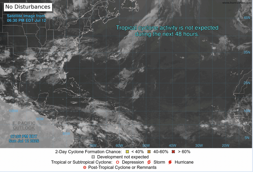
Good news on the tropical front, no development is expected within the next 2 or 7 days! Remember, it is still early in the season. We are still nearly two months away from the climatological peak of hurricane season.
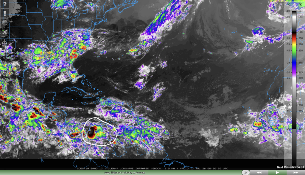
The NHC has pointed out one tropical wave situated north of Colombia in the Caribbean seas in their discussion. This wave has strong convection and is moving westwards at 15-20 kts.
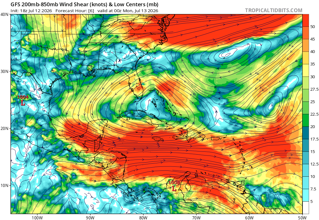
While waters are certainly warm enough to support development, this tropical wave will run into very heavy wind shear as it continues its trek westwards. Wind shear is the difference in wind speeds between two layers in the atmosphere. Wind shear tends to prevent tropical cyclones from strengthening, sometimes destroying them altogether.
Extended Outlook
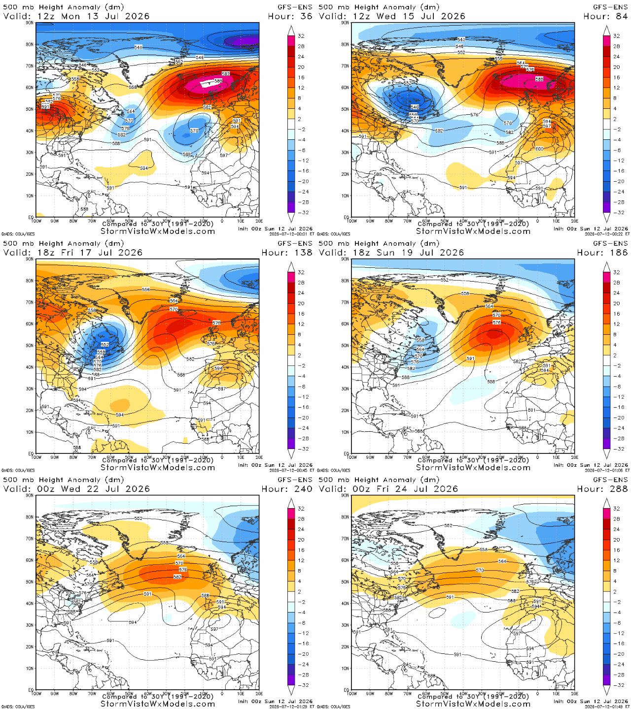
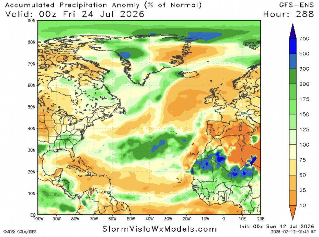
Conditions for tropical cyclone development looks fairly unfavorable over the next 10 days. Ridging looks likely over the main development region (region between Africa and the Caribbean) within the next 10 days, which will lead to sinking motion over that area. This isn’t ideal, as most tropical cyclones develop from tropical waves, which are areas of convection and intense thunderstorms.
This is reflected in the % of normal precipitation over the same time period. The GFS Ensemble model shows the MDR seeing below normal precipitation from July 13th until the 23rd. This would indicate that a below average number of tropical waves that originate in east Africa and travel westwards will develop.
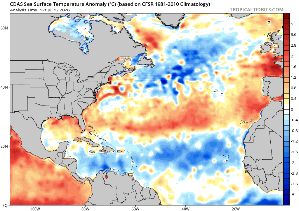
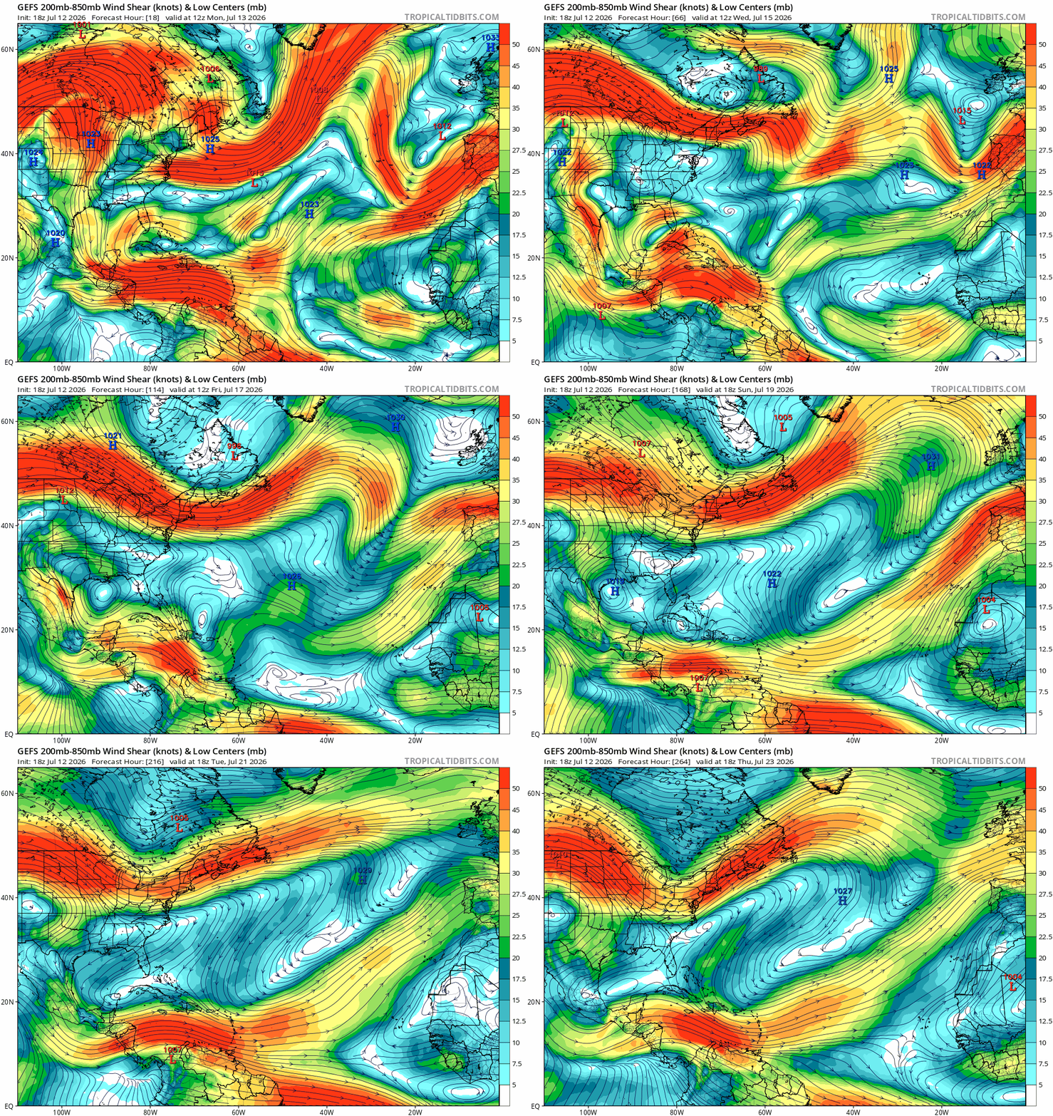
Other parameters such as wind shear and sea surface temperatures look relatively unfavorable for tropical development. High shear over the Caribbean sea and in the MDR look likely over the next 10 days. The sea surface temperatures in the MDR and Caribbean sea are also below normal for this time of year, which will further inhibit tropical wave development in those regions.
One region that actually does look somewhat favorable for tropical development is off the coast of the Carolinas heading northeast. This is because sea surface temperatures are above normal for this time of year, and wind shear looks to be low over the next 10 days. Tropical development is no guarantee, and tropical cyclones that develop in that region usually don’t impact land, but it’s still an interesting thing to think about.


