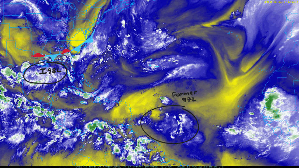
The Atlantic really wants to remain quiet as Invest 97L in the eastern side of the basin lost most of its thunderstorm activity and is not being currently monitored for any development. As 97L goes, invest 98L in the Northern Gulf of Mexico comes into the picture. This system is being kept over water and will head westward thanks to a stalled frontal boundary over the Southeast. Over in the Eastern Pacific, things have quieted down as Howard dissipated. However, there is still an area to watch for development.
Atlantic
Invest 98L
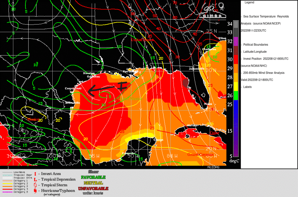
Attempting to form off of a stalled frontal boundary near the Central Gulf Coast is Invest 98L. A broad low has formed as well as some low-level counterclockwise spin around the still disorganized cluster of showers and thunderstorms.

Heading through Saturday and Sunday, the low is forecasted to move towards the west and into the Southern Texas Coast. Any development would be slow as the NHC gives this system a 10-percent chance of becoming a storm over a two day and five day period. As it moves west, the sea surface temperatures get a touch warmer at 30C (86F). Wind shear is also lower in the Northwestern gulf. These two ingredients could help 98L become a storm, whether a tropical depression or weak tropical storm.
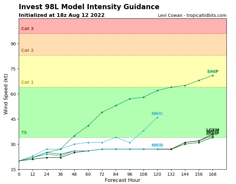
Model guidance is showing some slight strengthening through Saturday; however, some particular models do not develop it at all. Again, the key is model consensus. Looking at model intensity guidance, the consensus seems to be no developed storm or weak tropical depression.
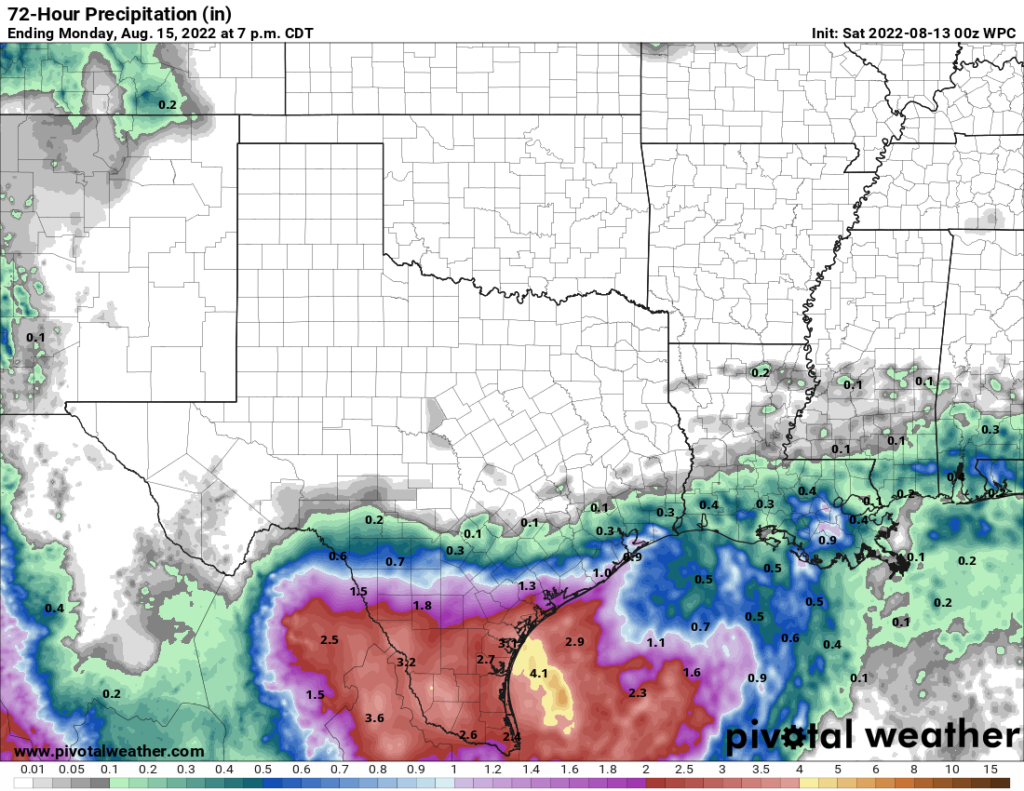
Regardless of any possible development, this system will be mostly a rain event. Heavy and prolonged rain will be the main story as it rolls into the Texas coast on Saturday. Through Monday, rainfall totals could range between 1″-3″ with locally heavier totals.
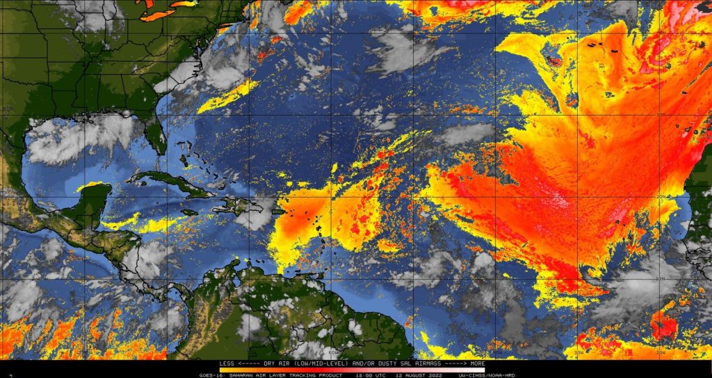
As for the rest of the Atlantic, all is quiet for now. Dry air, including the Saharan air layer, is still in the main developmental region. This drier air coupled with some strong wind shear is what killed off Invest 97L. Because of this, the NHC is not actively monitoring any areas besides 98L.
Keep in mind, there is still plenty of hurricane season left to cover as the climatological peak occurs on September 10. With August just beginning, expect things to heat up more as September gets closer. Remember to always have a plan in case a storm comes to your community. Here, you can find tips on how best to prepare from NOAA. As always, the best time to prepare is now.
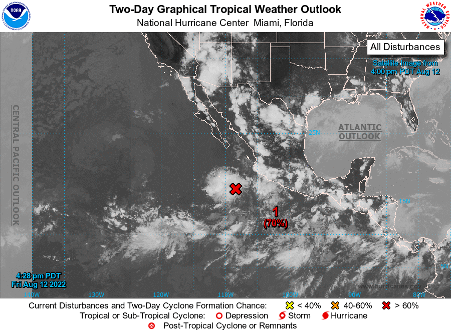
Eastern Pacific
As Howard became no more, another area of interest is in the picture. Invest 90E off the western coast of Mexico has 70-percent chance of development over the next two and five days. Showers and storms are working to become more organized on Saturday which would result in a tropical depression forming. This may be short lived as stronger winds aloft are expected to interact with the system by Sunday. Invest 90E is expected to move northwestward.