Hello everyone and happy Tuesday! For today in the tropics, we will focus on taking a look at the current conditions, as well as any progression of systems and wrap up with a conclusions section.
Firstly, we will take a look at any areas of interest marked by the NHC, and then do a breakdown of the current conditions.
From the NHC

Currently, the NHC is monitoring a tropical wave just to the west of the Cape Verde islands. With the current state of the environmental conditions, the NHC is currently giving the wave a 30-percent chance of further development within the next 5-days as it continues to move towards the west.
Current Tropical Conditions
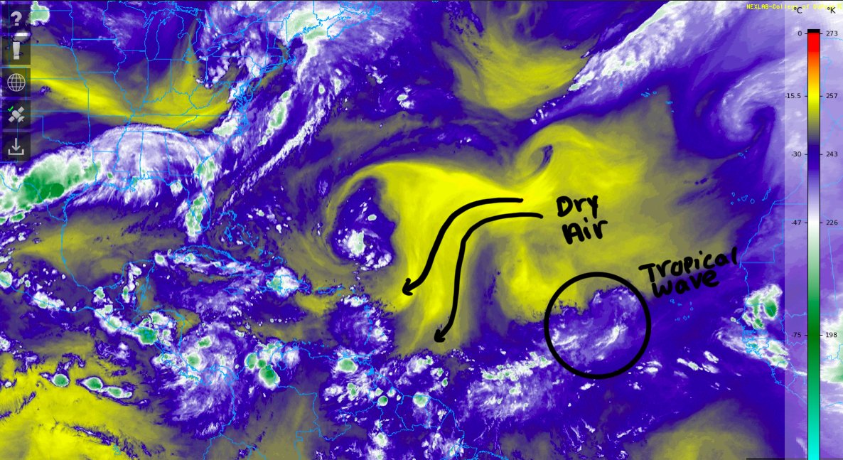
Taking a look at the the current mid-level water vapor of the Atlantic Basin, we can see the tropical wave of interest currently located to the west of the Cape Verde Islands as marked by the NHC. With the systems westward movement, it will initially encounter moist air before running into the drier Saharan Dust. Elsewhere across the Atlantic Basin, all is mainly quiet besides the usual ITCZ moisture and thunderstorms further to the south.

Taking a quick look at the current IR image, we can once again pick out the disorganized tropical wave, and another round of tropical moisture about the leave the coast of Africa. Otherwise, the Atlantic is mostly devoid of activity, besides typical ITCZ moisture.

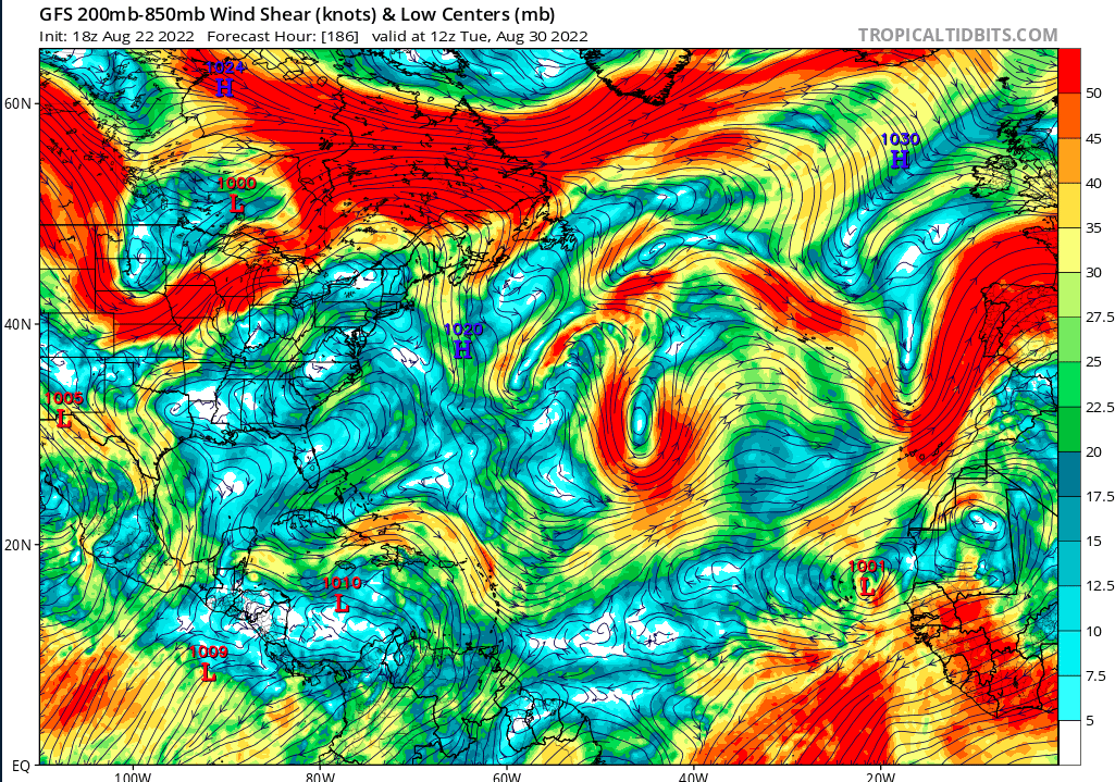
When observing the current wind shear, the area of thunderstorms and showers just to the west of Cape Verde is in an area of relatively low shear. With its current trajectory headed towards the Lesser Antilles, the shear is currently light and won’t greatly hinder development. Otherwise, shear across the Gulf is high with the Caribbean being devoid of any high levels of wind shear.
Model Prognosis


Looking at future relative humidity values for the next week, both the Euro and the GFS show more moisture along the coast of Africa, before a dry pocket just before the reaching the Caribbean. The models do slightly disagree with the moisture content in the Caribbean, where the GFS is showing less ry air.

Both models are generally in agreement that much of the Atlantic MDR and the Caribbean will have low values of shear moving into next week. This would allow for any tropical systems that develop to not be held back by high levels of wind shear.


Looking at the model tracks for the next week or so, both the Euro and American models show a significant cluster just off the coast of Africa, with some tracks going to the north of the Bahamas. While we can’t exactly pin down any tracks or certainty of tropical formation, with conditions continuing to favor tropical development rather than hindering it, it will be important to monitor to the tropics, especially as we get closer and closer to the height of the Atlantic Hurricane Season in early September.
Conclusions
As we begin to approach the height of Atlantic Hurricane Season, you may be thinking to yourself that we may have escaped any significant tropical systems this year, as the season has been very quiet so far. However, it is still too soon to make such assumptions, as we still have yet to reach the peak of the season, which is typically in early September. While the current tropical wave only has a 30-percent chance of development in the next 5-days, model guidance is suggesting that other tropical waves will make their way off the coast of African and out into the Tropical Atlantic, and these will have to be monitored along their journey.


