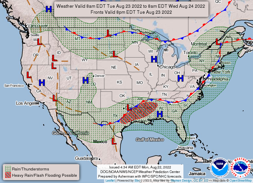
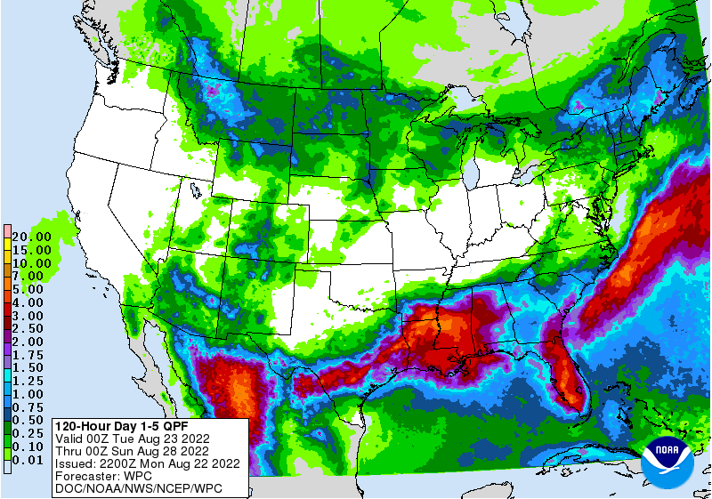
After what has been deemed a one in 1,000-year event that saw the Dallas metro receive up to 15 inches of rain or more, finally the deluge looks to taper off throughout the week for those in north Texas. However, those further south and east into the Southeast US will experience these heavy rains for the next couple days. Very rich moisture, with PW values being mostly greater than 2 inches or even 2.5 inches, along with a slow-moving stationary front, will allow for repeated rounds of heavy to torrential downpours for those especially in southeastern Texas, southern Arkansas, Louisiana, and Mississippi. Forecasted rainfall totals over the next three days includes the possibility for widespread totals of 3 to 5 inches possible, with some places seeing even greater amounts. This, along with the already saturated soil, will create opportunities for possibly widespread flooding.

Heavy rainfall looks to depart the area by the middle of this week and more seasonal conditions replace it, with the majority of showers and thunderstorms be initiated by the diurnal heating cycle as well as sea breeze boundaries. Places should for the most part begin to dry out with this in mind, as well as temperatures in the 80s and 90s.
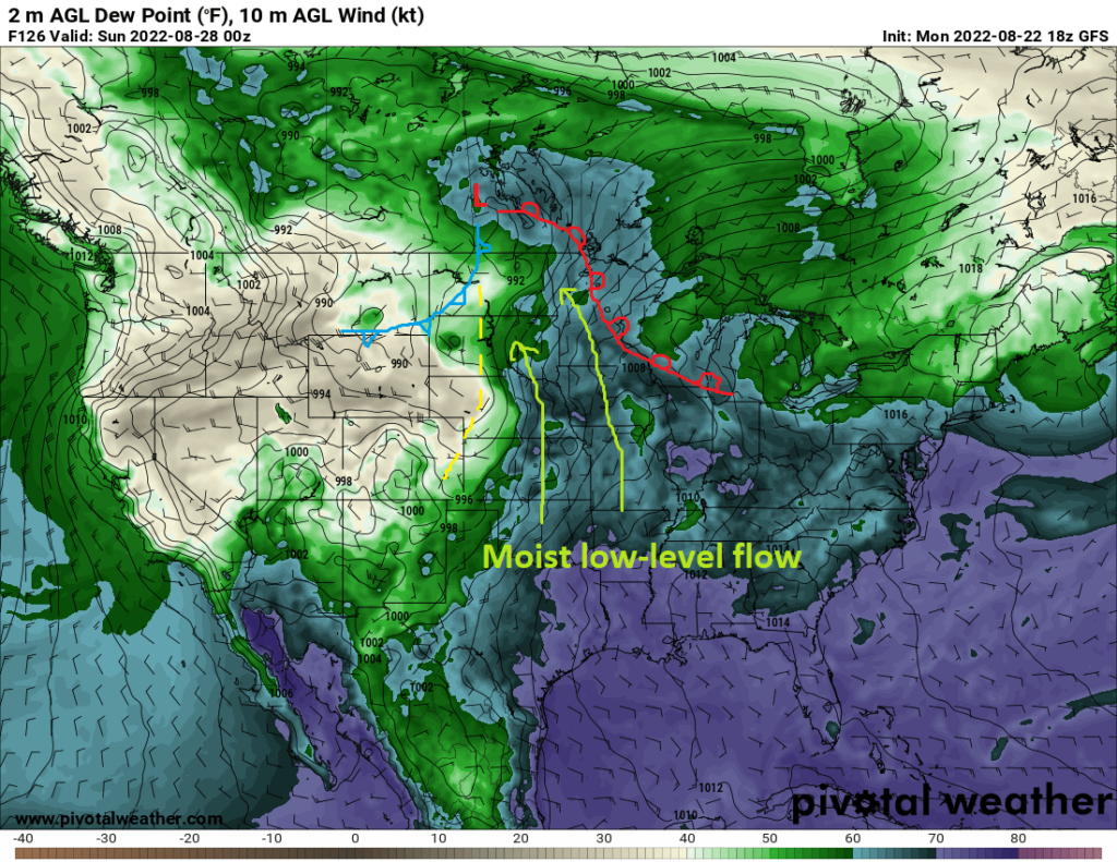
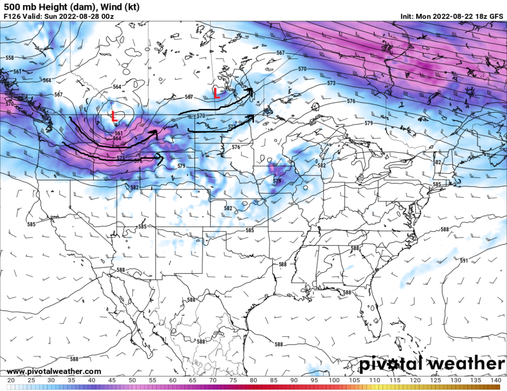
Out in the Great Plains, things will remain fairly summerlike and dry for the majority of the week. By this weekend through, there is hints of possibly the opportunity for rainfall or even severe thunderstorms towards the weekend. A shortwave trough is slated to eject across the High Plains by Friday and the upper Midwest/Great Lakes by Saturday. Ample south-southeast flow will bring in moisture from the Gulf of Mexico. Modest lapse rates (change in temperature as you increase in height) and vertical wind shear may allow for the organization of isolated severe thunderstorms, but general thunderstorms will be more common and more widespread. These scattered thunderstorms will look to occur throughout the Great Plains and Mississippi River valley through the weekend.
A little side note…
After a very thrilling summer forecasting for you guys, this will be my last duo of weather forecasts (Coast and CONUS) for this internship. It has been an absolute blast and huge privilege to be able to work with Nick and write these forecasts for you guys over the last few months. Hopefully you guys have enjoyed these forecasts and I will definitely cherish and use this experience to assist in the pursuit of my meteorology career. I cannot wait to see the things to come for this website and all the stops Nick will pull out in the future. Thank you to everyone and until we meet again!
Kaden Schroeder


