It has been quiet over in the Atlantic for quite some time now. It has been 59 days since the last named storm (July 3rd) which was Tropical Storm Colin that formed and dissipated quickly over the Carolinas.
Now, August is coming to a close without any named storms this month. Since the records from 1950, this has only occurred twice: 1961 and 1997. So, this is pretty rare. With this, you may be wondering if there are any systems of concern since we are less than two weeks away from the climatological peak of hurricane season. The Atlantic is beginning to see some more activity with some tropical waves.
There are a few areas of interest to keep an eye on over the waters as of now, but they should not bring any threats to land. Invest 91L, which has the best chance of development is slowly getting more organized. A tropical wave off of Africa also has a chance of development of the next few days.
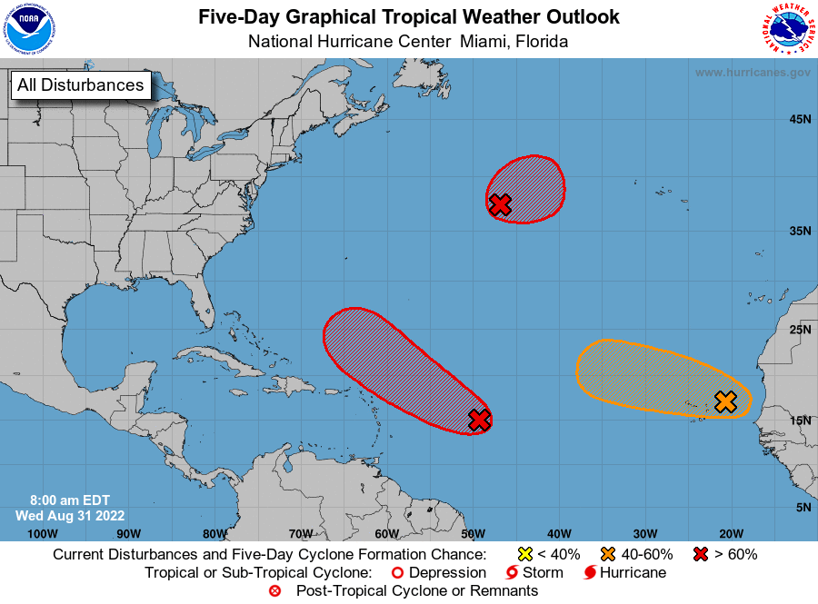
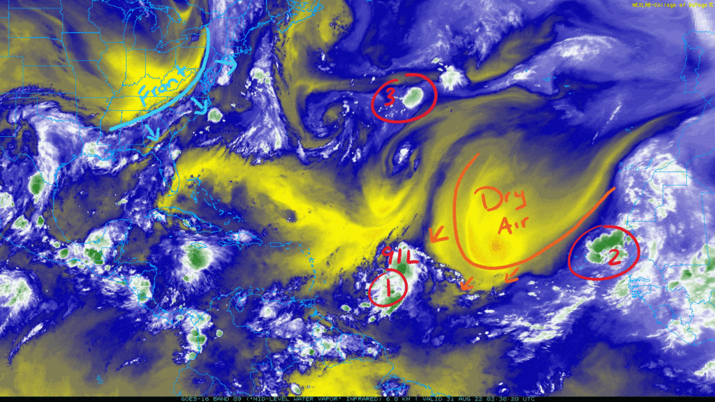
In the area highlighted with a 2, a tropical wave is moving off the African Coast and is producing some disorganized showers and thunderstorms. A quick tropical depression may form from this as it moves westwards towards a plume of drier air in a more hostile environment. Because of this, the NHC is giving it a 40-percent chance of development over the next 2 days and a 50-percent chance over 5 days. Any development that occurs will stay over the water as it would curve northwards.
In the circle with the 3, a low pressure center has formed to become Invest 93L over some convection seen with the green colors in the image above. Gradual development is possible with a 60-percent chance of development over the next 2 days and a 70-percent chance over 5 days. It will over a favorable environment that would support a subtropical depression within the next few days. It will move eastward and be of no threat to land.
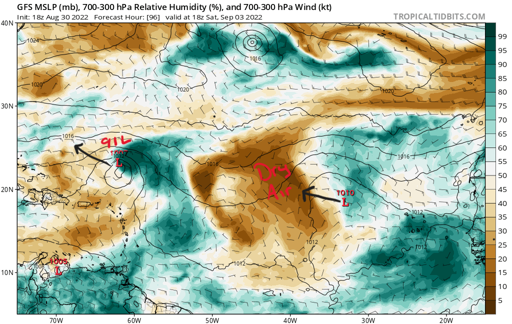
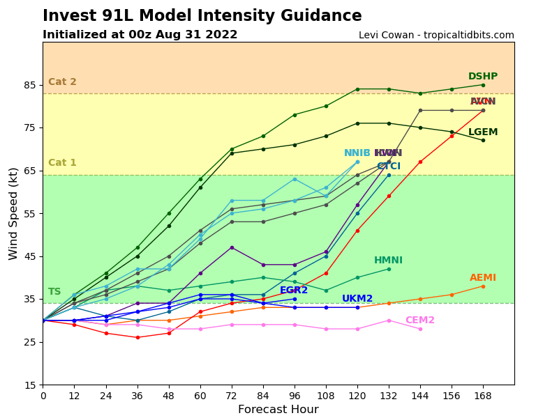
Now the system that is officially an invest is Invest 91L currently east of the Lesser Antilles Islands. Even though the atmosphere is not the most favorable for development now as there is some good wind shear ahead of it, gradual development is expected as there should be enough deep moisture for it to work with. The NHC is giving it a 60-percent chance of development over the next 2 days and a 80-percent chance over 5 days. It currently has an elongated circulation which is keeping it from a named storm as it has maximum winds at 34 mph. If this becomes a named system, the next name would be Danielle unless 93L steals the name first.
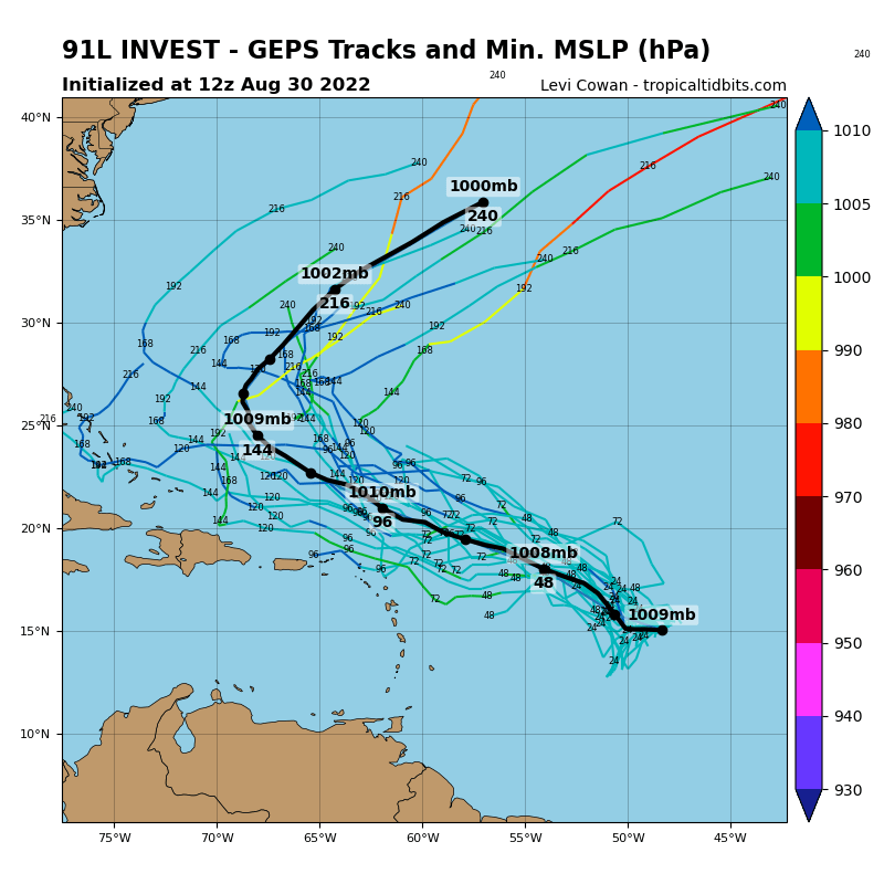
As it treks to the west, then west-northwest, it will likely become a tropical depression in the next few days. Going out closer to Labor Day weekend, it should interact with a upper-level trough exiting the Eastern Coast that will curve it back over to the northeast. Model guidance is showing 91L developing into at least a tropical storm and even into a possible hurricane. The GFS is being a bit more bullish on its intensity while the Euro is keeping this a weaker system into the weekend so far. Again, this won’t have any impacts on your Labor Day plans.
Even though these areas of interest will not be coming towards the U.S., it only takes one storm to cause great concern. With many significant hurricane anniversaries recently, I am reminded of the human impact these storms cause. With that said, we still have plenty of hurricane season left as September rolls in. I’ll keep saying to have a plan in the event one comes towards your community and make sure that your friends and family are prepared as well. Explore some hurricane preparedness tips here from the NWS.


