The Eastern Atlantic continues to churn out storm after storm in what is an active season so far. Currently, Tropical Storm Howard exists while another area of interest has a good chance of development. Meanwhile, the Atlantic is finally showing signs of life after a quiet past three weeks. A tropical wave southwest of the Cabo Verde Islands has caught the attention of the NHC, but it has an upwards battle for development.
Atlantic
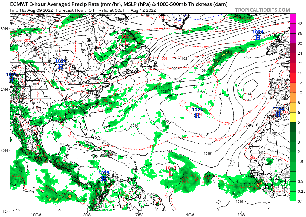
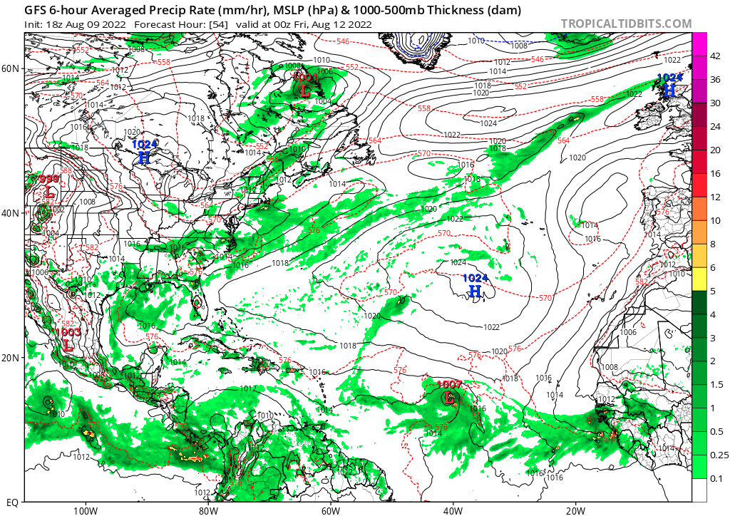
Invest 97L
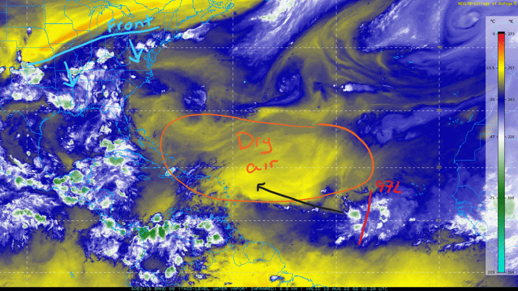
A tropical wave has emerged off of the African Coast in the Eastern Atlantic that is being monitored by the NHC. It currently consists of disorganized showers and thunderstorms with no real center of circulation. Slow development is possible over the next few days as it heads westward. The NHC has a 20-percent chance of development over the next 48 hours and a 30-percent chance over the next five days. Model guidance for intensity sees a potential tropical storm strength system before unfavorable environmental conditions affect it.
Over the next few days as 97L moves towards the west, it will reach more hostile conditions. A large swath of mid-level dry air with some Saharan dust still exists over the center of the basin. This will limit any robust convection that attempts to organize. Also ahead of the system is strong wind shear. In the image below, strong shear is indicated by the red and pink colors ahead of where 97L is located over an area of weak shear. Additionally, ahead of 97L is increasing shear shown by the white contour lines.
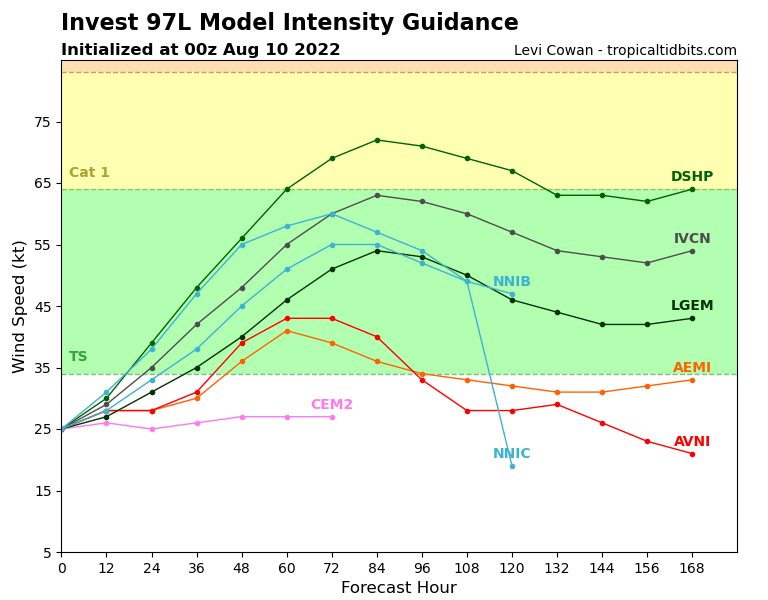
Not all models agree yet on the development of 97L. The GFS has been consistent in the past few model runs in developing the system to a storm by Friday into the weekend. On the other side, the Euro model has been consistent so far with fizzling out the system before any real development. As always, the key is to watch model trends over time to get a good grasp on what the guidance is suggesting.
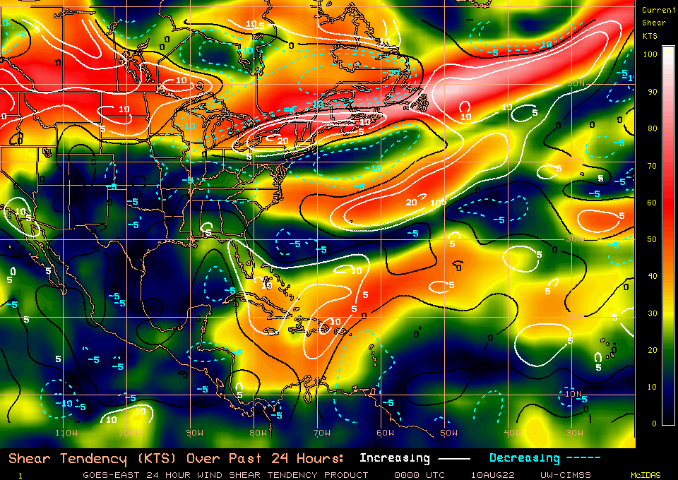
Regardless of development, 97L will drift towards the west-northwest through the week. The steering pattern setting up will prevent it from getting close to land as it should move north into next week and away from land. An upper-level trough will move through the Northeast along with a cold front. The Bermuda high shifts slightly to the east guiding 97L westward before a more northward direction. If 97L becomes a storm, it will most likely follow the steering pattern indicated by the arrows in the image below.
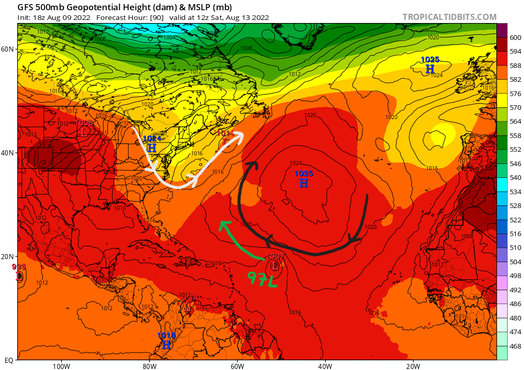
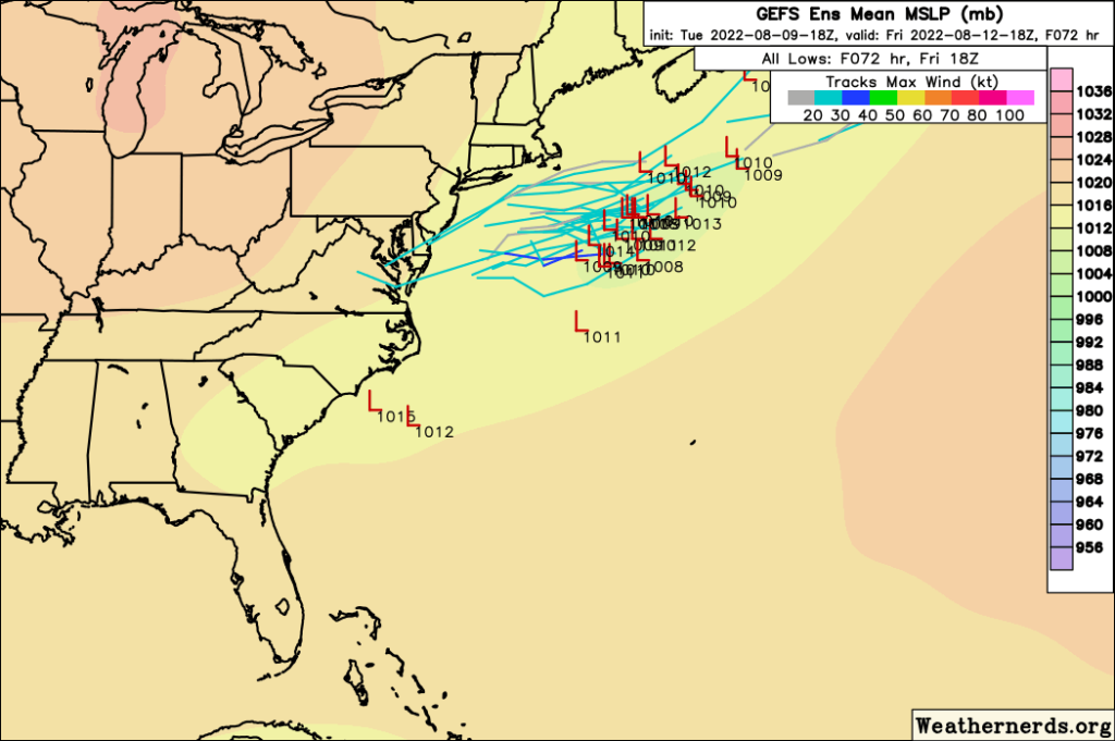
Possible Low in the Northwest Atlantic
As the upper-level trough moves over the Northeast, a cold front will also pass through the area. Associated with the front is a line of increased vorticity ahead of it. Remember vorticity is basically a measure of spin in the atmosphere. Along this line of heightened vorticity, a low pressure system could spin up where the sea surface temperatures are warm enough before they are too cold more north.
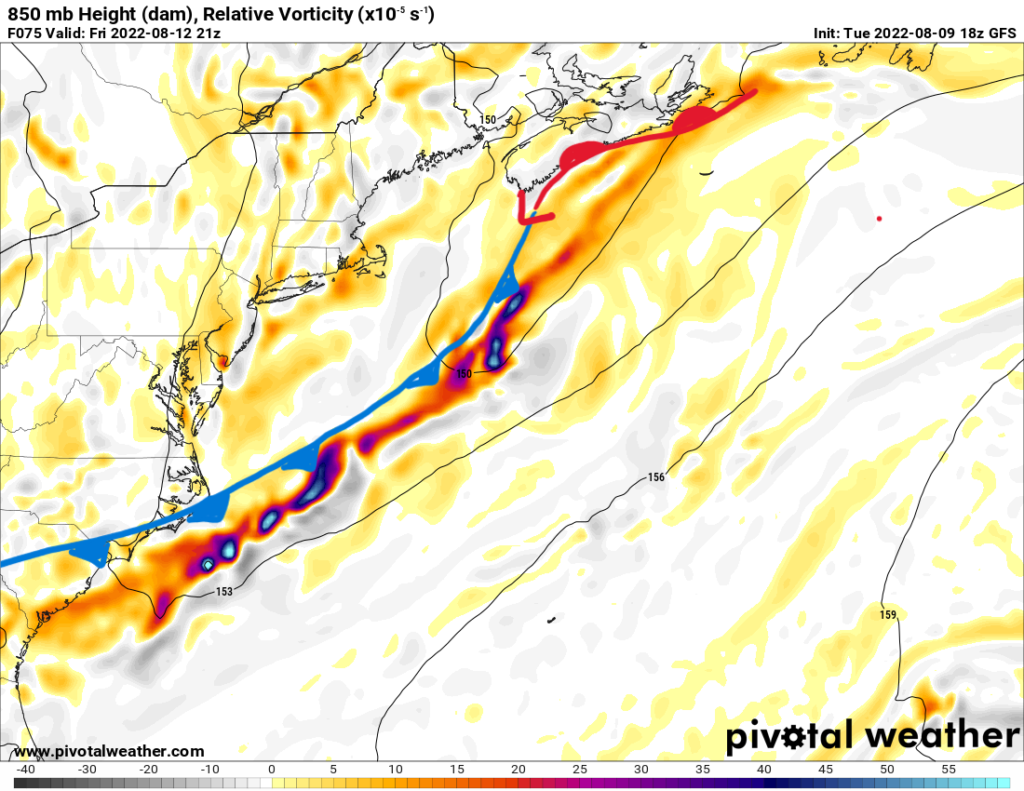
A quick low could form along this line ahead of the front; however, if anything formed, it would most likely be weak and move out to sea without any threat to land. Some model guidance has picked up on the formation of a low, but timing would be this weekend when the front moves out to sea. Either way, there is no real threat to land and this would be an area to watch over the week.
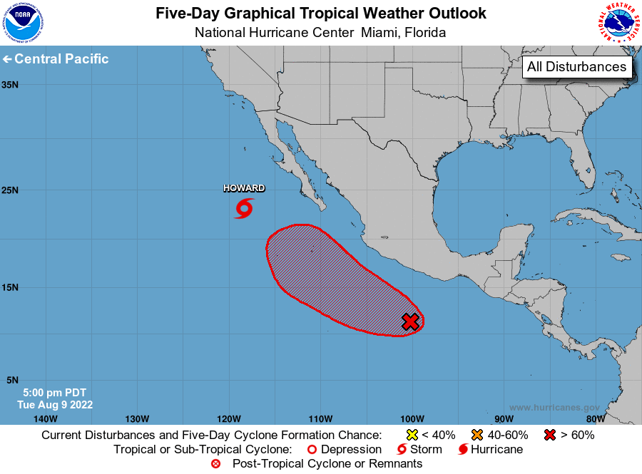
Eastern Pacific
Over in the Eastern Pacific, Tropical Storm Howard is on the decline and is forecasted to weaken to a depression by Thursday evening as it moves over colder waters. The system peaked as a hurricane with max sustained winds of 85 mph before encountering drier air. Howard is currently over open waters and is no threat to land. Another area of interest is a broad region of low pressure with thunderstorms that is forecasted to gradually develop by the weekend. It has a 30-percent chance of development over the next 48 hours and a 70-percent chance over the next five days from the NHC.