As calm as the weather is going to be this week, you’d think Mother Nature forgot about the Southern MS/AL/LA region! Highs around 50 to 60 each day this week with plenty of sunshine and no significant weather rolling through.
As much as I know some of you folks don’t care for cooler temperatures, you have to admit that cooler air like this beats dodging hail and tornadoes!
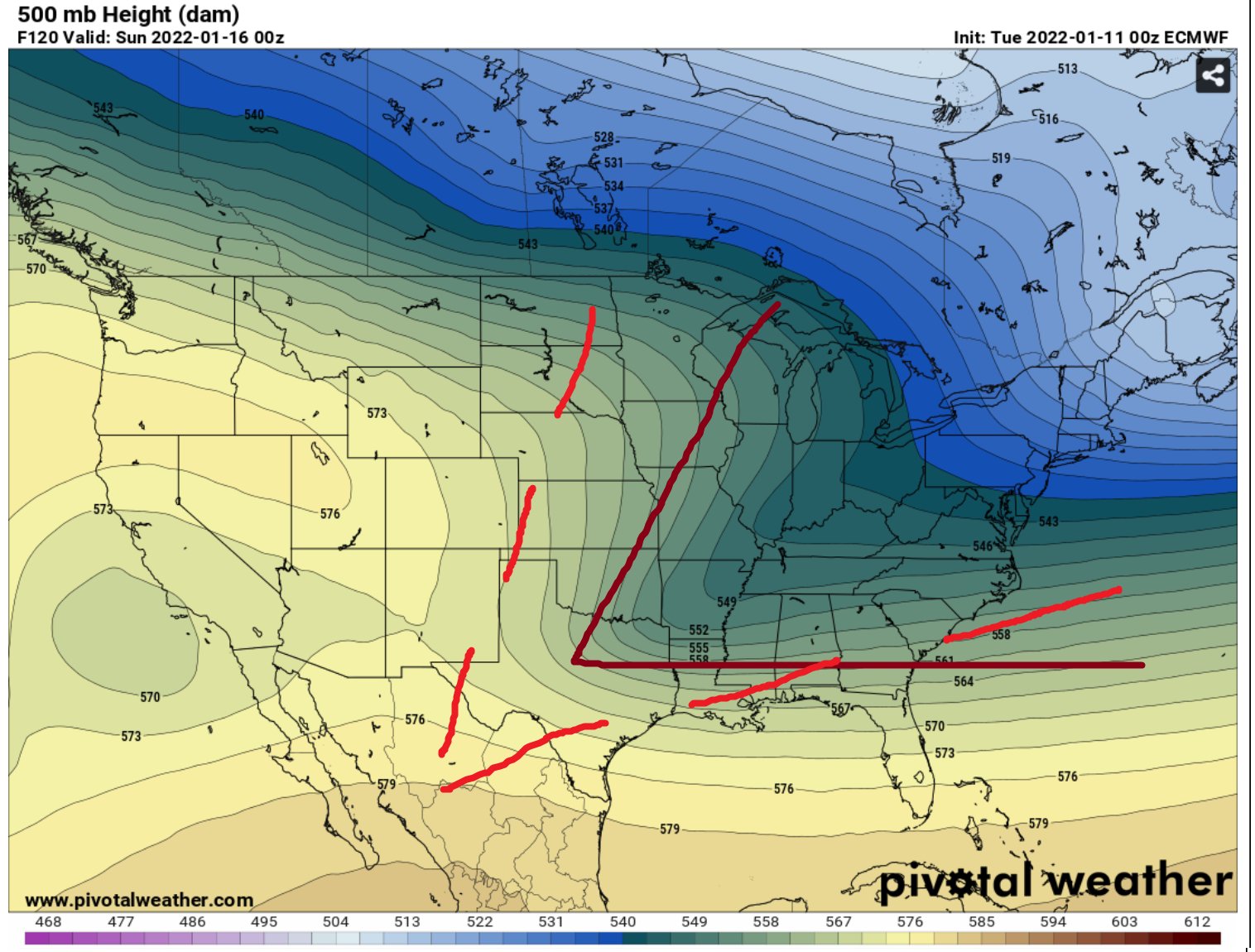
Once we head toward the weekend, things do get a bit more interesting. A cold front will swing into the area from the northwest on Saturday. The most interesting part is that the CIPS Analogs says there are no good analogs for this system. So this is a bit of a wildcard.
The top analog is from January 22, 2016. It was a day forecast to produce – and did produce – severe weather for the area. I even did one of my severe weather videos for that day.

But before you get too worried, while it is the top analog, the score is also pretty low. A 10/15 isn’t a great grade. I mean, think back to school, if you got a 10 out of 15 on a quiz, that’s a D. So, I’m not overly concerned at this point.
Why bring it up then? Well! It turns out that a slightly better analog from a different location pulls a different severe weather event. This one is from February of 2003

It still isn’t a great score – at 11.5/15 or about 76-percent. But it is better.
It turns out you can find a better analog and it doesn’t say diddly about severe weather. It has just regular rain.

But, this setup is a bit of a wildcard. This analog is from 1983. So it has been almost 40 years since a similar setup like this has occurred. And a lot has changed in the atmosphere since then.
On top of that, the estimated snow cover behind this cold front will be reasonable. Not great, but reasonable. So behind the front, there will be a fair bit of cooler air.

So, that means, if we can pool enough warmer air ahead of the front, we may be able to squeeze out one or two severe storms. I don’t think that is very likely, but it is a possibility.
More importantly, I would argue that behind the front, any leftover moisture/precipitation would likely fall as a very cold rain, perhaps mixed with some sleet.
Snow? Not as likely. Some of you guys may remember me doing research to find ‘the elbow’, among other things, needed to get Gulf Coast snow. This time it doesn’t look like the elbow will be in the right place.
But a good cold rain behind the front and maybe some sleet pellets will be possible. Especially if you are farther north. And as we get closer in times, things may change. Please keep checking back for details on the forecast.
Day to Day Forecast
Today
Sunny. Highs in the mid 50s.
Tonight
Increasing clouds with areas of drizzle across portions of Louisiana and western Mississippi. Lows around 40 to the west and in the mid 30s to the east.
Wednesday
Partly cloudy in the morning, then clearing. Highs in the upper 50s.
Wednesday Night
Mostly clear. Lows in the mid 30s.
Thursday
Sunny. Highs in the lower 60s.
Thursday Night
Mostly clear. Lows in the upper 30s.
Friday
Mostly sunny. Highs in the lower 60s.
Friday Night
Partly cloudy. Lows in the lower 40s.
Saturday
Partly cloudy with a 30-percent chance of showers. While severe weather is possible, it certainly doesn’t look likely. Highs around 55.
Saturday Night
Cloudy with a 40-percent chance of showers in the evening. Any lingering precipitation may mix with sleet after midnight. No accumulations or travel hazards anticipated at this time. Lows in the mid 30s.
Sunday
Morning clouds, with some afternoon sun. Highs in the lower 50s.
Sunday Night
Partly cloudy. Lows in the mid 30s.
Martin Luther King Jr Day
Mostly sunny. Highs in the upper 50s.


