Scattered showers and storms continue to be the main story for the Southeast as we head towards the weekend. The upper-level high remains over the Southwest before it will begin to shift eastward. This will work to limit some storm coverage to isolated and scattered in nature. But, most places will still see a chance for storms in the afternoon.
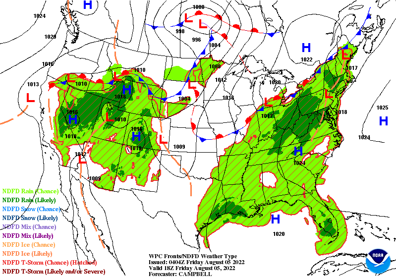
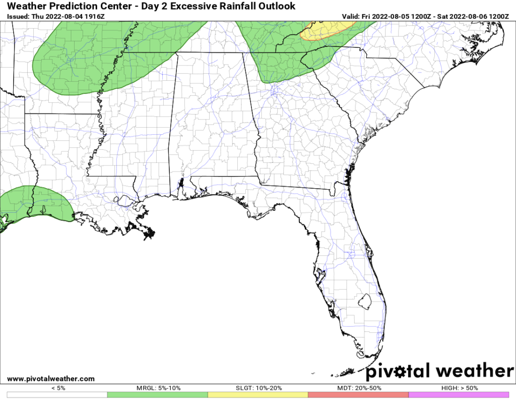
Storm coverage on Friday will be the greatest near the coasts where the sea breeze will be the main forcing for lift to initiate convection. Storms will continue to be diurnally driven even as the ridge moves eastward. Precipitable water (pwat) values will be around 1.75″ over most of the region to support locally heavy rainfall. Pwat values around 2″ will be present over the Western Gulf Coast providing enough moisture in the atmosphere for the potential for flooding. Over this area exists a marginal risk for excessive rainfall with possible 3″+ of rainfall for some areas.
Showers and storms ahead of a stationary front that is north of Tennessee will bring some heavy rainfall to parts of the Tennessee Valley into North Carolina as well.
Saturday
Saturday will be very similar to Friday will possible isolated to scattered storms driven by daytime heating. High temperatures will be of typical values around the low-to-mid 90s. With dewpoints reaching into the 70s, heat indices will be hitting the upper 90s and possibly 100F in some parts. With the heating, storms will develop in the afternoon. With southerly and southeasterly flow into the region, the sea breeze along the coast will also kick off convection.
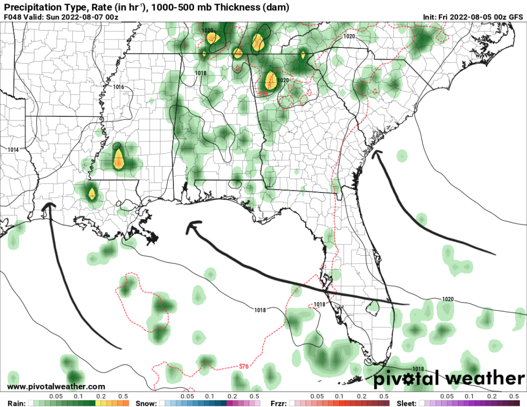
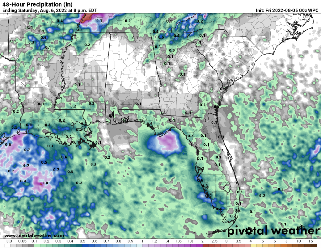
Heavy rainfall is possible in Tennessee into northern AL and GA as the frontal boundary dies out and storms drift slowly to the south. Rainfall totals could reach up to 2″ in some parts. Most of the rest of rainfall will be near the coasts from the aforementioned sea breeze. Rainfall up to 1″ with locally higher totals are possible with some of the slower moving storms as flow aloft is generally weak to steer storms quickly.
Sunday
The upper-level ridge will expand more towards the east and if it gets stronger, storm coverage will be less pronounced. Still, a daily chance of scattered storms is possible as daytime heating kicks in and other storms produce outflow boundaries to initiate new convection.
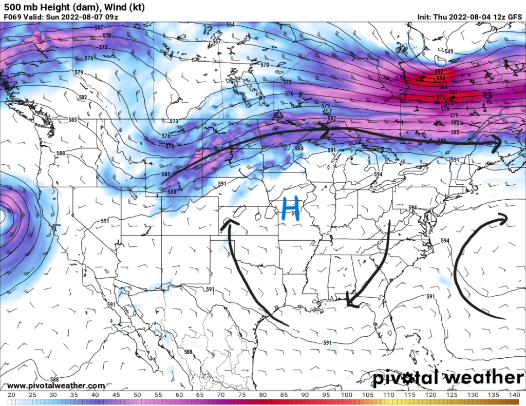
As this ridge expands, temperatures will increase slightly. Much of the eastern half of the region will still see highs in the low-to-mid 90s. More to the west over TX, LA, and AR, highs will begin to reach the upper 90s and low 100s in some areas. Heat index values to the east will be in the upper 90s and to the west into the low 100s.
3-Day Forecast
| Dallas, TX | ||
| Friday | Saturday | Sunday |
| High: 102 | High: 101 | High: 101 |
| Low: 80 | Low: 80 | Low: 80 |
| Precip: None | Precip: None | Precip: None |
| Houston, TX | ||
| Friday | Saturday | Sunday |
| High: 94 | High: 93 | High: 94 |
| Low: 79 | Low: 79 | Low: 79 |
| Precip: 60-percent | Precip: 50-percent | Precip: 40-percent |
| New Orleans, LA | ||
| Friday | Saturday | Sunday |
| High: 88 | High: 88 | High: 90 |
| Low: 78 | Low: 78 | Low: 78 |
| Precip: 60-percent | Precip: 70-percent | Precip: 70-percent |
| Little Rock, AR | ||
| Friday | Saturday | Sunday |
| High: 90 | High: 94 | High: 93 |
| Low: 75 | Low: 75 | Low: 75 |
| Precip: 40-percent | Precip: 10-percent | Precip: 20-percent |
| Memphis, TN | ||
| Friday | Saturday | Sunday |
| High: 90 | High: 92 | High: 92 |
| Low: 75 | Low: 75 | Low: 75 |
| Precip: 40-percent | Precip: 10-percent | Precip: 20-percent |
| Birmingham, AL | ||
| Friday | Saturday | Sunday |
| High: 93 | High: 92 | High: 92 |
| Low: 74 | Low: 73 | Low: 73 |
| Precip: 20-percent | Precip: 40-percent | Precip: 40-percent |
| Atlanta, GA | ||
| Friday | Saturday | Sunday |
| High: 90 | High: 90 | High: 88 |
| Low: 72 | Low: 72 | Low: 72 |
| Precip: 40-percent | Precip: 50-percent | Precip: 50-percent |


