Good morning folks and happy Saturday!
As has been the story this week, the Atlantic remains unfavorable for the development of tropical cyclones, due to a relatively dry Intertropical Convergence Zone and a very large dry air mass in place over much of the Atlantic. This may change however with the arrival of tropical waves from West Africa, moistening the atmosphere in the Atlantic Basin’s main development region along the ITCZ…
Current Conditions

Taking a look at the water vapor imagery, we can see that the only area of convection is over the Intertropical Convergence Zone (ITCZ) just offshore of West Africa. To the north of this area, a large swath of dry air remains in place, with the mid-levels only moistening slightly more toward the Caribbean and the Gulf of Mexico.

One of the other factors that we look at to determine the favorability of the environment for the development of tropical cyclones is wind shear, and according to the current GFS analysis, the wind shear is relatively low throughout much of the Atlantic. This tells us that the main limiting factor is the dry air that is preventing organized convection along the ITCZ.
Looking Ahead
As the shear continues to decrease as we head further into next week, we need to pay more attention to the African Easterly Waves (AEW) emerging into the Tropical Atlantic into the basin’s main development region (MDR).
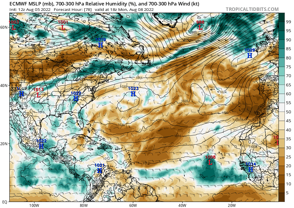

With the next AEW emerging off the coast of West Africa this weekend, the associated packet of enhanced moisture is something to watch, especially regarding the low wind shear over the area. In fact, both the American GFS model and the European ECMWF model show a weak tropical cyclone develop from this wave sometime next week, a rather new development in the latest model runs…

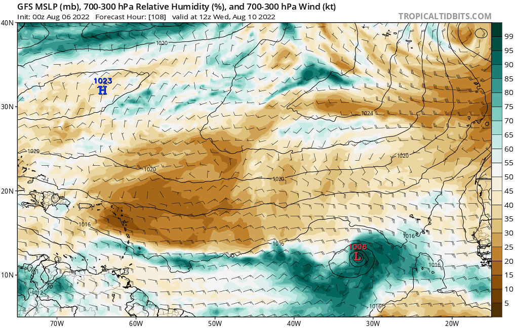
For this potential tropical cyclone, however, both model solutions show dry air being able to infiltrate the cyclone’s circulation, leading to the system weakening some as it approaches the Leeward Islands by late next week…
Conclusions
As this potential tropical cyclone is a newer feature in the latest model runs, it is yet to be seen if future model runs will continue to output similar solutions. As we head into the peak of the Atlantic Hurricane Season in late August through September, it is very important that we keep a close eye on features like this as the environment becomes climatologically more favorable for the development of tropical cyclones this time of year.


