Dry conditions will set in as a cold front exits our forecast area, and a high-pressure system moves east along the Gulf Coast. Afternoon highs are expected to peak in the low 50s. Temps will hold between the 30s and 50s from today through Thursday. In fact, a little shortwave on Monday evening will bring a surface high into our region, resulting in one of the coldest nights with morning lows in the upper 20s to lower 30s on Tuesday morning.
By Thursday, temperatures will rebound back to above normal with a shot for some rain. As the week progresses, additional shortwaves will traverse the region, keeping the surface high in motion. The potential for severe storms associated with a developing low-pressure system is anticipated Thursday night into Friday morning, bringing widespread rain of one to two inches, with the heaviest amounts in the south.
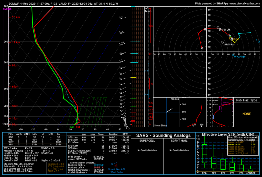
Looking at the model guidance from the Euro operational guidance, we see plenty of showers and storms across the area on Thursday night. But the atmosphere, according to this model run, wont have surface-based storms across much of the area. That may limit the tornado threat.
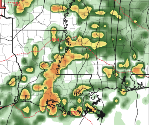
The models have some differences for Thursday night and Friday, but generally agree on showers and storms.
Model discrepancies widen a bit for rain potential on Saturday, with trends suggesting a drier start to the weekend after the Thursday/Friday system.
[wpcode id=”41149″]
REGIONAL DAY-TO-DAY FORECAST
Monday: Mostly sunny. Highs in the upper 50s. North winds 5 to 10 mph.
Monday Night: Mostly cloudy. Lows in the mid 30s. North winds around 5 mph.
Tuesday: Sunny. Highs in the upper 50s. North winds 5 to 10 mph.
Tuesday Night: Clear, cold with lows around 30. North winds around 5 mph in the evening, becoming light and variable.
Wednesday: Sunny. Highs in the lower 60s.
Wednesday Night: Partly cloudy in the evening, then becoming mostly cloudy. Lows in the upper 30s.
Thursday: Partly sunny. Highs in the mid 60s.
Thursday Night: Mostly cloudy with a slight chance of thunderstorms. A chance of showers in the evening, then showers likely after midnight. Not as cool with lows in the mid 50s. Temperature rising to around 60 after midnight. Chance of rain 60 percent.
Friday: Mostly cloudy with a slight chance of thunderstorms. Showers likely, mainly in the morning. Highs in the mid 70s. Chance of rain 60 percent.
Friday Night: Mostly cloudy with a chance of showers with a slight chance of thunderstorms. Lows around 60. Chance of rain 20 percent.
Saturday: Cloudy with a chance of showers with a slight chance of thunderstorms. Highs in the lower 70s. Chance of rain 30 percent.
Saturday Night: Mostly cloudy with a chance of showers with a slight chance of thunderstorms. Lows in the upper 50s. Chance of rain 30 percent.
Sunday: Mostly cloudy with a slight chance of thunderstorms. A chance of showers in the morning, then showers likely in the afternoon. Highs around 70. Chance of rain 30 percent.


