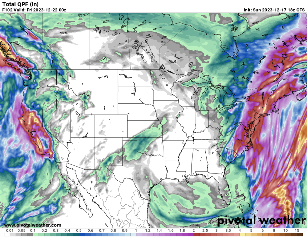
The first half of the week will be wet on the coasts and dry in the interior of the country. A low pressure system currently moving up the Atlantic coast will bring drenching rain to the Northeast tonight into tomorrow. The system is intensifying rapidly and has the potential to reach bomb cyclone status (which is defined as a low pressure system where the central atmospheric pressure drops by at least 24 millibars in 24 hours). This usually results in heavy rain and strong winds.
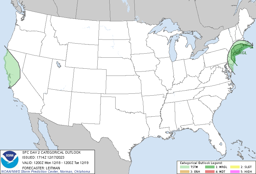
The SPC currently has a Marginal risk over some of the coastal areas of the Northeast for severe winds, although even if winds don’t reach the severe criteria, there is still the potential for moderately strong sustained winds at 25+ mph with even stronger gusts.
On the West Coast, a low pressure system off the coast of California is expected to bring a fair amount of rain to the state over the next few days. Most other US states will see dry weather for the first half of the week.
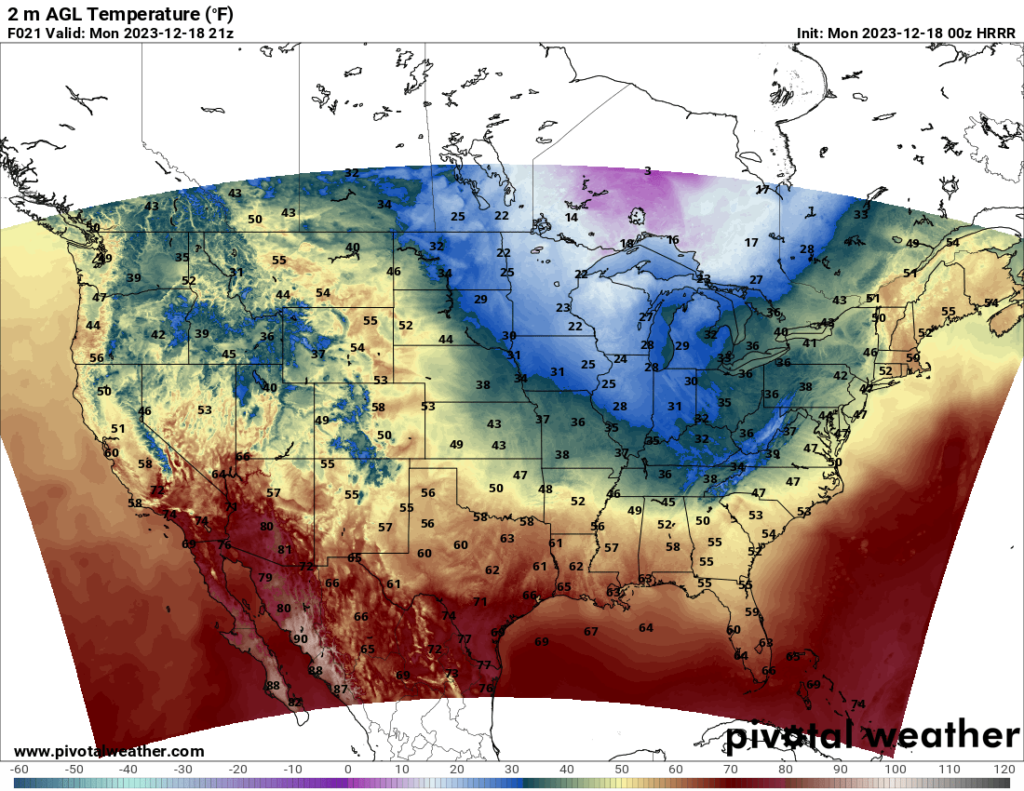
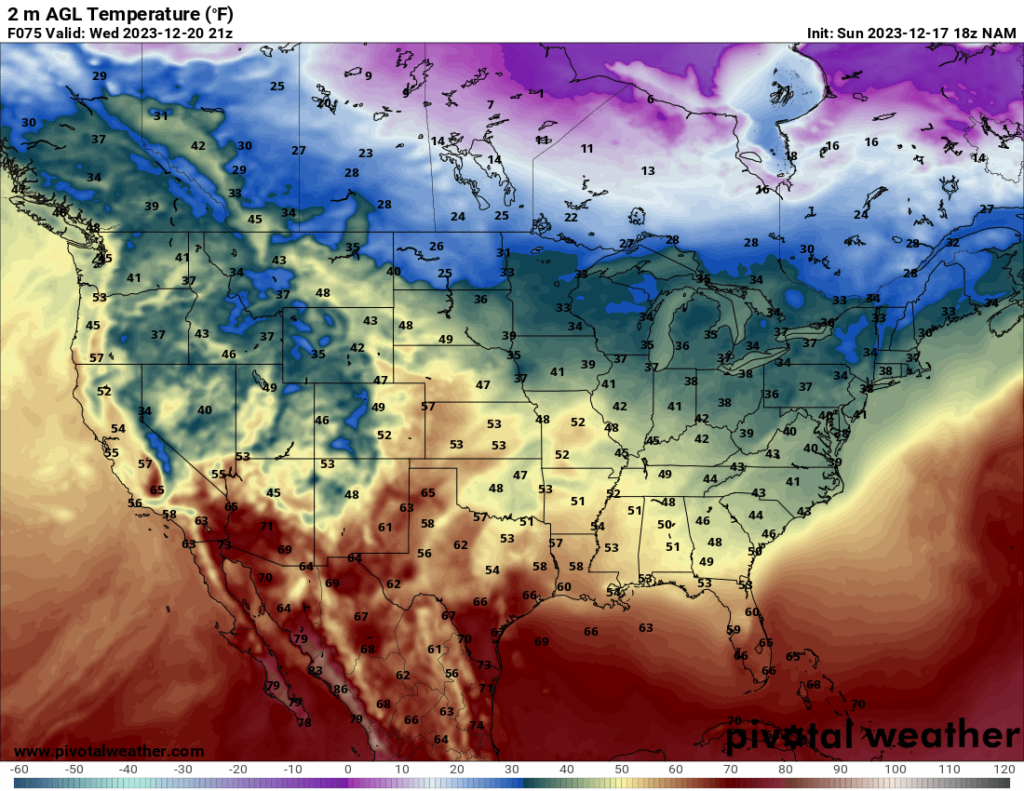
Looking at temperatures, a trough moving over the Midwest will bring a cold spell to the Midwestern states. Highs may not get above freezing in quite a few areas Monday and Tuesday. Thankfully, this cold spell shouldn’t last more than a few days before temperatures become more manageable again.