This weekend is shaping up to be a rather dry and hot one as rainfall will tend to be limited. The upper-level trough is moving away towards the Atlantic while the upper-level ridge is shifting east to take its place. As the ridge moves in, rain chances will be low as synoptic scale subsidence factors in alongside a frontal boundary set up across the lower Southeast.
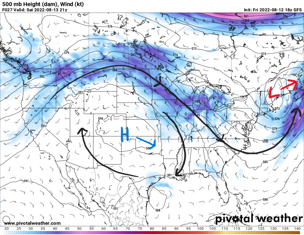
As the ridge moves in, flow aloft will be from the north. This is helping push the frontal boundary towards the south through the area. As this front sinks to the south, drier air will follow behind it. However, for Saturday morning expect patchy dense fog between I-20 and Hwy 84. Relative humidity will be high on the boundary with dewpoints in the low-to-mid 70s. Visibilities could be as low as 1/2 mile to 1/4 mile in some parts. Fog should decrease mid-to-late morning as the sun climbs.
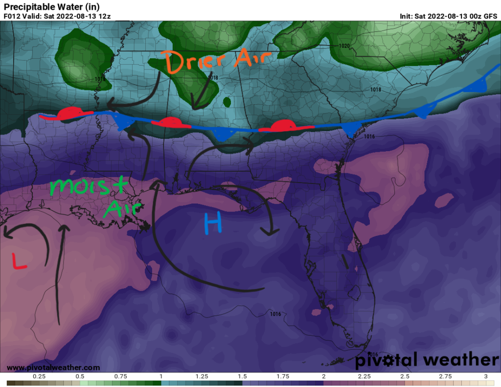
Precipitable water (pwat) values will be around 1.5″ around the I-20 corridor and lower to the north. This sets up a more moist environment to the south towards the coast with pwat values nearing 2″. A surface high in the Northeastern Gulf will work with the low pressure system (Invest 98L) over the Northwestern Gulf to bring southerly winds into the area. Northerly flow behind the front might aid in some convergence of winds to get lift for storms to use to form.
However, with a lower moisture content, coverage will be limited to the more southern counties closer to the coast that have higher atmospheric moisture. Even still, thunderstorms will be isolated in nature with a 30-percent chance.
Temperatures on Saturday will be a relatively typical upper 80s and low 90s across the area. With dewpoints in the upper 60s and low 70s, heat index values will be in check in the low 90s. As the ridge takes hold, temperatures will start to climb into the next work week with highs reaching the mid 90s for the beginning of the week. Higher heat indices will also make a return reaching to possibly 100F.
The pattern will shift once again mid-to-late next week with a trough digging into the Eastern U.S. bringing another frontal boundary to increase rain chances and decrease high temperatures.
Day-to-Day Forecast
Saturday
Morning fog before mostly sunny conditions. A 20-percent chance of precipitation in the northern counties and a 30-percent chance of isolated thunderstorms for the southern counties. Highs in the upper 80s and low 90s. Lows in the low 70s.
Sunday
Sunny and hot with a 20-percent chance of an afternoon shower or storm. Highs in the low 90s with heat indices in the upper 90s. Lows in the low 70s.
Monday
Sunny and hot with a 20-percent chance of an afternoon shower or storm. Highs in the mid 90s with heat indices between 95F and 105F. Lows in the mid 70s.
Tuesday
Mostly sunny and hot with a 40-percent chance of precipitation. Highs in the low-to-mid 90s with heat indices between 95F and 105F. Lows in the mid 70s.
Wednesday
Partly cloudy with a 50-percent chance of precipitation. Highs in the upper 80s and low 90s with heat indices in the upper 90s. Lows in the low 70s.
Thursday
Partly cloudy with a 60-percent chance of precipitation. Highs in the mid-to-upper 80s. Lows in the upper 60s and low 70s.
Friday
Partly cloudy with a 50-precent chance of precipitation. Highs in the mid 80s. Lows in the upper 60s and low 70s.


