Main attention once again is back in the Eastern Pacific Ocean with Hurricane Dora moving its way off to the west-southwest. As has been for the majority of the Pacific basin up to this point, we are currently monitoring another area of interest off the Mexican coast that has a high potential of organizing itself into a tropical disturbance. Over on the Atlantic side of things, things are currently still quieter than they are in the Pacific. There is currently one area being monitored in the Central Atlantic, but organization into any tropical disturbance is not expected at this time. Beyond this, we will continuously watch the stream of disturbances coming off the coast of East Africa for development over the long-term period.
Short-Term Outlook
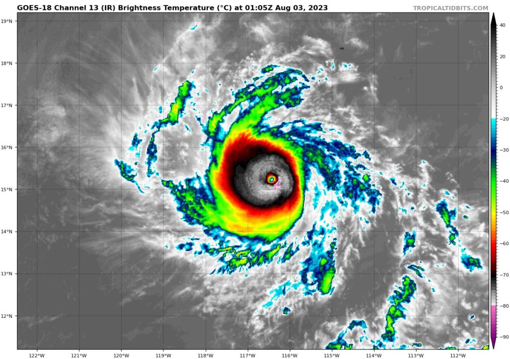
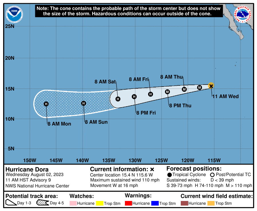
Beginning with the most pressing of matters, we have Hurricane Dora here in the Eastern Pacific, Hurricane Dora, as of 4pm CDT, is a Category 2 hurricane with sustained winds of 110 mph, moving off to the west at 16 mph. Dora will continue to remain as a major hurricane at least through today, with current model trends have Dora’s intensity either mostly staying in the Cat 2 range or possibly intensifying to a Category 3 storm by today and stretching into the weekend. This is in response to this hurricane remaining in largely favorable conditions, with warm SSTs, weak wind shear, and decent moisture present out ahead of this storm. At the moment, Hurricane Dora is not expected to threaten any landmasses at this time.
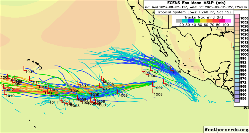
Back towards Mexico, a cluster of thunderstorms off the southwest coast has a very high potential to organize into a tropical system sometime over the next few days. Very warm SSTs and very favorable upper-level winds will allow gradual organization and intensification into a low-pressure system to a potential tropical depression. Both GEFS and Euro ensemble members so far are also in strong agreement regarding development. Movement of this disturbance would be off to the northwest paralleling the Mexican coast in the near-term.
Out in the Atlantic Ocean, not a whole lot of remarkable activity regarding tropical activity. The only area that was being watched over the short-term period was a region of low pressure southeast of Bermuda that has became more unimpressive as the days have progressed. Very dry air plus interactions with a front should prevent any further development.
Extended Outlook
Hurricane Dora will steadily progress westward over the next week, maintaining hurricane strength as it does. This storm should stay south of the Hawaiian Islands, as strong wind shear and higher pressure should keep this storm steered away from the islands at this time. Back towards Mexico, this new disturbance, once it does organize, will track northwest along the Mexican coast and may come very close to the southern tip of Baja California before making a more westerly turn and heading out into open waters. Future intensity is uncertain at the moment, but a weaker storm is currently favored with colder SSTs and stronger wind shear more prevalent the further north this system travels. This region of the world will still be a much more favorable basin for tropical development in the long-term as compared to the Atlantic.
Over in the Atlantic, things still look to remain mostly quiet over the long-term period. Any opportunistic system off the coast of East Africa and the Canary Islands will still have to content with very dry air, as has most systems out here up to this point, as well as increased wind shear. As such, any tropical development over the next week or two cannot be confidently stated at this current time.
Conclusion
Hurricane Dora will continue to make its journey westward into the Central Pacific as a major hurricane over the coming days. Current tracks have this storm staying over open waters but approaching somewhat close to Hawaii by next week. Closer to Mexico, a cluster of thunderstorms will organize into a tropical system sometime over the next couple of days and move northwest along the coast and towards Baja California.
Over in the Atlantic, the only area of interest that has been watched so far has been progressively becoming less and less impressive and should not see itself organize or develop. So far, this still looks to be the theme out here, with very dry air and higher wind shear out closer to Africa helping to keep the basin fairly quiet over the next week or two.


