Sunday a strong cold front will sweep through Mississippi ushering in much colder air. Along the leading edge of the cold air, showers and storms will develop with the potential for severe weather, too.
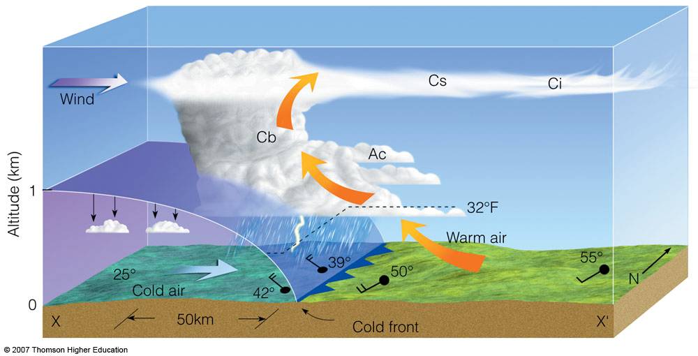
Generally, when strong cold fronts push into warm, moist air masses, storms occuer. So far this winter Mississippi has been lucky. Despite a mild – to at times very warm – Winter, there haven’t been many severe weather events.
The Setup
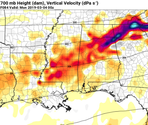
As a once-closed low gets pulled into the main flow of the atmosphere at 500mb, the remaining troughiness will offer enough lift in the atmosphere to promote the development of a surface low as well as showers and storms on Sunday afternoon and evening across the Southeast.
From the Storm Prediction Center:
ECMWF has been the most consistent model generating a surface low over the Arklatex immediately ahead of a surging arctic front. This feature will be induced by a pronounced mid-level short-wave trough that is forecast to translate across the lower MS Valley through the Mid-South by Sunday evening. Latest guidance suggests higher-PW air mass should advance to near the TN border ahead of the surface wave which should allow a broad warm sector to materialize prior to frontal passage. It appears strong-severe organized convection could develop ahead of the short wave as strong shear and adequate buoyancy will be in place prior to convective development.
The “higher-PW” air mass discussed by the SPC is the warm, moist air mass that has been in place across the Gulf coast region for the last few days. Temperatures have been in the 70s with hit and miss showers and storms.
As the expected cold front digs under the higher-PW air mass, storms will develop into an atmosphere that is highly sheared. The shear in place will be mainly speed shear for a lot of area, but could – in some places – be directional shear. In places where the shear is directional, and not speed, there could be a higher potential for severe weather and tornadoes.
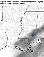
As of now, the Significant Tornado Parameter isn’t terribly high for the Gulf Coast region – with a stripe of the highest numbers across parts of southern Mississippi Sunday evening.
That said, the numbers aren’t very high given the environment isn’t as directionally-sheared and speed-sheared.
The orientation of the front, storm motion and placement of the surface low will, in the end, dictate the type of shear in the atmosphere.
What we don’t know yet
The orientation of the front, storm motion and placement of the surface low. While model guidance can give us approximations, the exact placement of these things is still an unknown. And till it is depicted in the models with more consistency, this will still be an unknown.
If, when, and where storms will specifically develop. All we know right now is that there is the potential for severe weather, but that is about it.
The timeline looks to be between about 2p and 11p for south Mississippi, but that is likely to change a bit in the coming days.
The Bottom Line
If you have plans to be outside on Sunday, it may be time to start thinking about making back up plans. If you have plans to be inside on Sunday, make sure you have a way to get alerts about the weather outside. Stay weather aware on Sunday.
In the meantime, keep an eye on the forecast tomorrow and Saturday and track any changes to the forecast.
After all of that
Then the area gets a few nights near or below freezing. What a roller coaster!


