After a fairly quiet start to the day across portions of southern Louisiana, Mississippi, and Alabama, conditions are becoming much more active this afternoon as daytime heating and increasing Gulf moisture fuel scattered thunderstorms across the region.

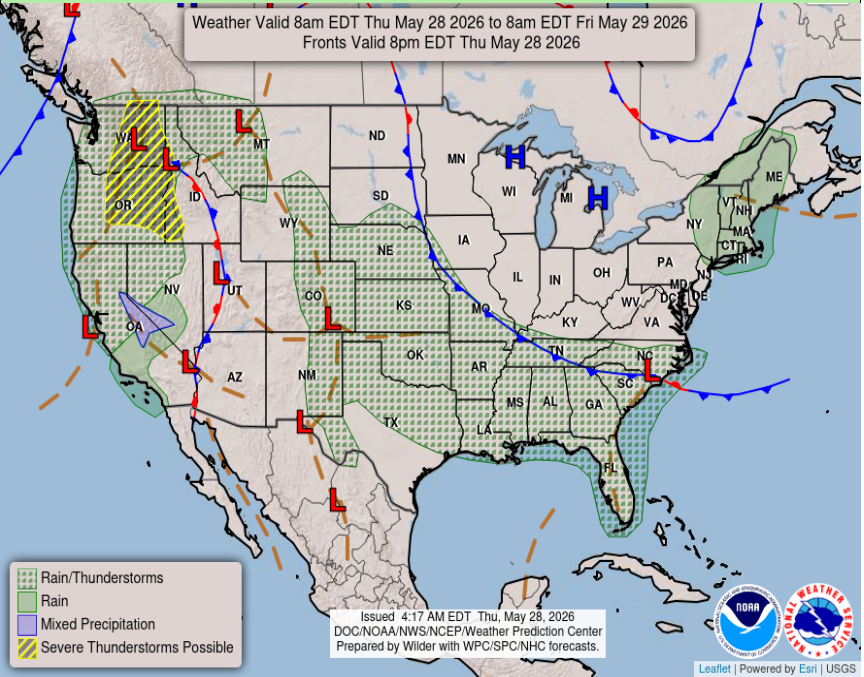
Temperatures have climbed into the upper 80s to lower 90s, but heat index values are pushing the mid to upper 90s thanks to humid air in place across the Gulf Coast. While not everyone will see rain, storms that do develop may quickly become heavy at times. Over our area, we are seeing scattered rain/thunderstorms lasting through the night and into tomorrow. These storms have been moving North from the Gulf and specifically impacting Southern Mississippi and Louisiana, areas which have seen plenty of rain these past few days.
Tomorrow
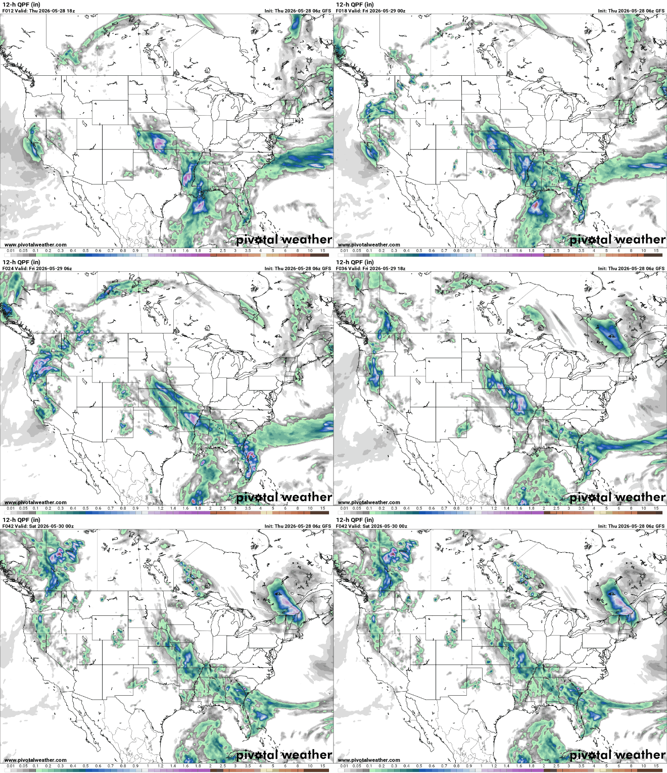
Moving into tomorrow, we are seeing these storms from tonight heading into the overnight hours and continuing through the night, leading into a wet Friday for us in the South. Some areas we see on our 12hr Quanitative Precipitation Forecast (12-h QPF) are looking to receive up to an inch of rain! Safe to say it hasn’t been dry across Southern AL/MS/LA this week.

River Forecast
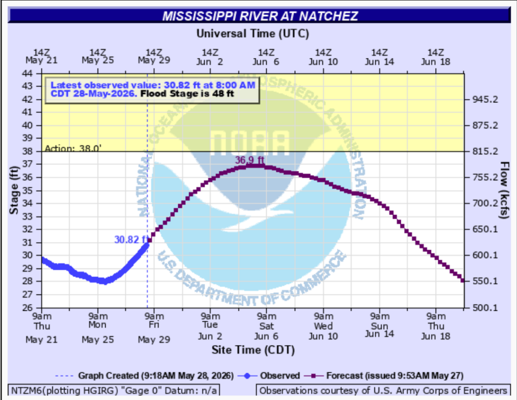
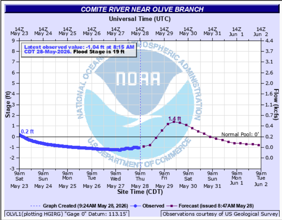
Looking at our rivers, we can expect increased flow and water levels on the Mississippi at Natchez and the Comite near Olive Branch. Typically, the Mississippi at Natchez is 35 feet in June, while the Comite near Olive Branch is between 2.5 and 3.5 ft for reference. We are nowhere near the flood stages of 48 ft and 19 ft, respectively, but consistent rainfall over the past few days will definitely be raising the water level. We can thank these summer storms for getting our water levels back to normal!

Extended Forecast
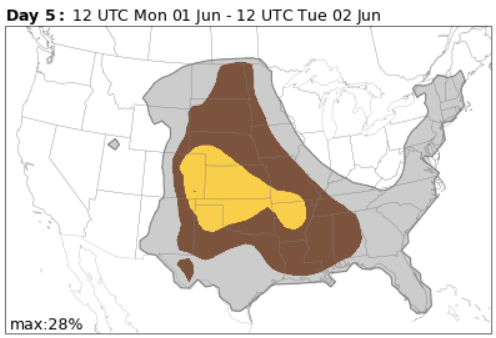
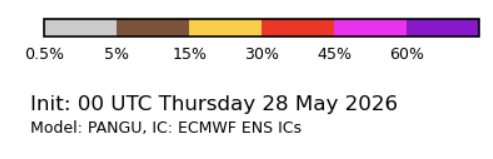
Looking ahead, Monday, June 1st is going to bring in some severe weather across much of the Central United States. Our specific area has up to a 10% chance on the Convective Hazards Forecast for Monday, as of today, so stay tuned for more on that.
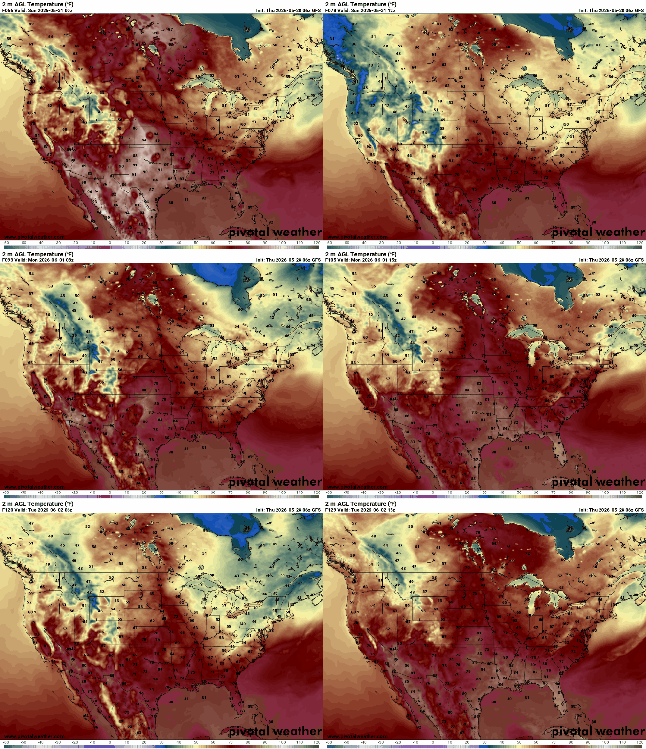
You can see the 2m AGL Temperature in the top left corner, and what that means is that this model measures the air temperature exactly 2m Above Ground Level (AGL), the more you know! As we can see on the above graphic from Pivotal Weather, warm days are ahead! Especially with the high temperatures we’ve been seeing in the afternoons, the atmosphere is primed for those summer afternoon thunderstorms. This supports the Convective Hazards Forecast we saw in the previous graphic from The NCAR, expecting severe weather across the central US on Monday.


